Smooth journey to Borth. Popped in to see lovely Chris. Arrived in Cardigan about 7.30. Found the very pink Llety Teifi guest house. Very clean with cafetière and ground coffee in the room. Straight out to Los Caballeros for beef chilli which was chunks of very tender meat, not minced, served with chips, salad and slaw. The veggie options were a bit too dull. I ate it all, washed down with San Miguel. Back to guest house for a bottle of Snowdon lager which is my current fave.
It started off badly when I found I’d forgotten my compass! I walked a circuit from Lydgate near Littleborough.
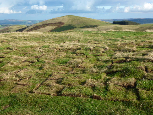
First went south quickly reaching the motorway and crossing it. Here I headed east and this was fine for about 1 km but then the right of way had no path under it. Sometimes this is alright but today after all the rain, the bog was too much especially when it went over my ankle and into my boot, so I headed up to a clear bridleway which I could follow up to the mast just near Windy Hill. This was all ok but by the time I got to the mast the fog had descended and the mast was barely visible although I was right next to it.
Then it was back across the motorway and a long quite dull stretch northwards to Blackstone Edge. It was even more dull as there was nothing to see except the flagstones in front of me. This is part of the Pennine Way and Cath and I walked this in September. I don’t remember there being flags then but I may be mistaken in this.
From Blackstone Edge it’s a short hop to the Aiggin Stone, this was also barely visible and what light there was was disappearing rapidly. West down the Roman Road where I promptly fell over, turned my ankle, knocked my pride, and managed to land on the soft bits. My wrist feels a bit weak but will probably be OK tomorrow.
Down through the soggy, boggy bits back to the car. The whole walk took just over 4 hours but felt much longer in the fog.
Map and …. the lack of compass was not a problem as I had backup of GPS on my phone and an electronic compass on my watch, however I have returned my emergency compass to the bag.
Please visit Map and Compass and learn how to interpret a map and use a compass with me and my navigation partner, Cath.
I’d bought a map of the West Pennines and wanted to give it an airing. Parked up at Sunnyhurst Wood car park. Bimbled my way up to the Darwen Jubilee Tower which was erected in 1897 by public subscription and renovated in 1997 by public subscription and it’s clearly a place a lot of people come and enjoy. The tower itself looks like a spaceship from afar.
I did a short circuit on muddy and in places icy paths overlooking Sunnyhurst and Earnsdale reservoirs. Sunnyhurst has been drained by United Utilities and is being converted to moor and wetland because they have “more efficient ways of managing water supplies”. It just looks like a drained reservoir so this may take a little longer than the projected one year which they wrote in Spring 2014.
Please visit Map and Compass and learn how to interpret a map and use a compass with me and my navigation partner, Cath.
Friday 9th October
Just over 3 hours to reach Elyhaugh in Longframlington and be welcomed by Sandra with really good cake, eggs and milk in fridge.
Our barn is very clean. So nice not to have to wash the cutlery and plates before we use them. We each have a big en suite room at either end of the barn. The middle is an open kitchen, sitting and eating space. There is a dishwasher to my delight! which explains the clean pots and pans.
Made an omelette for our supper. No wireless and the phone signal is limited to a small spot in the yard.
Saturday 10th October
Walked round Rothbury. Parked a little up from Cragside and did a 6 or 7 km circuit through Armstrong land passing a hill fort site and a standing stone. Not much to see of either. Pleasant walk. Weather a bit misty but we could see where we were going.
Stopped to look at Angler’s Arms and Carol bought me a beer!
Green chicken curry and rice.
Watched DVD of The Cazalets.
Sunday 11th October
Intended to amble round Amble but it looked horrible so we ambled round Warkworth instead.
Then to Boulmer to walk north along coast for a few km and back. Dull day but no rain.
To the Angler’s Arms to eat. C had steak and ale pie and I had a carrot and cashew loaf with salad. Good hearty portions with beer.
More of The Cazalets.
Our barnThis is very uncomfortable, please take photo quickly!
From the barnPromising not to get dashed into the wavesSea lightDunstanburgh castle
Monday 12th October
From Harbottle up to the Drake stone which is an enormous chunk of sandstone perched on the hill. Legend has it that children passed over it will be cured of their ailments. The stone is so huge they will likely acquire some further ailments in the attempt. Sort of upward keel hauling comes to mind.
On to Harbottle lake then across the forest avoiding the red flag zone. We heard distant explosions most of the day. Back down to cross the River Coquet. Up and around Harbottle crossing back over the Coquet, through the village and up to the castle. Great views from here.
Lovely walk, it stayed dry and then did a massive downpour as we stopped in Rothbury for C to get provisions. Home to shepherd’s pie.
The Drake Stone
Harbottle Lake
Harbottle LakeRoe deer tracks
Ye olde lime kilnHarbottle castleThe Drake Stone from Harbottle
Tuesday 13th October
Felton to look at old church and a little walk along St Oswald’s way. Looked at a gallery and an artisan bakery charging artisan prices for bread and biscuits.
Dropped C off at industrial estate for dialysis.
Decided not to try the Cheviot as the big hills had big clouds on their tops. Tried to get to the hill forts west of Wooler but the road was closed so I went to Ingram for a 7 km hill fort walk which took 2 and a half hours. The sign said it would take 3-4 hours!
Collected C and home for more shepherd’s pie.
From a hill fortOn the hill forts walkOn the hill forts walkLoved the coloursEvidence of a digOn the hill forts walkFelton church looks like it hasn’t got a roof but it is there reallyFelton church
Wednesday 14th October
We started off a circular walk to Darden Lough however C wasn’t keen on the bog and unevenness of the path so we headed back to the car.
Drove to Otterburn for PC then Rochester for Roman fort. The fort now has 2 houses in it but you can see clearly where it was. Then we looked in at Otterburn Mill shop which is similar to the Edinburgh Woollen Mill and has the same weird CDs and DVDs you can’t imagine anybody wanting.
Home and then out to the Cook and Barker in Newton on the Moor. I had beetroot and goat’s cheese followed by sirloin strips with veg and a small bucket of chips. It didn’t seem a lot but I was stuffed. C had a salmon and muffin thing which looked nice. The food was good and well presented. A bit more pricey that I expected. Good beer. C had Pagan Queen and I had something else maybe a London brew.
Back for the last of the Cazalets which was slightly disappointing.
Thursday 15th October
To Alnwick for a pootle round. Delivered C to the renal unit on the industrial estate.
Drove just south of Rothbury to park up. Walked to Simonside summit. Practically all on paved path. Great views.
Picked up C. Home to pack. Lovely holiday but I struggled without the wireless and mobile connections.
Pavement up SimonsideLittle cannonOn SimonsideMade me think of Henry Moore
Friday 16th
Stopped in Wetherby on the way home and wandered round the shops. I found some Old Amsterdam cheese in a cheese shop which sold bread at even more inflated prices than the artisan bread shop!
Please visit Map and Compass and learn how to interpret a map and use a compass with me and my navigation partner, Cath.