Walshaw and Top Withens 4th November 2012

I left home in quite thick fog, with the intention of really having to navigate with no visibility. As I drove up to Blackstone Edge, the fog thickened, but by the time I reached Widdop to park up it was a lovely sunny but cold day.
I headed up to the Walshaw Dean reservoirs, I got stopped by a couple wanting to know where the nearest food could be obtained. Fortunately the pub was still in sight. They’d come all the way from Haworth without food, map or compass. Admittedly this is a section of the Pennine Way that is well marked (some of it isn’t and requires map skills) so it wouldn’t really have been a problem, but they didn’t actually seem to know where they were even broadly and said they were aiming for Colne! The only good thing was they were togged up for the Arctic!
I then did something I’ve done before that was wrong! There is a footbridge over the drain that says “walk this way”, at least it does to me, despite looking old and knackered and unused and so I did, although part of me knew it would be troublesome. It’s followed by a section where you climb the steps in the wall, teeter spread-eagled on the top and then plunge down the other side. I actually got over fairly gracefully this time, crossing the raging torrent to the drain and stopped for a quick lunch in the sun. I then headed for a Land Rover I’d seen before lunch on the basis that it was likely to be on the track. This was preferable to the wall retreat option. The Land Rover had moved on but the track was there and this quickly got me back where I wanted to be.
I stayed on the Pennine Way and walked until I could see Top Withens and the valley to Haworth. It’s a great bit of featureless moorland and so good for testing out navigation accuracy and techniques. I did some ground to map bearings and a 2 point resection.
My timings all worked out and I got home just as darkness came along, time for a quick shower, nice grub and then back out to see Fairport Convention at Hebden Bridge Trades Club, just 34 years since I last saw them at Cardiff Uni. Simon Nicol has just emailed me to say I can put a video I made of them doing Fotheringhay on YouTube!

I like playing with the twirly camera on my phone!
Walshaw Dean upper reservoir
Top Withens, supposedly Wuthering Heights (I ask you!)
2 Walshaws and a Gorple reservoir
Spot the birdy
Steps up the wall, higher than it looks
Do NOT cross this
Fairport Convention – Ric Sanders, Simon Nicol, Dave Pegg and Chris Leslie

[googlemaps https://maps.google.com/maps?f=q&source=s_q&hl=en&geocode=&q=Walshaw+Dean+Middle+Reservoir,+Wadsworth,+Calderdale+District,+United+Kingdom&aq=0&oq=walshaw+dean&sll=53.66049,-2.04408&sspn=0.018208,0.060339&t=p&ie=UTF8&hq=&hnear=Walshaw+Dean+Middle+Reservoir&ll=53.798775,-2.051525&spn=0.015208,0.025749&z=14&iwloc=A&output=embed&w=300&h=300]

Please visit Map and Compass and learn how to interpret a map with me and my navigation partner, Cath.

Dry Mere and the Roman Road 3rd November 2012

A very short walk, taking advantage of the time I get to myself while Carol is plugged into the machine away in Leeds!
I picked up Babs and we drove to the start of the walk and then walked it in the reverse of what we did back in July. The weather seemed much nicer today although it was cold and the wind was bitter.
We did the walk as fast as we could to facilitate me getting to East Leeds on time. There seemed to be a lot of people out. Babs very similar to Carol in wanting not to meet anyone on walks!!
We had a nice time catching up and in some ways the views are better this way round. There is a very boggy bit at the bottom of the Roman road but this has now been improved with some drainage channels.

I had a feeling I looked remarkably silly even in the nice new jacket!
Dry Mere
Just a cairn
Across towards Todmorden
Babs’ new wellies, she is very proud of these!
The white blob sticking up is the trig point being cheeky

[googlemaps https://maps.google.com/maps?f=q&source=s_q&hl=en&geocode=&q=Dry+mere,+Littleborough,+United+Kingdom&aq=0&oq=dry+mere&sll=54.445461,-3.10263&sspn=0.071469,0.241356&t=p&ie=UTF8&hq=&hnear=Dry+mere&ll=53.633341,-2.066803&spn=0.015268,0.025749&z=14&iwloc=A&output=embed&w=300&h=300]

Please visit Map and Compass and learn how to interpret a map with me and my navigation partner, Cath.

Withens Clough 6th October

I parked near the Hinchliffe Arms in Cragg Vale. Set off up the track towards Turley Hole B&B and instead of heading down the very boggy bit to the stream, which I had done the last time here with Babs and co. I stayed on the track going past an old farm sign saying “If you haven’t been invited, stay away”. As the sign was very old and I was on a public right of way, I ignored this charming command.
The path rises up and goes alongside an old wood, then past a couple of houses, great remote spot. There were some large pedigree dogs here (no, I don’t know what they were, sort of pinky grey colour, smooth coats) but they were well behaved and closely supervised, however I should have got my walking poles out in advance. (Remembering my encounter with a horrible Swiss dog, where I defended myself by crossing the poles in front of me for protection, shouting at it helped too.)
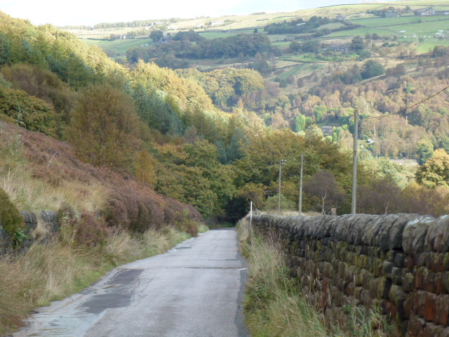
Then I was up on the moor, and took a right heading towards Tenter Wood. This section was quite boggy but OK with gaiters on.
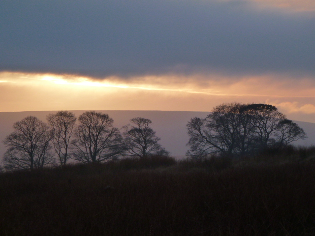
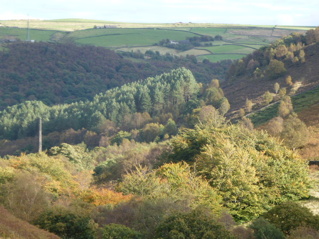
At the end of Tenter Wood, I headed left along a terrace towards Withens Clough reservoir. This is a lovely part and although not dramatic like the Climbers’ Traverse on Bowfell or the Heather Terrace on Tryfan, still has a soothing feel to it, and today it was inspiring looking across to the turning leaves and swathes of colour.
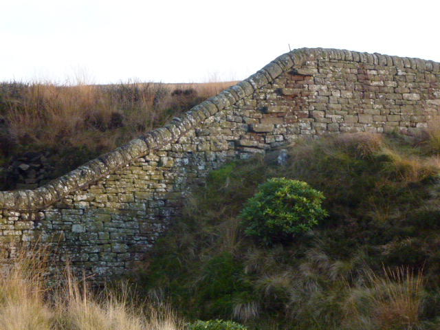
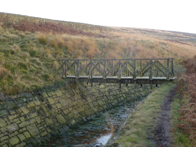
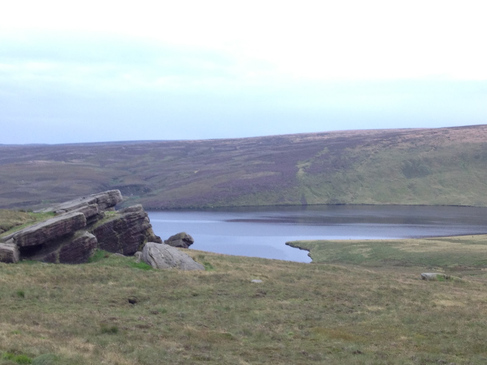
The terrace ends up at the reservoir, where they have finally finished all the construction work, many months overdue. I circuited the reservoir noting that Yorkshire Water seem to have gone mad for fencing. Fences against walls, fences where no-one in their right mind would want to go. But they have improved some of the track and some gates.
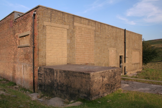
At the dam end, they have taken down a hideous building and replaced it with guess what? Well you decide. I can’t make out what it’s for but it has a letter box, although it doesn’t look like a house. They’ve put up a great wind turbine, which was whizzing round madly despite there not really being much wind. Is it me, but wouldn’t a water turbine have made more sense?
Nice walk to keep my feet in!

Add caption
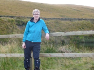
Got the self timer working
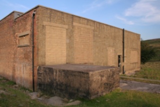
The old building, photo by Mark Anderson
Wind turbine and new building
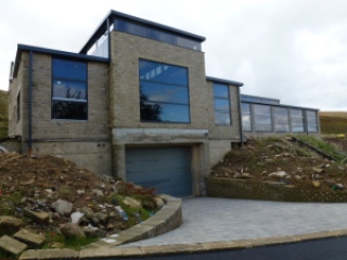
Surely not a house?
Just buy a longer chain

[googlemaps https://maps.google.com/maps?f=q&source=s_q&hl=en&geocode=&q=Withens+Clough+Reservoir,+Hebden+Royd,+Calderdale+District,+United+Kingdom&aq=0&oq=withens+clough&sll=52.826174,-3.301967&sspn=0.148532,0.482712&t=p&ie=UTF8&hq=&hnear=Withens+Clough+Reservoir&ll=53.702804,-2.029467&spn=0.015243,0.025749&z=14&iwloc=A&output=embed&w=300&h=300]

Please visit Map and Compass and learn how to interpret a map with me and my navigation partner, Cath.

Widdop August 24th

Nice early evening walk in Widdop with Anita passing several reservoirs and looking at some slightly different navigation tricks.
We stayed out until it started raining and then headed back as it got dark. We didn’t have to use our lights as despite the low cloud, it was still easy to see because we’d got accustomed to the light changing as we walked.
Managed not to get too badly bitten by midges. Anita came up with really useful piece of advice to prevent being eaten alive which is to eat marmite or take a Vitamin B pill if you don’t like it, before encountering the evil beasties.

Widdop reservoir
Gorple reservoir

[googlemaps https://maps.google.com/maps?f=q&source=s_q&hl=en&geocode=&q=Widdop+Reservoir,+Calderdale+District,+United+Kingdom&aq=1&oq=Widdop+re&sll=53.632733,-1.945001&sspn=0.01822,0.060339&t=p&ie=UTF8&hq=&hnear=Widdop+Reservoir&ll=53.792387,-2.105684&spn=0.01521,0.025749&z=14&iwloc=A&output=embed&w=300&h=300]

Please visit Map and Compass and learn how to interpret a map with me and my navigation partner, Cath.

Night and Day at Walshaw Dean 4th and 5th August 2012

Saturday
By the time we arrived at Widdop it was nearly dark. To start Carol off on night walking we used a tarmac path in order to gain confidence from the car park to the top of the first of the three Walshaw Dean reservoirs. It was mild and the sheep were just going to bed.
The forecast for the weekend had been for thunder, torrential rain and hail which is why we ended up doing a night walk instead of camping. As it turned out Saturday was pretty good all day and none of the horrors appeared.
It was cloudy but the moon still gave a lot of light and this then shone off the water, so all in all it was very easy to see and we didn’t need to use our headlamps.
The moon had been full so was doing waning gibbous but rose where I expected it to so we did a bit of natural navigation.
A short but quite exciting walk. And we saw 2 owls on the way up to Widdop.

This makes me thinks of etchings
Moon reflected in the reservoir

Sunday

I decided to return to Widdop by day to prospect for possible camping spots. I didn’t really find anywhere that would fit the bill but had a nice walk and went off in a different direction from my usual trips to Walshaw Dean.
I got down to the fabulously named Pisser Rough accompanied by rumbles of thunder and was just looking at the bridge across the weir when it started to rain heavily so I abandoned that idea as it meant working a way on not very clear paths along the steep sides of the clough. I probably would have done it if someone else had been there but didn’t want to take a chance of falling into the beck and getting wet and stuck.
Instead I more or less retraced my steps. This was quite a bleak walk and I only saw a few people at quite a distance when I got off the main track.
On the way back, the torrential rain came on and was really awful in Hebden and it was easy to see how easily it gets flooded there as it looked like it was about to happen again.
We saw later on that Bradford had a big dump of hail several inches deep in places, so the weather did all turn up but a day later than forecast.

Before the thunder
I want to say this is ectoplasm but it isn’t
Steam rising

[googlemaps https://maps.google.com/maps?f=q&source=s_q&hl=en&geocode=&q=Walshaw+Dean+Middle+Reservoir,+Wadsworth,+Calderdale+District,+United+Kingdom&aq=0&oq=walshaw+dean&sll=53.66049,-2.04408&sspn=0.018208,0.060339&t=p&ie=UTF8&hq=&hnear=Walshaw+Dean+Middle+Reservoir&ll=53.798775,-2.051525&spn=0.015208,0.025749&z=14&iwloc=A&output=embed&w=300&h=300]

Please visit Map and Compass and learn how to interpret a map with me and my navigation partner, Cath.

css.php