Warland 120610

Withens Clough

Beautiful walking weather. Carol and I set off quite spontaneously (a first if ever there was one) and parked up at Withens Clough reservoir car park. Despite being annoyed by the building site which was blaring out something probably to do with football, we soon passed this hazard and got into the peace and quiet.
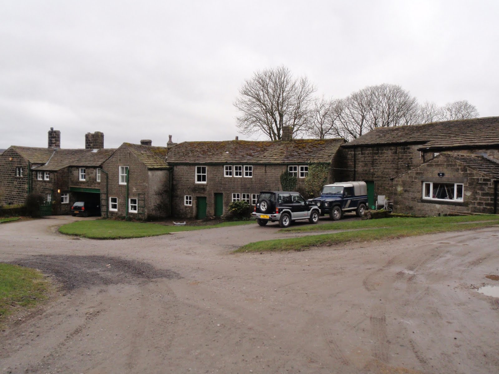
Headed up away from the reservoir and across to Red Dyke ruined farm. Although the farm itself is roofless, the whole farm set up must have been very well built as all the surrounding dark walls are still in excellent condition, it’s a bit foreboding and I’ve never fancied poking about the place. So we didn’t!
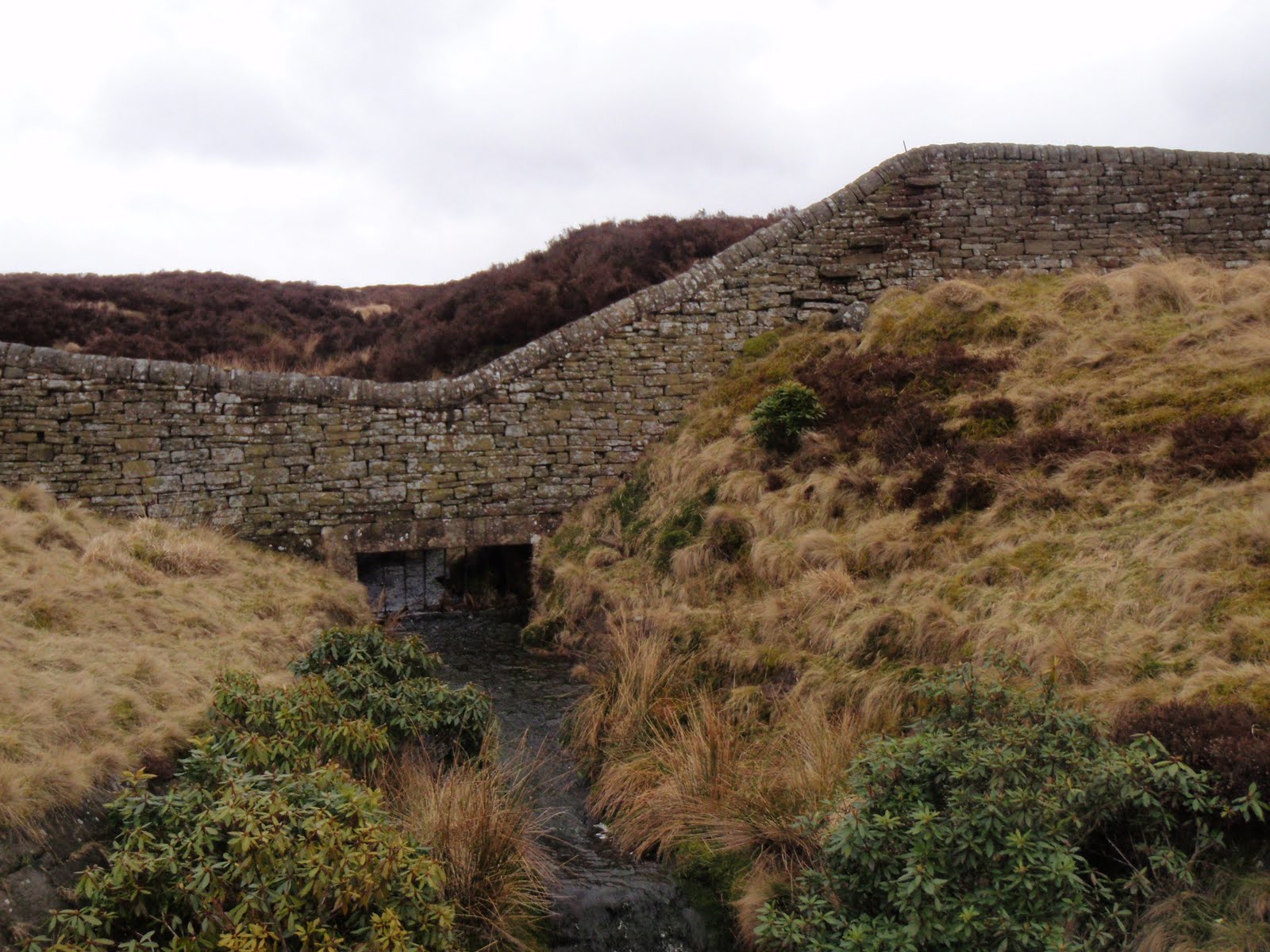
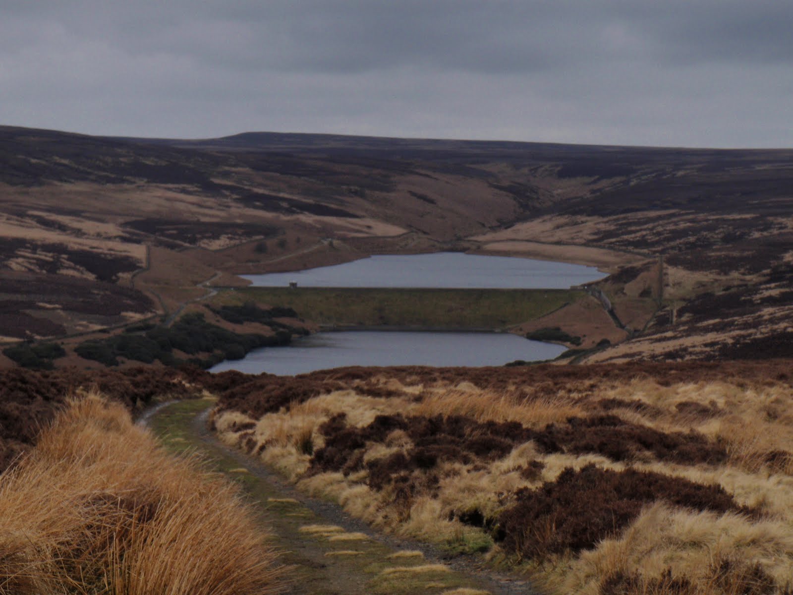
Wandered on a bit more and stopped on a rather windy stone bench overlooking Tod for a very late lunch. We just meandered along the Pennine Way until we got to the turn of the drain and kept along until reaching Warland reservoir. The reservoirs are very low in water, haven’t seen them this low for a while.
Returned via the same route mostly. Did cut across the rough as we could see the gate we were aiming for, but it was a lot of old tussocks and they are hard work. The path although longer, would probably have been quicker.
We managed to make a not very long walk last for hours, must have been the good company!

Warland Reservoir

[googlemaps https://maps.google.com/maps?f=q&source=s_q&hl=en&geocode=&q=Warland+Reservoir,+United+Kingdom&aq=0&oq=warland+re&sll=54.43331,-3.216591&sspn=0.062904,0.209255&ie=UTF8&hq=&hnear=Warland+Reservoir&t=m&ll=53.68461,-2.0644&spn=0.015249,0.025749&z=14&iwloc=A&output=embed&w=300&h=300]

Please visit Map and Compass and learn how to interpret a map with me and my navigation partner, Cath.

Night nav on Blackstone Edge 07/05/10

This one is specially for Peter M!
This was a welcome relief from the real nastiness that’s been exposed because of the E word. I was in good company and we didn’t even touch on it.
BB met me and CD at the biker pub in Littleborough. BB assured me that the bikers were mature and quite nice really. Sadly just these ones were not very handsome, well there was one who I wouldn’t have pushed out.
After a quick meal and change of clothes, CD and I drove up to Blackstone Edge and parked up in the layby at 8.30. It was very cold and windy so we headed off first south along a good path and then east along a less good one, all in daylight. We had to go fast just to keep warm, and this was with both of us wearing 4 layers. As we approached the road, we could see the moor was on fire but we worked out it wasn’t blazing just where we were going and also that the wind would be taking it away from us.
By the time we got to where we had to cross the road, the light was going and here we made our first mistake, by thinking we were further down than we were. This meant we were not the side of the gully that we thought so we did a quick change of plan to follow the gully. We stood under the pylons in the dark trying to take a bearing, Cath convinced the electricity was affecting her compass but actually it was her phone. Basically we stomped around in the clumps and dips for a while  and eventually reached the top of the gully.
We had decided to aim for a spot height, however both forgetting or not seeing that there was a water way to cross! Another change of plan, to handrail along the drain which we did, using timing and pacing. And then lo and behold, in the middle of all this nothingness, was a little footbridge and post to cross the drain. So we did, then more pacing to find the spot height. This was harder to locate as the local map is marked in 5m contour intervals and so a spot height would be hard to find in daylight let alone at night.
We next headed due West for another drain with a name like Cold and Windy Drain which we found although it was about 20-30m beyond our estimation. We followed this drain to the fence whereupon Cath said “what’s that white line?” “it’s the road!” At this point, she decided to roll around on the tussocks. First Aid was not needed. I dazzled some cars with my beacon headlight and soon got back to our cars. It was nearly 11.30 by then!
When I got home I was so cold I had to put the heating on, make a hot water bottle and drink whisky. I didn’t really warm up properly until lunchtime today!

[googlemaps https://maps.google.com/maps?f=q&source=s_q&hl=en&geocode=&q=Blackstone+Edge+Reservoir&aq=1&oq=blackstone&sll=54.482,-2.898778&sspn=0.031414,0.104628&ie=UTF8&hq=&hnear=Blackstone+Edge+Reservoir&t=m&ll=53.660509,-2.044058&spn=0.015258,0.025749&z=14&iwloc=A&output=embed&w=300&h=300]

Please visit Map and Compass and learn how to interpret a map with me and my navigation partner, Cath.

Walshaw 2

It should really be Walshaw Reservoir 2. Same route, different way round, different personnel. Just me and Anita. Better this way round as had the long flat bit to warm up on with wind behind us at the start. Lunched by a BT wireless station in the woods. Met 2 incredibly stupid women who had got miles off where they wanted to be, they had no map and no bloody sense. I could feel myself getting really irritated with them at the point where they were inviting us to take responsibility for them. We directed them as best as possible and I can only hope they are home now. These are the people who should pay for Mountain Rescue services. After A and I had left them behind and spent a good bit of time analysing their crass stupidity, we continued to find the correct path to the reservoir and saw how to cross the big drain without playing horses with the huge wall. Got back to the car, a bit wind swept and with relatively fewer knee issues than yesterday. Great walk finished off with a beer at the Packhorse.

[googlemaps https://maps.google.com/maps?f=q&source=s_q&hl=en&geocode=&q=Walshaw+Dean+Lower+Reservoir,+Wadsworth,+Calderdale+District,+United+Kingdom&aq=0&oq=walshaw+dean+lo&sll=53.399298,-1.882095&sspn=0.064481,0.209255&ie=UTF8&hq=&hnear=Walshaw+Dean+Lower+Reservoir&t=m&ll=53.793452,-2.063971&spn=0.01521,0.025749&z=14&iwloc=A&output=embed&w=300&h=300]

Please visit Map and Compass and learn how to interpret a map with me and my navigation partner, Cath.

Walshaw 1

Set off with Babs and Carol from Pennine Way crossing road. Went up to reservoirs whereupon the others became starving, in fact they seemed to be hungry right from the start. We followed the reservoir along and then crossed the drainage channel via a footbridge. This brought us up to a high wall with foot steps sticking out of it just where there was a steep drop into a water inlet. After a bit of pfaffing around about it being a bit too high etc., all the party managed to get their butts over the wall by riding it like a horse. The far side of the wall was fairly sheltered so we stopped for lunch. It was still windy and cold. We then struck up across the bog and tussocks and found we had missed the actual path but we got onto it before long. We went up across the hill and then down the other side to Walshaw which is a pretty hamlet. B and C inspected some olde pig styes. We then cut back facing into the wind towards the car. Could see the upper Hardcastle Crags car park and the road opposite us as we walked. Back along to the car park, we didn’t get rained on and it brightened up through the day. Very nice walk indeed. 

[googlemaps https://maps.google.com/maps?f=q&source=s_q&hl=en&geocode=&q=Walshaw+Dean+Lower+Reservoir,+Wadsworth,+Calderdale+District,+United+Kingdom&aq=0&oq=walshaw+dean+lo&sll=53.399298,-1.882095&sspn=0.064481,0.209255&ie=UTF8&hq=&hnear=Walshaw+Dean+Lower+Reservoir&t=m&ll=53.793452,-2.063971&spn=0.01521,0.025749&z=14&iwloc=A&output=embed&w=300&h=300]

Please visit Map and Compass and learn how to interpret a map with me and my navigation partner, Cath.

Blackstone Edge 03/01/10


Posted by Picasa

[googlemaps https://maps.google.com/maps?f=q&source=s_q&hl=en&geocode=&q=Blackstone+Edge+Reservoir,+Littleborough,+United+Kingdom&aq=0&oq=blackstone+edge+res&sll=53.660408,-2.043629&sspn=0.016021,0.052314&ie=UTF8&hq=&hnear=Blackstone+Edge+Reservoir&t=m&ll=53.660408,-2.043629&spn=0.015258,0.025749&z=14&iwloc=A&output=embed&w=300&h=300]

Please visit Map and Compass and learn how to interpret a map with me and my navigation partner, Cath.

css.php