 |
| It really was this WET |
 |
| Stir crazy |
Carol and I set off early and arrived in Ennerdale after stopping for M&S treats and then to eat them. We both had sandwiches we’d made at home as well.
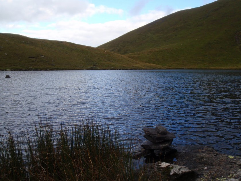
We parked the car and set off up the path to Floutern Tarn which we reached without event at 4.00 p.m. This time we found a flatter spot a bit higher up than previously. I quickly erected the tent and got the beds made up and then it started to rain. And then it continued to do so for the next 18 hours without cease.
At first it was ok because we had things to do, latrines to dig, organising our little space for maximum comfort and ease. We had a cup of tea and a little rest. We took some clothes off and then put a whole load more on as it went a bit nippy in the wind and the rain. It did not remind me of this song at the time: Drive All Night. Then it was time to cook the dinner. The tent has a good sized porch so we could cook without getting drenched. Starter of chick pea curry, followed by basmati rice and chilli con carne. C provided buttered brown bread. We finished it off with some chocolate. Then more hot drinks, whisky and sherry. We did a quiz, played some games, did the crossword. Hot food and drink make all the difference, whatever the weather.
We did of course have to leave the tent for the loo, yes in the dark and the rain, so misty I could barely see the walking pole marker post but mainly staying in a very confined space for such a long time is quite hard work. We did sleep but not brilliantly. The tent kept us warm and dry but you can’t really sit up in it very easily, it’s a good job we seemed to be not too bad at tentiquette. By morning I was going mad just to move my legs further than the tent door.
We woke at about 8.00 a.m. Some tea and coffee, and a rain check! Oh what a surprise still bloody raining and no sign of the tarn a mere 30m away.
We packed up everything possible from within. Then stepped out in all our gear and stowed away the tent. Soon got warm by walking back up the hill. The path is pretty distinct which is a good thing as there was very limited visibility. It was really a great relief to be walking about.
At the first gate you come to, we met a man and dog. We chatted and he told us that the farmer who owns the land including the tarn, has a penchant for waving his shotgun at “trespassers” – in inverted commas because the tarn is on Access Land i.e. we have a right to use it. This is the 3rd time I’ve camped there now, and I feel reluctant to go back. This farmer is known for his negative attitudes and the Ramblers have done Mass Trespasses on his land but to no avail.
We got back to the car and then guess what, it stopped raining! After a bit of pfaffing about, we got into the warm and dry and drove off to our next meal stop.
I felt I needed to get some pampering after 18 hours of rain, so we went to the hotel which said we could check in from 2.00 p.m. We arrived at half past and our room wasn’t ready so we had to wait for another half hour. After this annoying start, we got into the room which felt very hot. Turned all the radiators off, but this made no difference at all. So from one extreme to another. We opened all the windows but it just stayed hot. I even ended up sleeping outside the covers for most of the night, that’s how blooming tropical it was!
After all the rain we needed more water so had a shower/bath to clean up, went for a swim which was nice as the water was cool and then another shower/bath after the swim.
We pootled about a bit, read the paper etc. Got some ice in a bucket and dunked the wine in it.
Time for dinner, I had smoked salmon blinis and mushroom stroganoff. C had fillet of salmon and sticky toffee pudding. All very nicely done.
We returned to the sauna bedroom, drank all the wine and fell asleep.
 |
| Cloud carrying 18 hours of rain |
[googlemaps https://maps.google.com/maps?f=q&source=s_q&hl=en&geocode=&q=Floutern+Tarn,+Loweswater,+Allerdale+District,+United+Kingdom&aq=0&oq=floutern+&sll=54.640267,-3.132133&sspn=0.062585,0.209255&t=p&ie=UTF8&hq=&hnear=Floutern+Tarn&ll=54.541003,-3.354177&spn=0.014938,0.025749&z=14&iwloc=A&output=embed&w=300&h=300]
Please visit Map and Compass and learn how to interpret a map with me and my navigation partner, Cath.


