What I carried on the Ceredigion Coast Path

Clothing

  • Lightweight Scarpa boots
  • Fresh socks for each day
  • Fresh pants for each day!!
  • Short sleeve merino shirt
  • Long sleeve merino shirt
  • Fleece jacket
  • Very lightweight Mountain Equipment insulating jacket
  • Thick walking trousers
  • Very lightweight trousers (for wearing in my accommodations)
  • Sandals (for wearing in my accommodations)
  • Two pairs of winter gloves [not used]
  • Two buffs [only used one]
  • Waterproof hat
  • Woolly hat
  • Lightweight Rab waterproof jacket
  • Lightweight Rab waterproof trousers

Gear

  • Osprey 30 litre Tempest rucksack
  • Map
  • Compass
  • First Aid kit including emergency kit e.g. headlamp, knife [took way too much stuff here]
  • Backup emergency phone
  • 1 litre water bottle
  • 0.5 litre water bottle
  • 2 Trek bars
  • 2 fruity bars
  • iPhone including maps, charger and back up charger case
  • Camera and waterproof bag
  • Emergency loo events bag [not used!]
  • Toiletries – toothbrush, toothpaste, moisturiser, sun cream, arnica salve (worked wonders on my feet)
  • Contact lenses and small mirror
  • 2 pkts tissues
  • 2 lightweight Fizan walking poles
  • Little Ted

The Osprey Tempest prides itself on its walking pole stowage system which on the couple of times I’d used it prior to this trip worked fine. I decided to use just one pole through the mud and stowed the second one. I’d tightened it as much as it would go. And then of course, it disappeared. I had no idea when or where, probably one of the many times I fell over on Day 1. So I had a failed rucksack and a lost pole. All very irritating. I’m now waiting to see what Cotswold Outdoor are going to do for me. Osprey themselves seem to have a very good customer service section. Will report back.

https://www.justgiving.com/Jak-Radice2

Please visit Map and Compass and learn how to interpret a map and use a compass with me and my navigation partner, Cath.

MAPandCOMPASS


Wall to wall Hadrian April 2015

Mon 6th April

As part of my job I’ve been taking some online courses called MOOCs (massive open online course). I did a very good one from Newcastle University on Hadrian’s Wall with FutureLearn for free.
You get to translate Roman tablets and identity objects. I’ve also done some very poor courses with FutureLearn but you don’t have to stick with it if you don’t want to.
It got me interested in the path and it looked like a walk with a lot of extra interest and lots of scenery. It’s also a test to see if I really can do 4 long days of walking and therefore will be able to do my Pyrenean trip in August.
The taxi I’d booked didn’t arrive so I drove to the station and parked in sight of a camera. Three trains were all fine. Chatted to a young Austrian woman who was on her way to Hawick to volunteer on a farm for a week and then coming back down to be an equine apprentice in the Midlands.
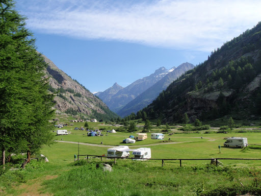
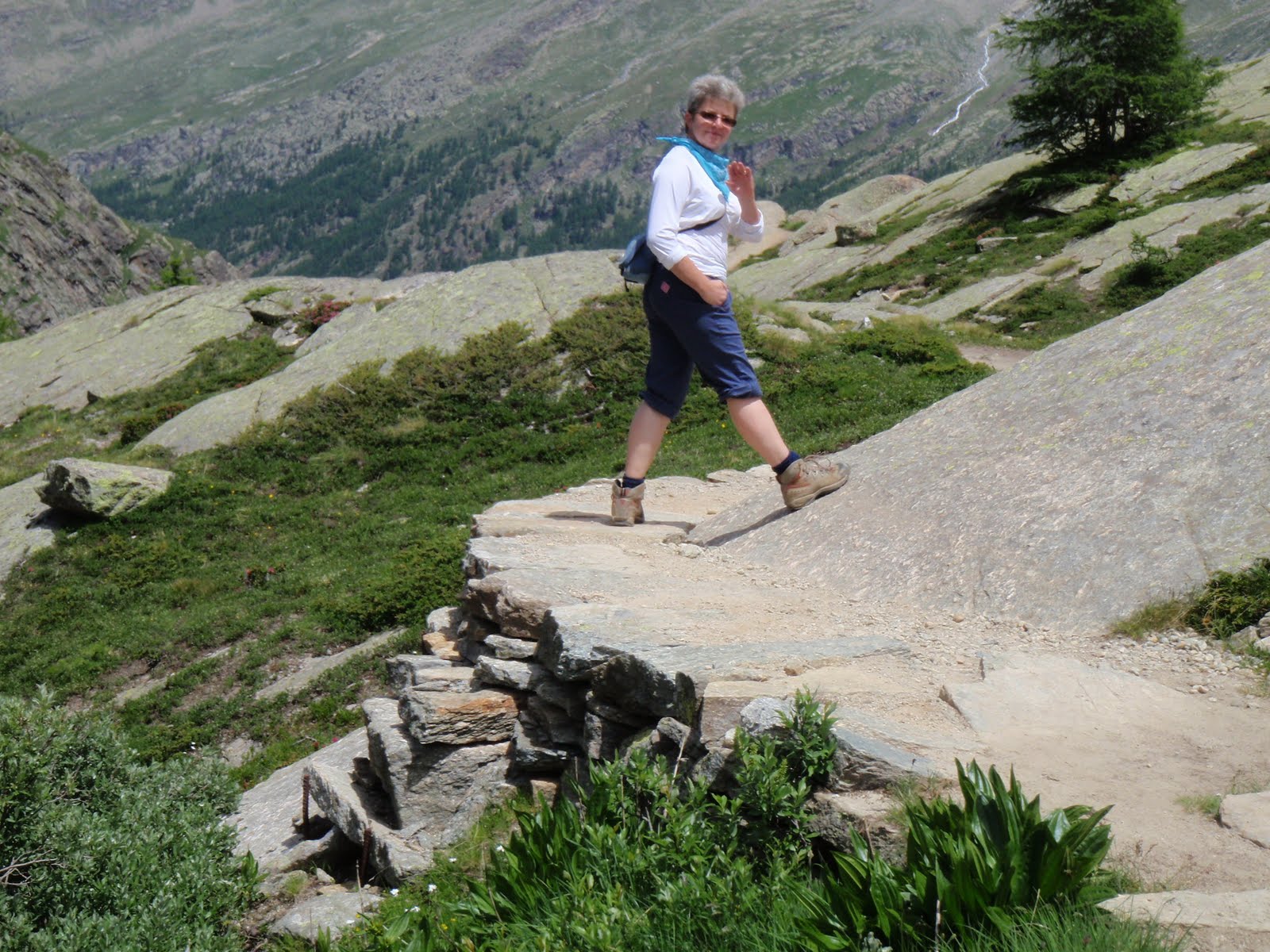
Walked to Ashleigh House B&B which is near my start of the Hadrian’s Wall Path (HWP). It’s probably 2* and frequented by builders but my room is clean.
Dinner in Pizza Express. I have a Peroni and a light pizza which is where they cut out the middle and fill it with salad. I can’t eat huge pizzas anymore. Also some roasted tomatoes and coleslaw on the side. Finish with fruity tea and a tiny piece of lemon posset crunch. Very nice.
Back to my room to take things in and out of bags.


Tues 7th April
Off to meet some Romans.
Breakfast of poached egg and tomato, and marmalade on toast.
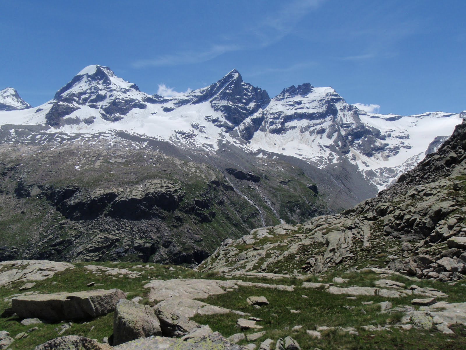
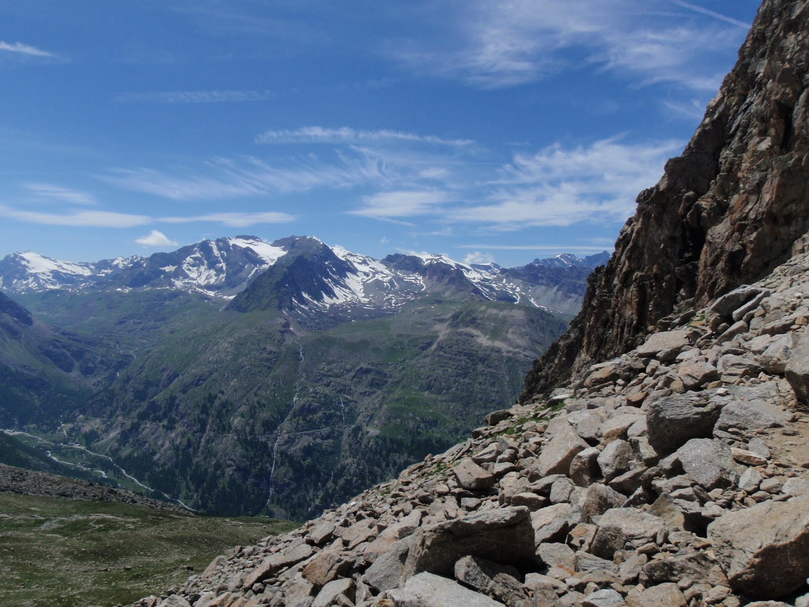
Set off at 9. My first HWP sign directs me over the River Eden across the memorial bridge into Rickerby Park. Lovely park full of dogs and their companions. Rickerby village is des res. Over the M6 into Linstock, along the river to Crosby. A little girl had set up a roadside stall so I bought some juice for 30p. Start to see farm names relating to the wall. The first section of vallum (big ditch) and Bleatarn (Roman quarry) now  full of reeds and bulrushes. Various honesty boxes along the way but have plenty of supplies. The path goes along lots of farmland, mainly sheep but some cows (well behaved). Also sections of road all very quiet. At Swainsteads the path crosses a tributary of the river Irthing with a weir.
I had my lunch at Walton sitting on a bench. On the road to cross King Water which also feeds the Irthing. Here there is a temporary road section of the HWP which looks like it’s a very long temporary. Just here is the first real section of wall but I missed it because of the diversion. I met a solo female American and had a chat. Just after Howgill I met 2 Northumberland National Park Rangers in a truck. They asked me about the condition of the path. First real climb up Craggle Hill for good views back west and south. At Hare Hill the first proper bit of wall. Quite high. Into Banks. Nice chat with woman doing her garden. Arrived 3.50 at Quarryside B&B which is lovely. Proper good welcome with tea and cake (skipped this) and biscuits. Nice room. Lovely hot shower. They will drive me to the pub 5 miles away and the pub will drive me back! Love this.
I saw 4 parties of wall walkers. 3 non UK girls with gigantic rucksacks, 2 UK women, 2 women and a man and the American.
Nice drive with David to the Belted Will Inn in Hallbankgate (Belted Will is taken from Walter Scott’s Lay of the Last Minstrel, a reference to William Howard of Naworth Castle which we drove past just after Lanercost Priory). This is the family that built Castle Howard.
Another great welcome in the pub. Sweet potato, chick pea and spinach curry with rice, nan bread and salad. Good grub washed down with Thwaites’ Wainwright beer. I have to wait for Steve the chef to take me back at 9. I had a bit of a headache so the nice bar woman has rung David to come and get me sooner. Her suggestion.
Sheets and blankets!
15 miles, 24km


Largest chunk of wall height wise

IMG_0191 IMG_0192

The acorn, where's the blasted acorn?
The acorn, where’s the blasted acorn?
One for Carol
One for Carol
P1030541
Tower at Rickerby
M6 weirdly looking a bit quiet
River Irthing
River Irthing

P1030547

Vallum
Vallum
I saw a lot of these sleepy lambs
Old Carlisle airport opposite the new one

P1030564 P1030566

Weds 8th April
Breakfast of poached eggs and beans while Elizabeth frantically makes toast to counteract a planned electricity outtage. Chat with 2 American women who are the support for a group of 19 walkers. They are all from RAF Lakenheath which I know well.
I set off at 9.25 and quickly reach my first turret. There are quite a few of these and 2 to each milecastle. Stop at Birdoswald for half an hour. Quite a lot of actual wall in this section.
Ghost boy. Strange little boy all on his own who looked like he had cancer holding a gate open. Then moments later another one who looked like him but smaller who then completely disappeared. I even looked to see where he had gone.
Cross the river Irthing which has a steel bridge brought in by helicopter. Through Gilsland crossing the railway line and then again at Greenhead. This morning at breakfast there were 2 men on the HWP. We leapfrogged for a while. I saw them when I stopped for lunch by a stream and one of them had a bad back and had to get his pack transported. I saw them again at Walltown Quarry and then later was waved at by someone being rescued in a Sea King helicopter which came right over my head. Don’t know if it was him.
First real ascent to Walltown Crags after Walltown Quarry. Frogs doing trigamy on path.
Lots of wall in such a difficult place. My back of a fag packet (mental arithmetic because haven’t smoked for nearly 15 years, hooray, best thing I ever did) calculation gets wall construction to 50 metres a day and it was 5m high which I thought could only be possible with vast quantities of slave labour, but apparently this is incorrect and it was auxiliary soldiers who did the work.
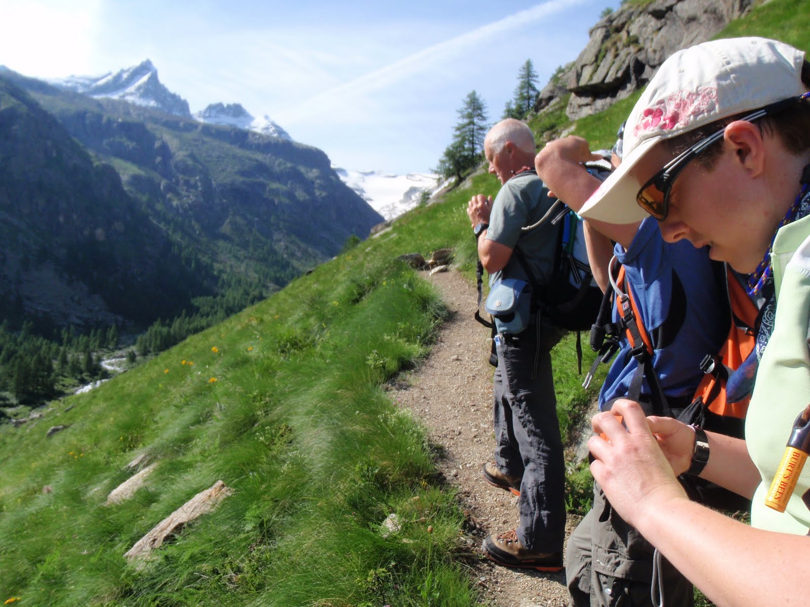
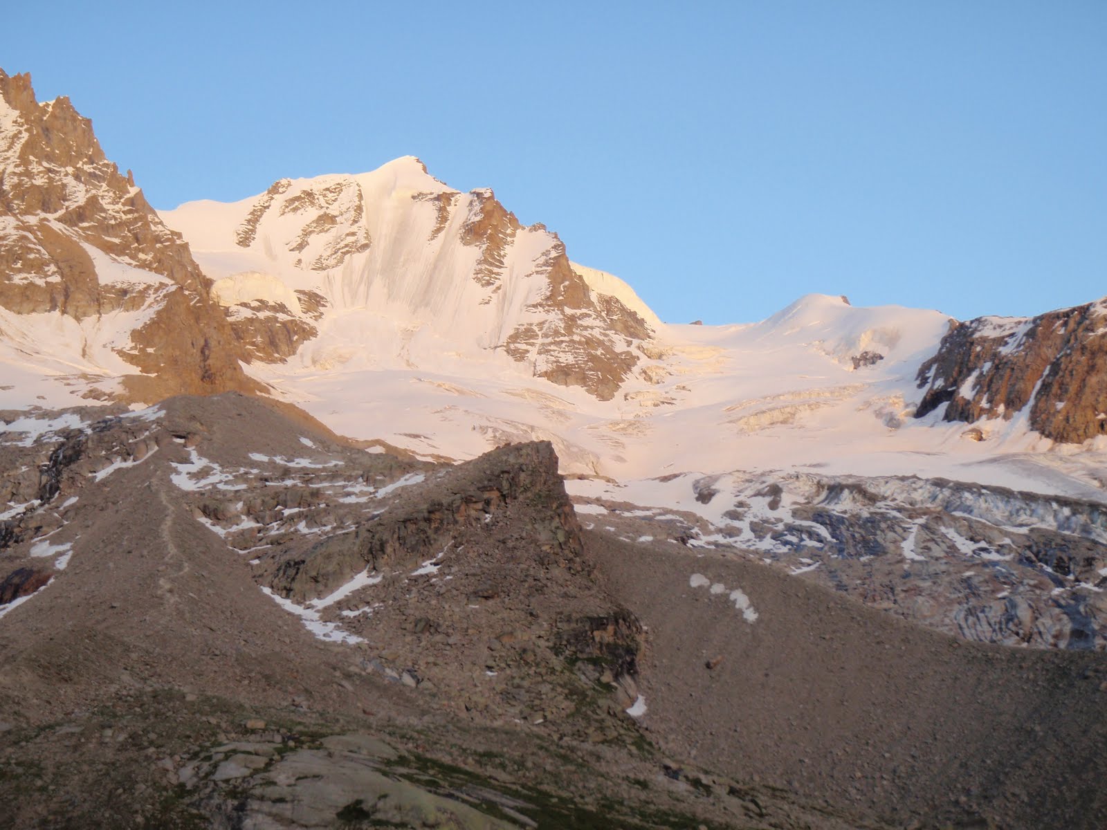
Along to Aesica fort which is really just a farm. Chat to woman who lives in Norfok and tells me the hardest bit is to come. Thanks. Today’s walk much tougher as a) muscles tired after yesterday b) much warmer and c) harder terrain with ups and downs. Down to Burnhead where there is a B&B. This would have been a sensible place to stop! It’s next to Cawfield Quarry (all the quarries are Roman and are now ponds), more mating frogs. Along the vallum to Caw Gap. Then some ups and downs to trig point at 345m where I meet my American pals from breakfast. Their party is 2.5 miles behind. I can see both my B&B and the Twice Brewed pub at Once Brewed from here. That last mile I fantasised about frothing tankards admittedly more likely in Bavaria! Val from the B&B rings me. Arrive at pub at 5.55, long hard day.
Twice Brewed beer is good. Eat a big bowl of pasta while drinking the Blonde beer waiting for my lift. It’s ok and I manage to eat it all.  The non bad back man turned up at the pub.
Two Belgians with beards tell me Val is here to take me to
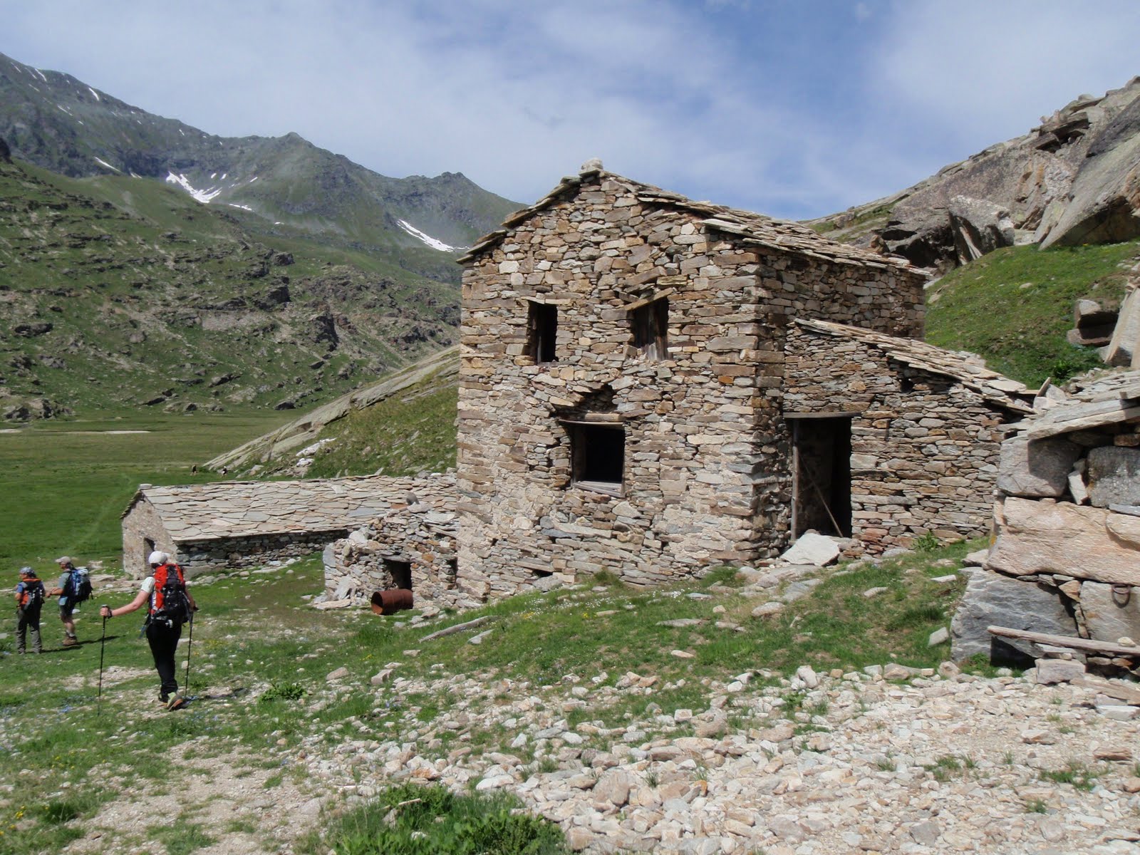
 Gibbs Hill Farm.
Val is 71 and is in a pickup. My first time in one. Gibbs Hill Farm is about a mile from the wall. Boots off outside. My room is large and comfortable. Long hot shower then down for a bottle of Becks. Long chat with David. He is in the middle of lambing. This means a month of 20 hour days. He has 600 sheep. Twins are inside and singles are outside. They own huge swathes of land from the wall to the forest and to the lough but it’s poor land. 32 miles to get round it. Used to be lots of staff and horses but now it’s bikes. He tells me lambs don’t try very hard to live! As well as the farm there is the B&B, the 3 holiday cottages and the bunkhouse. In the summer the wall is solid with hikers so I’m glad I am here now with just a few hikers and a few day trippers. Keep following the acorns (National Trail symbol). The HWP is very well marked and maintained so the Northumbria National Park rangers are doing a good job. Also relatively litter free.
When David gets time off he goes across to the Lakes and has done 70 Wainwrights.
My dad would have been 101 today.
13 miles, 21km


Little Ted on his first turret

P1030613 P1030612

Walltown Quarry
Walltown Quarry

P1030610 P1030606 P1030603

Thirlwall Castle
Thirlwall Castle

P1030596

I've got to get to the far end of that today!
I’ve got to get to the far end of that today!

P1030591

I was disturbed by the big hole in the roof and the washing on the line

P1030588

Birdoswald
Birdoswald
River Irthing
River Irthing
Birdoswald
Milecastle
Wall
Wall
And another turret
And another turret

P1030572

My first turret
My first turret
Thurs 9th April
Breakfast with the bearded Belgians. I’m not usually mad keen on beards but theirs are quite fun. One has a long but neat beard. I give the shorter bearded Belgian some sun cream.
We all get a lift back to the HWP at Steel Rigg and set off at 9.50. I go for a more relaxed pace although there is a teenage lad running up the hills like a puppy.
Up and down to Housesteads. A couple drop their National Trust card and I run to return it to them, could do with the boy for this. Pretty section through Scotch pines overlooking Broomlee Lough. I get in for nothing at Housesteads with my NT card. There are portaloos which are horrid and I wish I hadn’t bothered. Report the lack of hand cleaner to the staff. Eat choc ice cream. Quick trot round the fort. Came here a long, long time ago on a family holiday. Possibly as much as 50 years ago. I really cannot believe I am even saying that! Still some Ministry of Works labelling in place but a lack of apostrophes even then.
Say hello to the American walking group. They were 19 yesterday but today are only 10.
More ups and downs to Sewingshields Crags. Take the Americans’ photo and forget to ask them to take mine.  Chat with an HWP volunteer who is knocking down molehills and picking up litter although he says the path is not too bad and this is so but it is early in the years for hikers.
I have my lunch in a turret.
From this point on it’s down, down and then along the side of the road, not actually on it, some wall in between. This part is a bit dull, about 3 miles.
Across the road to the Temple of Mithras which also rings a very strong bell that I have been there before. I don’t bother with Procolotia fort as it looks to be lots of grassy mounds.
Back across the road and along to Limestone Corner. This is a Roman quarry where stone has been cut but then abandoned.
Down to the road, along a bit and then to Greencarts farm, arrive about 4.25.
Sandra is Val’s pal so I give her Val’s message and we are off to a good start. I have the whole bunkhouse to myself. It’s ok, but the floors are a bit grubby. First have to make my bed which is hard when I feel so tired. Second is to have a shower but I have to use the campsite ones as the bunkhouse one is being repaired so I am very glad I brought my flip flops as it’s all a bit old and grubby but my towels and sheets are all very clean.
Sandra drives me to the pub, the Crown in Humshaugh (said Humshoff). This is the best meal so far. Grilled chicken with couscous done with herbs and broccoli and red cabbage. Washed down with Blaydon Brick beer. Sandra picks me up and back we go. Huge hare in the field next to the farm.
Today’s walk was 10 miles. I’ve decided that as I’ve now walked all the exciting bits of wall and done all the ups and downs that I will have an easy day tomorrow. It’s 19 miles from here to my last stop at Heddon-on-the-Wall although they would be easy miles they look to be a bit dull. I have a plan.
Everything is signposted in miles on the ground and on one of my maps. I find it quite hard to think in miles for walking purposes as all my maps are metric.
10 miles, 16km


In Temple of Mithras
Start of the day
Start of the day
Milecastle
Milecastle

P1030621

Sycamore gap
Sycamore gap
And on and on
And on and on
Down to Broomlee Lough

P1030629

And on
And on
And on
And on
Bottom of an arch
Bottom of an arch
And on
And on
Soggy Temple of Mithras
Mithraic detail
Mithraic detail
Fri 10th April
It was odd sleeping in a bunk bed without Chris being in the one above!
I had asked for poached eggs for breakfast but got 2 small fried ones with the edges cut off which S was trying to palm off as poached. Sandra friendly etc. but the place was too grubby for me to want to come here again.
Walk to Chesters and happy memories of being in the bathhouse with Carol! Nice English Heritage coffee and shortbread. Sandra  suggested that I walk the dismtld rly (my favourite OS abbreviation!) to Hexham so I leave Chesters and go into Chollerford and cross the Tyne over a nice 18th C bridge. Along a permissive path to the Roman bridge abutment for the east side of the river looking across to Chesters. It’s an extensive structure and very clear in the water. I tried the old railway line but it was hard going, overgrown and soggy. Gave up at a private land sign to retrace my steps. Along the road a bit still on the HWP but no acorns or signs at all. Thought about looking at Brunton turret but instead got the bus to Hexham. The bus was 2 minutes late. Hexham is a bit tired and I wanted to leave almost immediately as I just didn’t want to be in a town. Went to tourist info and ran into the bearded Belgians from Ghent again. Their walk to Wark (said as in park) yesterday had been hard.
Back to the bus station. Nice chat with old man who reminded me of dear Dave, I’m a pushover for twinkly eyes! Bus to Corbridge was 10 minutes late.  Corbridge is a nice old village. Off to the Roman town which is 15 minutes walk from the centre. It’s our own Pompeii! Ice cream in the sun. Back to the village to wait for bus to Heddon-on-the-Wall. Bus was 7 minutes late. Get off at the Three Tuns. The barman says Houghton North Farm is 500m along the road. Off I trot, it is a bit more than that. Pass a bus stop I could have got off at next to the hostel. Paula is very welcoming and this really is a nice clean hostel. I have a bunk room I can lock all to myself. My bed not a bunk is already made up. The kitchen is next door and a skinny man is cooking several tons of pasta for 9 serious skinny cyclists who are in a race tomorrow. They are Wiggins level apparently.
Paula recommends the Swan. After I’ve sorted myself out and had a nice shower it’s off to the pub. I measure the distance back to the Three Tuns because I am quite obsessive and it is 800m.
The Swan is mainly a carvery. I opt for a pint, a whole pint of Doom Bar, veg lasagne and Eton Mess. It’s all ok but the beer is the best!
Back along and then take the footpath next to the hostel signed Military Road half a mile. I can’t see it at all because crops growing on it.
Back to the hostel. Despite planning not to walk much I’ve knocked up loads of miles which wasn’t the plan at all. My feet are quite good this evening. Am very grateful to Mandy for my birthday arnica salve which has saved my feet.
14 miles, 23 km


Corbridge
Corbridge

P1030651 P1030652 P1030654 P1030656 P1030658

Hypercaust
Hypercaust
Ministry of Works managed an apostrophe
Bath house at Chesters
The fog is not on the Tyne
Bridge foundations
Bridge foundations
Bridge over the Tyne at Chollerford
Art deco flicks
Art deco flicks
Hexham Abbey
Hexham Abbey
Corbridge Roman town
Sat 11th April
Very glad no ailments on this trip – no blisters, no cuts, no bruises, no insect bites. Just slight headache because of not drinking enough which was soon remedied. Very pleased with what I’ve done. It got easier each day. Still slept badly everywhere. But I like waking early and the early mornings are the best part of day for me. Bruce song accompanying me on the trip in my head was Further on up the road. Of course.


[youtube https://www.youtube.com/watch?v=R0PAZXY3ZEE]


Breakfast was a bit bonkers with the cyclists but pleasantly overlooked by Paula who made sure everyone had what they wanted. Surprise to see the 2 American women again. 12 of the 19 air force men finished the walk. They rushed off.
The Express bus got me into Newcastle. I recognised Eldon Square, decided to spend 20 minutes in the big M&S and had a coffee. Then onto the Metro to Central Station and into my First Class seat to Leeds (£1 extra). My car was still at Sowerby Bridge station much to my relief. Home before 2pm. Always funny to see how much further on the plants are in just a few days. Feels like weeks!


Gear, kit and tips
Planning was done using:


Maps:
National Trail 1:40K strip map, basic but despite the metric scale also shows exactly how many miles you’ve walked, good for detail of services available.
Harvey’s 1:40K strip map, showed better contour detail. I had the 2 maps on either side of a case so that I could quickly get the different but equally useful bits of information.
At no point did I need a compass. It would have been possible to do the whole walk without a map but you would also lose a lot of the historical detail.


I used a baggage service, Walkers’ Bags, to take my holdall to each destination. This was efficient and cheap, cost £7 per day.


Because the weather was so stunningly good I was able to ditch my waterproof jacket and trousers after the first day. I took:
Medium sized rucksack
Trekking poles (only used on one day)
Bladder for water (essential), I used about 1.5 litres each day, drink lots before you leave your accommodation.
Small first aid and emergency kit, Compeed essential here, I didn’t have to use it but if there’s a hint of a possible blister, you need to be able to deal with it. Sunscreen also essential.
Snacks, I ate a couple of energy bars each day, one mid morning and one as I started to flag near the end of each walk with a big hill looming! I didn’t eat much else but made up for it in the pubs.
Camera
Lightweight summer boots
Summer walking trousers
Short sleeve merino top
A sun hat, mine is a baseball cap with a foreign legion flap, I don’t care how stupid I look and I can always tuck the flap away and look almost normal if the sun isn’t shining on my neck.
Long sleeve merino top (merino lessens the terrible smells which you get with synthetic clothes)
Light weight warm synthetic jacket
Last but not least, a small Mountain Rescue bear, who has his own ruddy Facebook page! You will find him on Facebook by searching for Little Ted.


In the holdall:
Change of clothes
Wash kit
Arnica salve, this kept my feet in one piece, lovely stuff from Neal’s Yard
Books
Supplies of snacks, energy bars etc. I had far too many of these.
Extra layers because I thought it might easily be cold and wet!
I walked the walk I wanted to do, I didn’t stick strictly to the Hadrian’s Wall Path which starts at Bowness on Solway and goes to Wallsend. Once I had got onto the path at Carlisle though I did stick to it rigidly and followed it as far as Chollerford. It all went really well and I have a great sense of achievement plus I think the Pyrenees trip is now possible.


Please support the National Amyloidosis Centre
Lots of people decide to do big things, runs and walks and climbs and raise money for charity. I managed to not spend all the money I took with me so I’ve decided to donate £2 for every mile I covered to the National Amyloidosis Centre. Those of you who know me will understand why I’m doing this and I would urge anyone who has enjoyed this blog post to donate to the NAC. Amyloidosis is a hideous illness and is rare and thus needs more research, please support them and University College London to find out more and so be able to treat patients like my dearest friend.


Please visit Map and Compass and learn how to interpret a map and use a compass with me and my navigation partner, Cath.

MAPandCOMPASS

iPhone and 10 things to do when wild camping

  1. On the motorway, we used Traffic Info to find out if there were any jams on our route.
  2. The spirit level was useful, not to find a level spot for the tent (impossible) but to make sure that the stone coasters were level for our cups of tea and the stove.
  3. Weather info, of course, but only when I had a signal.
  4. I read a bit of an ibook in the dark.
  5. The Dictionary helped us with the crossword or more precisely it helped me to spell daiquiri correctly!
  6. I took a few photos but my proper camera is better.
  7. I attempted to amuse C with the SAS Survival Guide (dismal failure!)
  8. Used the alarm clock to wake us up (not entirely necessary)
  9. Sent a text message.
  10. Used the stop watch to do some navigation timing.
What we did not use it for:
  1. Navigation – map and compass were all we needed. GPS just a backup for the real thing.
  2. Making a phone call!

Please visit Map and Compass and learn how to interpret a map with me and my navigation partner, Cath.

Italy 5th – 9th July (Valsavarenche)

Monday 5th July
This day’s breakfast was excluding flies and seemed a bit better, croissant with jam inside, not sure about this, I like them plain.
The shoes/luggage superstore was shut until 3.00 in the afternoon so this was no good but Bennets was open and had a household section with very cheap luggage in it, so I bought a holdall on wheels for €19. I then had a coffee in the shopping centre which was nice but decided not to linger as the customers weren’t so delightful. I got a taxi to Stazione Dora. The queer ticket girl told me to go to platform 1 but actually the train went from platform 2, this meant a rush to get onto the train. Very nice train, new and air conditioned and quick to get to the airport. Annie and Caroline were sunning themselves next to the taxi park! I got under a shady tree and we just waited a couple of hours for Mel and Liz. We all got food – I had a huge aubergine, courgette and mozzarella sandwich as well as my own home made sandwich.
Lovely to see Mel and Liz, Liz is now the 7th person with an arm in a sling! We drove up to the mountains which takes about an hour and a half and stop in the village of Villeneuve where we stopped to get a map for Mel and then had a beer in a cafe. I rang home in case this was the end of my mobile signal.
After another half hour we were at the Hotel Genzianella which is a lovely old hotel in the hamlet of Pont near the head of the Valsavarenche valley which is in the Valle d’Aosta. Now that we were in the countryside everything was all clean and lovely.
We got settled in and I have the bed near the window. We devised some rules like a rota for showering, and no hairs in the plughole! The room was lovely – all wood panelled but the bathroom, complete with bath, is very dark. A and C wrinkle up their noses at the idea that someone might use the bidet!
We had dinner, the first course was pasta with ham and cheese, the second was slices of pork braised in wine, mashed spuds and mixed veg. Finished off with creme caramel.
We went to bed early. Not exactly a peaceful night but quite long (9.5 hours) so we must have had some sleep! Annie sleep talking at first which gave me a jump as had forgotten she did this.

View from hotel
Airport reflection!

[googlemaps https://maps.google.com/maps?f=q&source=s_q&hl=en&geocode=&q=Valsavarenche,+Valle+D’aosta,+Italy&aq=0&oq=valsa&sll=45.062852,7.678413&sspn=0.076387,0.209255&ie=UTF8&hq=&hnear=Valsavarenche,+Valle+D’aosta,+Aosta+Valley,+Italy&t=m&ll=45.590618,7.209864&spn=0.018019,0.025749&z=14&iwloc=A&output=embed&w=300&h=300]

Tuesday 6th July
Breakfast of muesli and yoghurt, sweet croissant, ham and cheese and an espresso. We, as in A, C, M and I set off just after 9.00, leaving Liz with the Italian phrase book and various supplies rejected from our picnics.
We went up the road through the remains of Pont, sad old timber houses left to rot, and past the other big hotel and the campsite. Beautiful walk going up and up – lots of Alpine flowers, a marmot, a chamois, big birds of prey and some wolf poo! In general, we walked in the order Mel, Annie, Caroline and me taking up the rear. I was a puffing Billy all the way up. It gradually cooled as we rose in height which was lovely. At Grand Collet (nearly 3000m) we stowed the bags and walked up the boulders a bit more. This gave us fab views across to France. We had our first lunch up here.
We slid down some steep scree to a big wide U shaped valley. On the plateau we had our second lunch. We met a couple of gay girls and A got very excited! It was flat for a good long stretch, following the river. Lovely clear rushing water and falls. We reached a cross with a plastic pink crucifix on it looking over to Gran Paradiso. It seemed quite a way down from here but my knee was being a bit rubbish. Whilst having a short rest I took my hat off and forgot to put it back on.
Soon back at the hotel for beer with Liz. I had a shower in M and L’s room as A and C managed to dismember the rota system causing themselves great confusion! A and I went to the campsite shop and I bought a new hat, a better one, baseball style with a flap at the back to keep my neck shaded like a French Foreign Legion hat. Seeing as how both hats made me look stupid there wasn’t much in it! Whilst I was busy buying the hat, A was busy chatting up the girls from earlier, so this was a bit of luck for her, and I still hadn’t really noticed them! I also bought a lip salve as mine had disappeared.
Dinner was pasta and ham, pork and polenta and salad followed by an eggy pudding – bit heavy. Lots of wine.
We went into the lounge where a fire was burning because the bloody football was on the telly with a great crowd of Dutch people watching it. We sort of supported Uruguay to annoy them. I had a sip of L’s genepi – nice! but I had a headache so went to bed, I had thought I’d be able to escape football in the mountains. Our beds here have 2 blankets and a big cover on them.
Camp site at Pont
Let’s all play with our cameras
Head of the Valsavarenche
Genzianella
GP in the background

[googlemaps https://maps.google.com/maps?f=q&source=s_q&hl=en&geocode=&q=+Valsavarenche,+Valle+D’aosta,+Italy&aq=&sll=45.699106,7.005795&sspn=2.417075,6.696167&ie=UTF8&hq=&hnear=Valsavarenche,+Valle+D’aosta,+Aosta+Valley,+Italy&t=m&ll=45.590618,7.209778&spn=0.036038,0.051498&z=13&iwloc=A&output=embed&w=300&h=300]

Wednesday 7th July
We left the hotel at 8.50, a slow, steady climb through the forest all along the side of the river. Very lush and green. We went all the way to the head of the river and the first snow/glacier ice. At this point we had our first lunch.
After lunch it was straight into the ice axe arrest, we did this in the following ways, getting it right and then moving onto the next, more challenging way of falling.

  1. Feet first, on back – left and right sides.
  2. Face first, on front – both sides
  3. Head first, on back – both sides
This was tiring as each time we had to go back up our slides to start again, thus requiring a second lunch!
We moved further on up the glacier to 2550m and then practised walking in crampons. Up a slope, down a slope, across and up, across and down. This was harder this year than it had been last year, partly because of my knee not being as good as it could be (M and I worked out that my knee goes “back a long way”!)
After all this, we went back to the hotel, we only saw 2 people on our whole way up and down. We went through the campsite, there was a hat very similar to mine that someone had put on top of a big pole but it wasn’t mine. C and I asked in the shop, which was plunged in darkness, making shopping even more fun, for snow baskets for our poles. Both C and I were using our poles a lot to take pressure off our respective ankle and knee. We had to explain that we had no money on us and would return later. Back at the hotel for a beer and then C went off and got our baskets which cost €3 for a pair. I had another shower in M and L’s room and then rang home from the big rock across from the hotel.
Liz had found a hat, which was very similar to mine but not mine, however I gratefully accepted it as it was better than mine! I also found my lip salve which had somehow got under the bed.
M came and told me and C what to pack which was fun just flinging stuff out, got our packs nice and light, but he could not be persuaded to go for soft shell at all!! L had given me a couple of stamps which I then promptly lost during the flinging.
Dinner was mushroom risotto, turkey and gravy plus chips and Swiss chard followed by choc mousse or ice cream, not sure which but I couldn’t quite manage it.
There was more ruddy football but less intrusive. M and I shared a whisky.
Each night I have a short read using my headlamp but don’t like to overdo this as A and C are trying to sleep and C sleeps very lightly.

Head of Valsavarenche
Most arresting!
Blimey!

When I was in the French Foreign Legion …
Pont

[googlemaps https://maps.google.com/maps?f=q&source=s_q&hl=en&geocode=&q=+Valsavarenche,+Valle+D’aosta,+Italy&aq=&sll=45.699106,7.005795&sspn=2.417075,6.696167&ie=UTF8&hq=&hnear=Valsavarenche,+Valle+D’aosta,+Aosta+Valley,+Italy&t=m&ll=45.590618,7.209778&spn=0.036038,0.051498&z=13&iwloc=A&output=embed&w=300&h=300]

Thursday 8th July
A leisurely start but we were ready by 9.00. Farewell to L. A nice walk up to the Federico Chabod Rifugio which is at 2750m, we started just down the road from the hotel at 1861m.
The refuge is lovely, clean, welcoming and civilised, the total opposite of the Gouter Hut from last year. It has flush loos, loo paper and running water and electricity.
I had pasta and tomato sauce for lunch – huge portions. C and M had gnocchi with leek and Gorgonzola which they said was delicious and I developed a hankering for this.
We had a bit of a rest after making up our beds, also nice and clean – cleaner than a YHA at least. We had a room with 6 bunks in it. I was in the top one above M, and C and A are in the bottom ones. A had Stephano the guide above her, so to speak!
We then went off for what turned into quite a big walk along path 10a, going up to about 3200m. It was quite exposed in places and there was some scree so we said we didn’t want to go back that way. We got up to the snow field with M testing the snow very carefully. To get down we went down the boulder field, some of which were enormous. We had a scary moment when a big slab had moved a bit when M passed it, a bit more when A got to it and then when C was at it, it just shot off down the mountain. M and A moved out of the way really fast and we were all ok. I was well out of its trajectory. We got back to the refuge after about 4 hours out and met Stephano the guide – a nice, gentle but firm man!
Dinner was more pasta and tomato sauce, pork slices and greasy veg. Where do all the pigs live? No pigs to be seen anywhere. I was a bit anxious about the big walk but decided to do it.
We all went to bed early after looking at the sunset. We saw the guy who ran the hotel we’d stayed in in Chamonix last year. It was very hot in the refuge and even hotter in bed, I felt roasted alive and was drenched from head to foot in sweat, just in my thin sleeping bag.
Hotel Genzianella
Looking back to hotel

Rifugio Federico Chabod

Big un
I want this wood pile

[googlemaps https://maps.google.com/maps?f=q&source=s_q&hl=en&geocode=&q=Rifugio+Federico+Chabod,+Valsavarenche,+Italy&aq=1&oq=rifugio+&sll=45.586894,7.197418&sspn=0.075684,0.209255&ie=UTF8&hq=Rifugio+Federico+Chabod,&hnear=Valsavarenche,+Valle+D’aosta,+Aosta+Valley,+Italy&t=m&ll=45.591414,7.209198&spn=0.004505,0.006437&z=16&iwloc=A&output=embed&w=300&h=300]

Friday 9th July 
Woke at 3.30 with swimming head, I knew immediately it was BPV (benign positional vertigo), I don’t get the paroxysmal bit. I firstly negotiated getting out of the top bunk and finding my specs, finished packing, wobbled drunkenly from side to side down the stairs to breakfast of grapefruit juice, cornflakes and milk, bread and jam and coffee. I mentioned I was feeling dizzy to Mel but didn’t go into the whole thing about BPV as usually people get completely misled by the word vertigo and don’t understand the condition.
We set off at 4.30 up the scree in the dark, headlamps aglow. I was struggling to stay upright and it was only my poles that kept me balanced. After about an hour Mel and Stephano asked if everyone was OK, I told Mel I was still dizzy and struggling, and explained about the BPV. Mel immediately understood as he has suffered from this himself. I’ve had this happen since I was a teenager and just to put the record straight it has nothing to do with altitude vertigo, for me it gets set off by stress and not enough sleep. It can go on for days or weeks but usually these days occurs quite briefly and passes off once I can get stable. I went for loads of tests about it years ago but only actually found out what it was from reading a book by Barbara Kingsolver called Prodigal Summer. In the book she actually describes a procedure which can help to clear the symptoms, the Epley manouvre, however it is not something you can do up a mountain as it involves  basically twirling yourself over and over backwards and forth whilst horizontal!! I definitely hadn’t slept very well being so hot and was a bit anxious about the climb up.
Mel and I said farewell to the girls and Stephano and set off back down to the refuge. On the way we were very privileged to watch a group of 9 or so ibex doing their clashing horns ritual for a good long time. Mel held onto me so that I could safely tip my head back and watch them without falling back through dizziness. We got to the refuge about 6.30 and left at 6.45 as M didn’t want to hang around there waiting all morning. We went straight back down to the car park in 1 hour and 45 minutes. It was a lovely cool walk and we only met a park ranger, complete with his gun. They carry guns because when the park was set up, hunters still hunted in the park and the only way to stop them hunting was to meet fire with fire. Thankfully no park ranger has had to fire his weapon. On the way to the car park, I ate half a granola bar.
Back at the hotel, Liz was much surprised to see us. I had a 2nd breakfast of coffee and 2 pains au chocolat. Mel had a coffee and went straight off back to the refuge (he did it this time in 1.5 hours!)
I had a bath and then Liz and I left the hotel at 10.30 and walked up to the big green valley we had come down on Tuesday. We were out for quite a while and I had 1 and a half granola bars but did not give any of them to the hungry fox we met! It was a lovely walk, very hot. We got back at 4.00 and A, C and S had just got back with M and so we helped them to celebrate their successful ascent of Gran Paradiso at 4061m. They said I would have hated the exposure of the very top bit.
We drank lots of beer and ate lots of crisps.
I had another bath, did a bit of packing and found my stamps. All lost items now recovered.
A herd of bullocks went up the road, very sweet and on the menu later.
Dinner was pasta and tuna, veal which was yet another item that turned out to be pork and salad. Liz and I went for a short walk to the campsite and had a look at the bullocks in their new field. Everyone was early to bed.

Ibex clash

Liz and neat bit of path
Foxy
Scabby foxy

Please visit Map and Compass and learn how to interpret a map with me and my navigation partner, Cath.

Lizard impersonation
css.php