WGL training 16th Feb 2010

Tuesday, no more Dave. On to Steve. We do more classroom work and then out to take turns leading a leg. Davy races us up a hill and most of us are panting, he isn’t but then he is militarily fit. As I get my leg to nav to, 2 women of a certain persuasion appear and want directions. I am convinced they are Steve’s stooges so am on my best behaviour and show them where they are. Very good practice as we have just negotiated a tricky non path.
I tramp the group across the heather just for fun. We finish up having to do a steep descent.
Back to PYB for more lectures, tea, cakes, showers.
We get a special early dinner because we are going out night navigating. Steve drives us about 2 miles down the road. It is frosty. We tramp up a hill again going far too fast straight after eating 3 courses. Then we send 2 ahead to walk on a bearing and direct from behind.
Once we work out we haven’t walked for long enough to reach our river, we continue and then find it. Our next stop is a spot height which we find by aiming off. Am very impressed that the techniques work. We aim off to a wall and descend back to the bus. Hannah gets stuck in the freezing bog, but no problem as the drying rooms are very efficient.
We only did a couple of kilometres but it was great that the principles worked and we achieved our aims and found the places on the map, fab.

[googlemaps https://maps.google.com/maps?f=q&source=s_q&hl=en&geocode=&q=Llyn+Dinas,+Beddgelert,+United+Kingdom&aq=0&oq=llyn+&sll=53.02609,-4.05859&sspn=0.032522,0.104628&ie=UTF8&hq=&hnear=Llyn+Dinas&t=m&ll=53.016642,-4.066658&spn=0.01549,0.025749&z=14&iwloc=A&output=embed&w=300&h=300]

Please visit Map and Compass and learn how to interpret a map with me and my navigation partner, Cath.

WGL training 15th Feb 2010

Arrived at Plas y Brenin on Sunday 14th, after a good journey taking just over 3 hours. I checked in, unpacked my bags in my twin room with just me in it. I have a brand new en suite and the rooms are warm and comfy. No TV which is great.
In the bar, I chat to a woman who is going to do kayaking and eat a burger and chips and salad, well I didn’t eat the chips, very nice home made burger.
Go to bed quite early after orienting myself around the rabbit warren on the place, it’s an old coaching inn for travellers from Dublin and has a staircase and selection of corridors at every turn. It’s been a mountain training centre for over 50 years.
In the morning, go to breakfast, eat various things on toast and fill a plastic bag with rolls for lunch, all labelled with day and contents and all very neatly filed, also fruit and a piece of home made cake.
The only criticism I have is that the coffee is pants, yes all the food is included which is great but they could do with a proper coffee machine.
Go to Introduction Lecture with the Director of the Centre and meet Lorraine who is in the WGL group. We all hive off with our trainers who are Dave and Steve. Follow them across the road to our training room in Berwen. Steve says he’ll see us next day and leaves us with Dave.
We are Lorraine, nurse from Cardiff; Cath, a DoE scheme leader from school in Surrey; Hannah, the same; Peter, retired construction firm owner from Brecon; Davy, who old deaf ears here thinks is called Steve, about to leave military intelligence after endless years; and me.
Dave the trainer does some talking and then we’re off in the minibus for about half an hour up to the north wales coast but inland a bit to spend the day practising our nav.
Cold and wet all day, we get to use the group shelter to eat our lunches, bit squashed but keeps the wind off well.
Then back to PYB for a shower, a bit more lecture, then tea and cake, then more lecture, then dinner of roast beef – very nice. Then more lecture. Working us hard.
A swift drink in the bar then bed.

[googlemaps https://maps.google.com/maps?f=q&source=s_q&hl=en&geocode=&q=Penmaenmawr,+United+Kingdom&aq=0&oq=penmaen&sll=53.289847,-3.985291&sspn=0.517174,1.674042&ie=UTF8&hq=&hnear=Penmaenmawr,+Conwy,+United+Kingdom&t=m&ll=53.266599,-3.92066&spn=0.0154,0.025749&z=14&iwloc=A&output=embed&w=300&h=300]

Please visit Map and Compass and learn how to interpret a map with me and my navigation partner, Cath.

Thursday 10th September Day 3

Both my heritages, left for pater, right for mater!
This is a rocket, right!
Cooee!

We did this earlier on, aaargh!


Having recovered from the ladder experience, this day was to present a different challenge. Before setting out all our bags were carefully inspected by Stephane, much got chucked out and packs were much lighter. I also chucked out my heel lifts and was instantly more comfortable and able to balance properly.

We set off on a big cable car up to the Aiguille du Midi. This station is at 3842m and you change cable cars half way up. The station has a rocket on top. Not a very good or beautiful rocket, more of a Thunderbirds type. We got out and cramponed up with axes at the ready.
Straight away, the first thing we had to negotiate was an arete (ridge) of mind numbing terror. My mind did go numb and I just stopped. Being roped to Ann and Stephane, I guess this was not a very bright thing to do but I did nearly lose it. However, on looking ahead, the actual ridge was not very long. I had seen people coming up it when we got out of the cable car and had taken a photo, as you do, thinking “blimey, some people do mad things!” little dreaming that I was about to be one of them.
But once done, soon forgotten and then it was across the Vallee Blanche which was just as described. We crossed crevasses, wending our way for about 5km in lovely weather, and consolidating the skills, crampon wise of the day before. Whilst roped up I got a phone call from the manager at the residential home where my aunt lives, I’m not sure he believed me when I said I was crossing a crevasse! A short stop for lunch, so short I didn’t get any in my mouth and then a short walk to the Helbronner cable station. This station is on the border of France and Italy so I celebrated my dual heritages by spreading myself across the border whilst Ann took photos of me under the flag signs.
The return journey from Helbronner involved a very small cable car which I shared with Annie and Caroline. They started jigging about to Leona Lewis and Steps and it got a bit worrisome for me. Annie stopped when I mentioned my fears were similar to hers of being stuck in the big cable car with lots of people. Fantastic views of where we’d walked. Then all the way down from the Aiguille du Midi to Chamonix and refreshments in a cafe. Walked back to the hotel and evening meal followed by seriously sad and quite weird film about a creepy young guy and his girlfriend Lucille, who he clearly thought was not really human, and their attempt to climb Everest. The attempt resulted in both their deaths. She falling down a crevasse and him just dying hopelessly. The film was strangely edited and the subtitles stopped even before L went down the hole. Just what you want to watch before climbing your first very big mountain!

[googlemaps https://maps.google.com/maps?f=q&source=s_q&hl=en&geocode=&q=helbronner+chamonix&aq=&sll=45.922329,6.874545&sspn=0.018808,0.052314&ie=UTF8&hq=&hnear=Pointe+Helbronner&t=m&ll=45.845722,6.931944&spn=0.017937,0.025749&z=14&iwloc=A&output=embed&w=300&h=300]

Please visit Map and Compass and learn how to interpret a map with me and my navigation partner, Cath.

Wednesday 9th September Day 2

Mer de Glace

Lots of continental breakfast to sustain us for the day ahead. Into town in Mario’s minibus to a little station to take a little train to Montenvers railway station which gives access to the Mer de Glace. We set off walking in our full winter gear (well I did), plus ice axes, helmets and crampons. After a short walk we came to a sheer cliff face which we descended via about 7 or 8 long ladders. My estimate was that the distance covered by the ladders was about 100m. When I read an article from the Independent (22/08/09) which has a photo of the ladders, the writer reckoned it was 200m. Go to More Photos and scroll through to see the wretched ladders! For me, going down, I quite enjoyed the ladders, it was only later on that I felt differently about them.

A few boulders and then straight onto the glacier. My only previous experience of a glacier was the Jostedal in Norway, which Chris and I just walked on very briefly in our ordinary shoes before a stampede of Japanese tourists arrived. I hope that is the right one!
Getting used to the crampons by tackling shallow slopes and then steeper ones. I do like crampons and feel very secure in them, I had really enjoyed the weekend in the Cairngorms with Chris Conley and Chris H learning to use them.
We moved onto some rope work – this means climbing up a slope using crampons and axe whilst attached to the rope which was attached to a fixed point. Again, this was made gradually steeper until finally we climbed a vertical wall of ice. I just about managed to do this, although did not make a very pretty picture! However the abseiling down was just fab, loved it!
We walked around and into sections of the glacier, wonderful ice formations.
Eventually it was time to return to ascend the cliff. I was very hot, and my pack was full, I also was having a problem balancing as my heel lifts had slipped to the middle of my boots so was pretty much totally out of kilter. Getting up those wretched ladders became a major challenge and there seemed to be many more of them than there had been going down. Both Pierrot and Stephane said my pack was too heavy.
We went back down on the little train and got picked up by Mario after a refreshment stop! A bit later we had our evening meal and then a bit of an old 50s climbing film where men wore corduroys but still dangled upside down from terribly high places.

Going down into the glacier
Ice climbing
Ice climbing
Alpinism oh yes!
Alpinism oh yes!


[googlemaps https://maps.google.com/maps?f=q&source=s_q&hl=en&geocode=&q=Montenvers+Mer+de+Glace,+Chamonix-Mont-Blanc,+France&aq=1&oq=montenvers&sll=45.923697,6.869433&sspn=0.300913,0.837021&ie=UTF8&hq=&hnear=Montenvers+Mer+de+Glace,+74400+Chamonix,+Haute-Savoie,+Rhone-Alpes,+France&t=m&ll=45.922737,6.875381&spn=0.017912,0.025749&z=14&iwloc=A&output=embed&w=300&h=300]

Please visit Map and Compass and learn how to interpret a map with me and my navigation partner, Cath.

Training for Mont Blanc

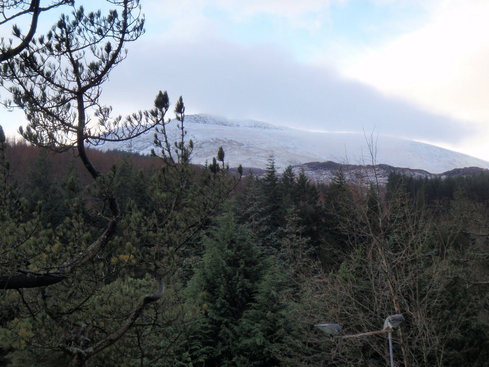
St. Sunday Crag 090809
Parked in the hotel car park at Patterdale. £3 for the day.
From Patterdale went through field with cows all lying down. Then up Thornhow End and Harrison Crag, no scrambling. Whilst stopped for short break, 2 women came past with concerns about the bull in the field who had been lively on their way up. I reassured them that all the cows were lying down and that I hadn’t spotted a bull and then forgot about him!
Carried on along the contour on the side of Birks and then up along the ridge to St Sunday Crag. There was one man and two girls on the summit, well we all arrived at the same time and all looked a bit like we wished the others weren’t there. I stuck it out and had my lunch in peace on the top! Whilst there a flare went up from the sheer scree east side of Helvellyn and a helicopter spent a lot of time trying to do something. I found out afterwards that a woman had fallen 3 metres from the top path onto a man on the lower path. She had hurt her leg. She also managed to get herself to hospital after being rescued. Given that the Mountain Rescue is a charity and receives no government funding, it seemed a lot of effort for someone who was walking wounded.
I went across to Gavel Pike as it was about a hundred metres away. It was a lovely spot, quite different, and worth the short hike. Then cut back to the main path and returned the same way.
When I reached the field with the cows, the bull was up and about, he was a very big chap in every way. I just said hello as I had done before and gave them a good wide berth. No problem.

[googlemaps https://maps.google.com/maps?f=q&source=s_q&hl=en&geocode=&q=St+Sunday+Crag,+Patterdale,+Eden+District,+United+Kingdom&aq=0&oq=st.+sunday+c&sll=50.917889,14.056706&sspn=0.008522,0.026157&ie=UTF8&hq=&hnear=St+Sunday+Crag&t=m&ll=54.511914,-2.975922&spn=0.029897,0.051498&z=13&output=embed&w=300&h=300]

High Street 020809
Parked for free on the road at Mardale. It was a bit busy here but then Julia Bradbury had been on the TV going up High Street earlier on in the week. After all, that had made me think of it too.
First turned towards Haweswater to reach the far end of the ridge. Then up along the ridge all the way to the top. The ridge is quite craggy and scrambling is needed. Could be a bit scary to those who don’t like heights. The top is fantastic, really does look like a Roman road, which it is, from I think, Ambleside to Keswick. Lot of effort up there in a toga I can tell you. It was very nippy and I had to put various winter layers on. Bit busy on the top.
Went across to Mardale Ill Bell and then down the Nan Bield Pass. Pleasant route via Small Water.

[googlemaps https://maps.google.com/maps?f=q&source=s_q&hl=en&geocode=&q=High+Street,+Lake+District+National+Park,+Patterdale,+Eden+District,+United+Kingdom&aq=0&oq=high+street+lake+dis&sll=54.410539,-2.850952&sspn=0.125877,0.41851&ie=UTF8&hq=&hnear=High+St&t=m&ll=54.491679,-2.864857&spn=0.029911,0.051498&z=13&iwloc=A&output=embed&w=300&h=300]

Shipman Knotts and Kentmere Pike 260709
Parked for free at Sadgill.
Took the path towards Stile End. Then turned off right to ascend. Quite a lot of scrambling on Wray Crag to get up to Shipman Knotts, by this time in thick mist so have little idea of what it looked like. Continued up following a wall and then fence which I kept in sight. There was one bit when I couldn’t see the handrail but fortunately this part was served by a good path. Got to Kentmere Pike and have no idea whether it has a lovely view or not. Very wet indeed.
I met 2 people on this walk. The cloud lifted a bit on the way down and surprised me with what was there, i.e. lovely views across to Longsleddale but quickly shrouded again.

[googlemaps https://maps.google.com/maps?f=q&source=s_q&hl=en&geocode=&q=kentmere+pike&aq=&sll=54.454223,-3.211602&sspn=0.062871,0.209255&ie=UTF8&hq=&hnear=Stony+Cove+Pike&t=m&ll=54.482007,-2.89876&spn=0.014959,0.025749&z=14&iwloc=A&output=embed&w=300&h=300]

Grey Crag and Tarn Crag 190709
Parked for free on the roadside at Sadgill which is at the end of Longsleddale. Very small road to get to it and Sadgill literally is the end of the road.
Straight up from the road onto the fell, through a lot of very high bracken, up what AW calls an easy gully, ha ha, there is no scrambling but it’s quite wearing. Onto Great Howe and across to Grey Crag. So far so good as good weather but would be hard in mist with no marked paths. From Grey Crag (the E in GrEy very important as there is another fell called GrAy Crag), I could see Harrop Pike was only a couple of hundred metres away so skipped over there, then skipped back and across to Tarn Crag. Then I decided to head back and thought I would go a different route from that planned. Over confidence rushing in here having detoured to Harrop Pike. I tried to get down but it was too steep, didn’t panic, just came back up again and went off an easier way, and followed the fence line across and then back over to just below Great Howe, some very steep bits where I had to hang on to the fence. It was ok and I found a handrail of a wall I recognised and then was back on track. Got back to the car and felt in trouser pocket for the keys, pocket was unzipped and no keys in it. So gave myself several moments of sheer unadulterated panic. Then remembered they were where they always are, on the key ring in the rucksack. Lessons learnt – make plan and stick to it, don’t go off piste unless completely sure of navigation. Be fully prepared and confident in knowledge that I can accurately navigate and not make mistakes.

[googlemaps https://maps.google.com/maps?f=q&source=s_q&hl=en&geocode=&q=Tarn+Crag+(Sleddale),+Longsleddale,+South+Lakeland+District,+United+Kingdom&aq=0&oq=tarn+crag&sll=54.399748,-2.796192&sspn=0.062955,0.209255&ie=UTF8&hq=&hnear=Tarn+Crag+(Sleddale)&t=m&ll=54.463453,-2.790527&spn=0.059864,0.102997&z=12&iwloc=A&output=embed&w=300&h=300]

Red Screes 110709
Parked in Ambleside in the college car park, opposite the main car park. £6 for the day. The route went up the Stock Ghyll waterfall which was nice but quite busy. I didn’t really need to do it to get onto the hill. But once past, a pleasant route up Red Screes. Notable for the big walls. Also no actual scree slope to cross, that’s on the east side, and yes the stone is red.
Quite a long old trudge up to the top but once there, the delight of reaching the trig point and then the reward of the view to Brothers Water. Fantastic and a surprise. Had the summit to myself. Came back down the same way.

[googlemaps https://maps.google.com/maps?f=q&source=s_q&hl=en&geocode=&q=Red+Screes,+Patterdale,+Eden+District,+United+Kingdom&aq=0&oq=red+scree&sll=54.463444,-2.790667&sspn=0.125714,0.41851&ie=UTF8&hq=&hnear=Red+Screes&t=m&ll=54.470586,-2.932577&spn=0.014963,0.025749&z=14&iwloc=A&output=embed&w=300&h=300]

Scafell Pike 010609
Parked in the free village car park at Wasdale Head. Went into tiny little village church, very sweet and cool. Headed on up along the valley. Whilst having a rest got interrupted by a man from Bangor who wanted to chat, at this point I managed to be quite pleasant to him but he was clearly quite needy.
Further on up the road, he had stopped just where I needed to, it being a very hot day and I had to do a reccy. Then 2 more people who wanted to chat to him came along, the man of the couple was a bit weird and asked me what I was laughing at in a very defensive way i.e. hostile. I decided I didn’t need any of it or them and so left them all to it, after all my walk was nothing to do with any of them, and I’m not a social worker.
I went up the corridor, a nice interesting route with a bit of low level scrambling. Stopped again for my lunch and they all went past so I happily ignored them. Carried on, the worst bit was the scree slope to get to the top but that done and then I was there, on top of the highest mountain in England, along with a great many other people. Needless to say, the man from Bangor, who I thought I had lost, appeared with another new friend. He asked me if I’d worked out a route down for US. At this point I said I’d found one for me and that he would have to find his own, I know it was rude but then so was his imposition on me.
Came down the west side which was a nice easy route, I had no idea it was there! I’ve done the big one now and feel no need to repeat it. Bit like Snowdon really, there are lots of nearly as high mountains without crowds or indeed loonies. I will go up Ben Nevis just to be able to say I’ve done the 3 Peaks and I am quite happy that Snowdon was done with the assistance of the train. At least we did walk all the way down it!

[googlemaps https://maps.google.com/maps?f=q&source=s_q&hl=en&geocode=&q=Scafell+Pike,+Wasdale,+Copeland+District,+United+Kingdom&aq=0&oq=scafell+&sll=54.470583,-2.932556&sspn=0.015712,0.052314&ie=UTF8&hq=&hnear=Scafell+Pike&t=m&ll=54.454173,-3.211613&spn=0.029939,0.051498&z=13&iwloc=A&output=embed&w=300&h=300]

Please visit Map and Compass and learn how to interpret a map with me and my navigation partner, Cath.

css.php