Stoodley Pike 15th January 2012

When I left our house it was -2.5C and thick fog, once up on Blackstone Edge the fog lifted (usually the most foggy place always) and the sun was out and it was a steamy 3.5C.
I popped in to see Chris and hear all about her trip to Cuba. It was lovely to see her and catch up, several hours and some Cuban coffee (lovely), Cuban chocolate (very nice), Cuban music (lovely), sniff of a Cuban cigar (not so lovely, smelt a bit like drains), I drove up to the base of the Pike.
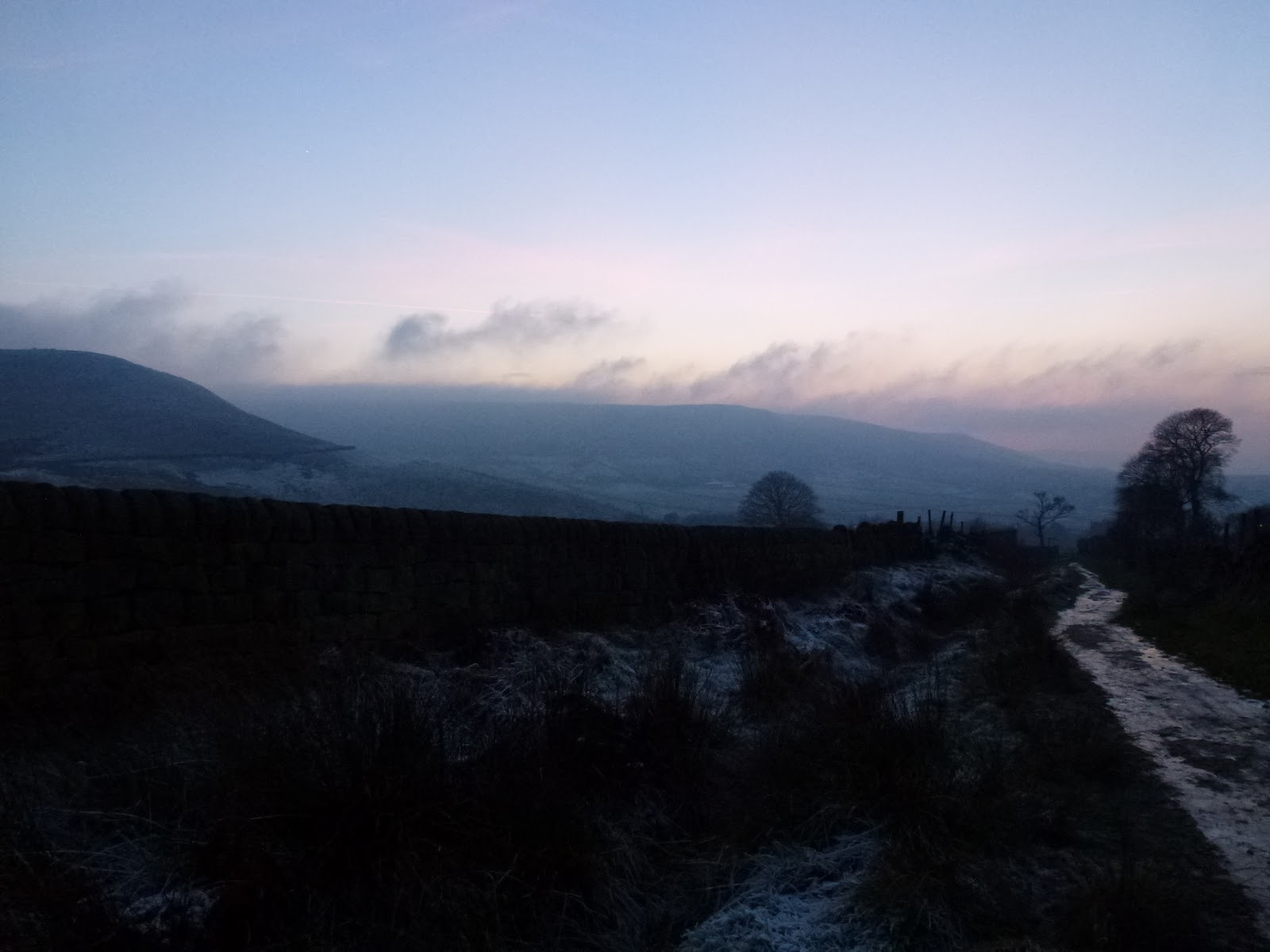
I went up the stone steps as I worked out these would be more slippery later, they weren’t too bad most of the way. I stopped at the end of the wall to blow my dripping nose and was passed by a couple, the female of which was teetering down each step and who informed me that it was “like the everglades up there”. I know I am deaf in one ear but I was so staggered by this that it struck me dumb, just as well really. Here is a picture of said “everglades”, it was funny because in a very weird way it sort of made sense, at least I could imagine her gliding gently down the slope forever ….

The “Everglades”

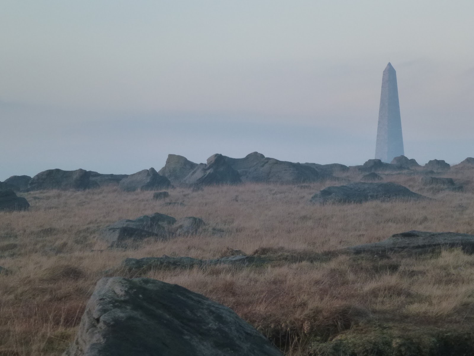
It was a nice short walk right at the end of the day. I reached the Pike and came down the steep side which has become badly eroded since I was last there, which isn’t that long ago.

Returned via Cragg Vale, two black deer silhouettes crossed the road in front of me quite slowly, and back up onto Blackstone Edge which had recovered its fog.

[googlemaps https://maps.google.com/maps?f=q&source=s_q&hl=en&geocode=&q=Stoodley+Pike+Monument,+Todmorden,+United+Kingdom&aq=0&oq=stoodley+pi&sll=54.7,-3.05&sspn=0.071024,0.241356&t=p&g=High+Pike,+Caldbeck,+Allerdale+District,+United+Kingdom&ie=UTF8&hq=Stoodley+Pike+Monument,&hnear=Todmorden,+West+Yorkshire,+United+Kingdom&ll=53.715301,-2.07058&spn=0.015238,0.025749&z=14&output=embed&w=300&h=300]

Please visit Map and Compass and learn how to interpret a map with me and my navigation partner, Cath.

Save

The Walshaw Dean reservoirs

At last, a rainless day so Carol and I met up with Babs at a grid reference on the road at Widdop. We had actually planned this in advance and selected today as the only really good looking day on the forecasts. It didn’t rain at all while we were out and there was quite a bit of sun but it was incredibly cold and we met some really nasty wind chill on our way back.
We walked along the west side of the Walshaw Dean reservoirs – Lower, Middle and Upper. I’ve been here a lot as it’s a good walk if you don’t want anything too challenging but has options for that if you do want it! Today we stayed with the mild side. We had a bit of a go at natural navigation spotting which ends of puddles were more silted up, there was certainly a strong southerly wind blowing but I already knew that so we didn’t really work it out but it was good to see the puddles showing hints. We talked about trees making a tick shape as they bend themselves towards the sun. I took out my Dad’s old military compass which is a Glauser Mk IX from 1938 but it was too chilly to play about with it, too chilly to get my hands out of gloves anyway.
I’d not walked all the way to the top of Upper before so was surprised when we came to the top reservoir inlet which is a torrential river. We tried to cross it going over a gate, at least Babs and Carol watched me whilst the gate swung too and fro and I struggled across to the other side, at which point we all decided that perhaps we wouldn’t all do it so they just buggered off and left me dangling over the torrent!
We then crossed the river a bit lower down where it was a bit less deep and looked for a suitable lunch location. We sort of huddled behind a wall but it was bitterly cold and so our lunches were fairly swift. I’d brought along a flask of coffee for which I was very grateful. Just for Kate, Babs had curried tuna, I had turkey and mustard and Carol had ham. We all had some chocolate. Babs had Lady Grey tea.
We tried to do a circuit of the reservoirs but the next hurdle was a big ravine leading to an enormous lagoon so we back tracked skipping across the river again. Then it was just going as fast as we could to get back to the cars. The last 500m seemed to be the coldest.
Despite the cold we were all glad to have been out.

I love these walls
Walshaw Dean Upper reservoir
Blimey!
Terrible posture, Jak!
Intrepid river crossers
This little sign brought on spontaneous praying!
Walshaw Dean Middle reservoir
Walshaw Dean Lower reservoir
Blackstone Edge reservoir on the way home or as we call it – The Sea

[googlemaps https://maps.google.com/maps?f=q&source=s_q&hl=en&geocode=&q=Walshaw+Dean+Lower+Reservoir,+Wadsworth,+Calderdale+District,+United+Kingdom&aq=1&oq=walshaw+dean&sll=54.7,-3.05&sspn=0.071024,0.241356&t=p&ie=UTF8&hq=&hnear=Walshaw+Dean+Lower+Reservoir&ll=53.793452,-2.063971&spn=0.01521,0.025749&z=14&iwloc=A&output=embed&w=300&h=300]

Please visit Map and Compass and learn how to interpret a map with me and my navigation partner, Cath.

css.php