Springy walks 2016

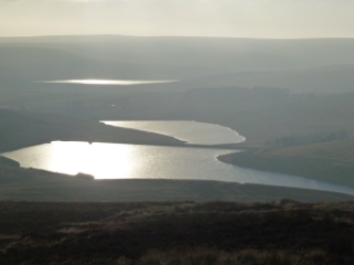
Stoodley Pike from Withens Clough 14th February

Fantastic bright day with deep light resolution.

IMG_0095IMG_0099

P1040596


Crimsworth Dean 25th February

Evening walk.

IMG_0137

Erringden 27th February

Bronze NNAS course.

IMG_0141

Crimsworth Dean 6th March

Chilly hill circuit, snow on the ground

IMG_0162
St. Ives that way

Brynarth near Lledrod 12th and 13th March

IMG_0176
It’s a Humphrey

IMG_0172 IMG_0179 IMG_0181 IMG_0185 IMG_0170 IMG_0189

Walsden and Quaker graveyard 25th March

From Todmorden along the canal and then up. Great walk for friend’s new hip!

Indeed
Indeed
Silly goose
Silly goose
Was not expecting this
In the Quaker graveyard

Hardcastle Crags circuit 6th April

Great route, just a small problem with horizontal hailstones. Evening walk. Too difficult for photos!

Top Withins 10th April

Reccy for the Brontes by dark, a night walk I’m planning for the South Pennines Walk and Ride Festival in September, hoping to make the most of the Bronte festivities this year. I may even have to re-enact Heathcliffe and Cathy by semaphore.

From the Bronte Bridge
Top Withins
Top Withins

IMG_0415

Widdop towards Burnley 17th April

I was looking forward to this so it was irritating that it was marred by 2 off road motorbikes and a quad bike, all without plates, using bridleways and also a footpath. They were busy illegally churning up the paths and the moor and   bog. I had planned a circuit but they were on the same route as me so I went out and came back the same way.

P1040775
Widdop reservoir
P1040749
Widdop reservoir, last bit of sun
P1040787
Sun down over Widdop

P1040762 P1040768 P1040786

Please visit Map and Compass and learn how to interpret a map and use a compass with me and my navigation partner, Cath.

MAPandCOMPASS

Widdop and Hardcastle Crags

I got the bike on top of the car relatively easily. We parked in the upper car park at Hardcastle Crags and set off along the road turning off before the steep zig zag section.
Went up to the first Gorple reservoir and then to the second. Here we decided to return to the first and fork to get to Widdop.
Then crossed the road and along to Walshaw Dean. Turned right along past some farms and a tiny hamlet. Chris came off her bike as we crossed the path to give way to some cyclists coming up. She hurt her ribs and her hand was sore but she soon got back on. Then we headed down down to Gibson Mill. Here we had to stop to sample Nat Trust cake and tea. It was ok, my first time in the mill. Now need to return to see round it.
Then a short walking section to get back up to the top car park.
Managed to get the bike back on the roof but less gracefully this time.

[googlemaps https://maps.google.com/maps?f=q&source=s_q&hl=en&geocode=&q=Widdop+Reservoir,+Calderdale+District,+United+Kingdom&aq=1&oq=Widdop+re&sll=53.632733,-1.945001&sspn=0.01822,0.060339&t=p&ie=UTF8&hq=&hnear=Widdop+Reservoir&ll=53.792387,-2.105684&spn=0.01521,0.025749&z=14&iwloc=A&output=embed&w=300&h=300]

Please visit Map and Compass and learn how to interpret a map with me and my navigation partner, Cath.

Save

Walshaw and Top Withens 4th November 2012

I left home in quite thick fog, with the intention of really having to navigate with no visibility. As I drove up to Blackstone Edge, the fog thickened, but by the time I reached Widdop to park up it was a lovely sunny but cold day.
I headed up to the Walshaw Dean reservoirs, I got stopped by a couple wanting to know where the nearest food could be obtained. Fortunately the pub was still in sight. They’d come all the way from Haworth without food, map or compass. Admittedly this is a section of the Pennine Way that is well marked (some of it isn’t and requires map skills) so it wouldn’t really have been a problem, but they didn’t actually seem to know where they were even broadly and said they were aiming for Colne! The only good thing was they were togged up for the Arctic!
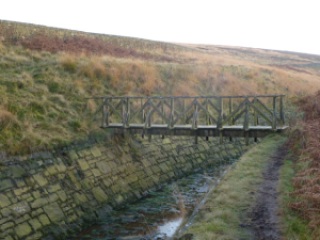
I then did something I’ve done before that was wrong! There is a footbridge over the drain that says “walk this way”, at least it does to me, despite looking old and knackered and unused and so I did, although part of me knew it would be troublesome. It’s followed by a section where you climb the steps in the wall, teeter spread-eagled on the top and then plunge down the other side. I actually got over fairly gracefully this time, crossing the raging torrent to the drain and stopped for a quick lunch in the sun. I then headed for a Land Rover I’d seen before lunch on the basis that it was likely to be on the track. This was preferable to the wall retreat option. The Land Rover had moved on but the track was there and this quickly got me back where I wanted to be.
I stayed on the Pennine Way and walked until I could see Top Withens and the valley to Haworth. It’s a great bit of featureless moorland and so good for testing out navigation accuracy and techniques. I did some ground to map bearings and a 2 point resection.
My timings all worked out and I got home just as darkness came along, time for a quick shower, nice grub and then back out to see Fairport Convention at Hebden Bridge Trades Club, just 34 years since I last saw them at Cardiff Uni. Simon Nicol has just emailed me to say I can put a video I made of them doing Fotheringhay on YouTube!

I like playing with the twirly camera on my phone!
Walshaw Dean upper reservoir
Top Withens, supposedly Wuthering Heights (I ask you!)
2 Walshaws and a Gorple reservoir
Spot the birdy
Steps up the wall, higher than it looks
Do NOT cross this
Fairport Convention – Ric Sanders, Simon Nicol, Dave Pegg and Chris Leslie

[googlemaps https://maps.google.com/maps?f=q&source=s_q&hl=en&geocode=&q=Walshaw+Dean+Middle+Reservoir,+Wadsworth,+Calderdale+District,+United+Kingdom&aq=0&oq=walshaw+dean&sll=53.66049,-2.04408&sspn=0.018208,0.060339&t=p&ie=UTF8&hq=&hnear=Walshaw+Dean+Middle+Reservoir&ll=53.798775,-2.051525&spn=0.015208,0.025749&z=14&iwloc=A&output=embed&w=300&h=300]

Please visit Map and Compass and learn how to interpret a map with me and my navigation partner, Cath.

The Walshaw Dean reservoirs

At last, a rainless day so Carol and I met up with Babs at a grid reference on the road at Widdop. We had actually planned this in advance and selected today as the only really good looking day on the forecasts. It didn’t rain at all while we were out and there was quite a bit of sun but it was incredibly cold and we met some really nasty wind chill on our way back.
We walked along the west side of the Walshaw Dean reservoirs – Lower, Middle and Upper. I’ve been here a lot as it’s a good walk if you don’t want anything too challenging but has options for that if you do want it! Today we stayed with the mild side. We had a bit of a go at natural navigation spotting which ends of puddles were more silted up, there was certainly a strong southerly wind blowing but I already knew that so we didn’t really work it out but it was good to see the puddles showing hints. We talked about trees making a tick shape as they bend themselves towards the sun. I took out my Dad’s old military compass which is a Glauser Mk IX from 1938 but it was too chilly to play about with it, too chilly to get my hands out of gloves anyway.
I’d not walked all the way to the top of Upper before so was surprised when we came to the top reservoir inlet which is a torrential river. We tried to cross it going over a gate, at least Babs and Carol watched me whilst the gate swung too and fro and I struggled across to the other side, at which point we all decided that perhaps we wouldn’t all do it so they just buggered off and left me dangling over the torrent!
We then crossed the river a bit lower down where it was a bit less deep and looked for a suitable lunch location. We sort of huddled behind a wall but it was bitterly cold and so our lunches were fairly swift. I’d brought along a flask of coffee for which I was very grateful. Just for Kate, Babs had curried tuna, I had turkey and mustard and Carol had ham. We all had some chocolate. Babs had Lady Grey tea.
We tried to do a circuit of the reservoirs but the next hurdle was a big ravine leading to an enormous lagoon so we back tracked skipping across the river again. Then it was just going as fast as we could to get back to the cars. The last 500m seemed to be the coldest.
Despite the cold we were all glad to have been out.

I love these walls
Walshaw Dean Upper reservoir
Blimey!
Terrible posture, Jak!
Intrepid river crossers
This little sign brought on spontaneous praying!
Walshaw Dean Middle reservoir
Walshaw Dean Lower reservoir
Blackstone Edge reservoir on the way home or as we call it – The Sea

[googlemaps https://maps.google.com/maps?f=q&source=s_q&hl=en&geocode=&q=Walshaw+Dean+Lower+Reservoir,+Wadsworth,+Calderdale+District,+United+Kingdom&aq=1&oq=walshaw+dean&sll=54.7,-3.05&sspn=0.071024,0.241356&t=p&ie=UTF8&hq=&hnear=Walshaw+Dean+Lower+Reservoir&ll=53.793452,-2.063971&spn=0.01521,0.025749&z=14&iwloc=A&output=embed&w=300&h=300]

Please visit Map and Compass and learn how to interpret a map with me and my navigation partner, Cath.

css.php