Top Withens April 20th 2013

Cath and I met at the car park for the Walshaw Dean reservoirs. We had a great day planning how we are going to teach one day navigation courses on a nice walk. We walked to Top Withens and returned via White Hill and Horrodiddle.

The lower Walshaw Dean reservoir has been emptied and there were BT men doing things with poles. I thought they were putting them in but we later found they were taking them out.

There are plenty of possible teaching points on this walk. We cleverly managed to miss our path just as we were talking about times when we’ve missed our path. You could not make it up! However because we do really know what we are doing, we were able to recover ourselves very quickly.

We met a keeper and this prompted us to consider how much we know about managing moorland habitats. There are several wide strips of cut heather in and amongst the grouse butts. The grouse butts have all been done up with decking. We also saw a fair bit of burnt heather and were able to work out that it was old burns. That said, a chunk of moor on my way home from Burnley on Wednesday was on fire on the road leading up to Blackstone Edge from Littleborough so it must be quite dry despite all the snow and snow melt.

I set Cath a challenge to find a boundary stone which is hard to see and which I’d set myself the last time I walked this area. Cath was of course spot on. Memo: must make it harder next time!

We lunched at Top Withens. This is an odd ruin with a plaque on it saying that it’s thought of as being Wuthering Heights but actually bears no resemblance to the description in the text. I subjected Cath to a short rendition of the Kate Bush song. But the best Wuthering Heights is this unforgettable semaphore version.

We took about 5 hours for the walk which was about 14 kilometres. The road that goes around from Hebden to Slack Top is still closed, and the diversion forces you through Heptonstall so we stopped on the way back and went to the really nice tea shop where we had some fab chocolate brownie and bought some goodies.

P1010588
Cath with lambo in background
P1010580
I liked this one despite the 2 people in bottom right corner
P1010577
View to Haworth from Top Withens, lots of tourists searching for Heathcliffe
P1010574
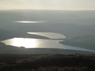
One of the Walshaw Dean reservoirs
P1010601
Blackstone Edge reservoir on my way home

P1010593

Please visit Map and Compass and learn how to interpret a map with me and my navigation partner, Cath.

Walshaw and Top Withens 4th November 2012

I left home in quite thick fog, with the intention of really having to navigate with no visibility. As I drove up to Blackstone Edge, the fog thickened, but by the time I reached Widdop to park up it was a lovely sunny but cold day.
I headed up to the Walshaw Dean reservoirs, I got stopped by a couple wanting to know where the nearest food could be obtained. Fortunately the pub was still in sight. They’d come all the way from Haworth without food, map or compass. Admittedly this is a section of the Pennine Way that is well marked (some of it isn’t and requires map skills) so it wouldn’t really have been a problem, but they didn’t actually seem to know where they were even broadly and said they were aiming for Colne! The only good thing was they were togged up for the Arctic!
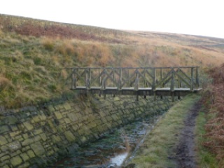
I then did something I’ve done before that was wrong! There is a footbridge over the drain that says “walk this way”, at least it does to me, despite looking old and knackered and unused and so I did, although part of me knew it would be troublesome. It’s followed by a section where you climb the steps in the wall, teeter spread-eagled on the top and then plunge down the other side. I actually got over fairly gracefully this time, crossing the raging torrent to the drain and stopped for a quick lunch in the sun. I then headed for a Land Rover I’d seen before lunch on the basis that it was likely to be on the track. This was preferable to the wall retreat option. The Land Rover had moved on but the track was there and this quickly got me back where I wanted to be.
I stayed on the Pennine Way and walked until I could see Top Withens and the valley to Haworth. It’s a great bit of featureless moorland and so good for testing out navigation accuracy and techniques. I did some ground to map bearings and a 2 point resection.
My timings all worked out and I got home just as darkness came along, time for a quick shower, nice grub and then back out to see Fairport Convention at Hebden Bridge Trades Club, just 34 years since I last saw them at Cardiff Uni. Simon Nicol has just emailed me to say I can put a video I made of them doing Fotheringhay on YouTube!

I like playing with the twirly camera on my phone!
Walshaw Dean upper reservoir
Top Withens, supposedly Wuthering Heights (I ask you!)
2 Walshaws and a Gorple reservoir
Spot the birdy
Steps up the wall, higher than it looks
Do NOT cross this
Fairport Convention – Ric Sanders, Simon Nicol, Dave Pegg and Chris Leslie

[googlemaps https://maps.google.com/maps?f=q&source=s_q&hl=en&geocode=&q=Walshaw+Dean+Middle+Reservoir,+Wadsworth,+Calderdale+District,+United+Kingdom&aq=0&oq=walshaw+dean&sll=53.66049,-2.04408&sspn=0.018208,0.060339&t=p&ie=UTF8&hq=&hnear=Walshaw+Dean+Middle+Reservoir&ll=53.798775,-2.051525&spn=0.015208,0.025749&z=14&iwloc=A&output=embed&w=300&h=300]

Please visit Map and Compass and learn how to interpret a map with me and my navigation partner, Cath.

css.php