Cath and I met at the car park for the Walshaw Dean reservoirs. We had a great day planning how we are going to teach one day navigation courses on a nice walk. We walked to Top Withens and returned via White Hill and Horrodiddle.
The lower Walshaw Dean reservoir has been emptied and there were BT men doing things with poles. I thought they were putting them in but we later found they were taking them out.
There are plenty of possible teaching points on this walk. We cleverly managed to miss our path just as we were talking about times when we’ve missed our path. You could not make it up! However because we do really know what we are doing, we were able to recover ourselves very quickly.
We met a keeper and this prompted us to consider how much we know about managing moorland habitats. There are several wide strips of cut heather in and amongst the grouse butts. The grouse butts have all been done up with decking. We also saw a fair bit of burnt heather and were able to work out that it was old burns. That said, a chunk of moor on my way home from Burnley on Wednesday was on fire on the road leading up to Blackstone Edge from Littleborough so it must be quite dry despite all the snow and snow melt.
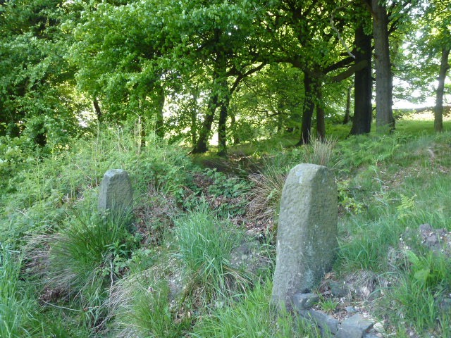
I set Cath a challenge to find a boundary stone which is hard to see and which I’d set myself the last time I walked this area. Cath was of course spot on. Memo: must make it harder next time!
We lunched at Top Withens. This is an odd ruin with a plaque on it saying that it’s thought of as being Wuthering Heights but actually bears no resemblance to the description in the text. I subjected Cath to a short rendition of the Kate Bush song. But the best Wuthering Heights is this unforgettable semaphore version.
We took about 5 hours for the walk which was about 14 kilometres. The road that goes around from Hebden to Slack Top is still closed, and the diversion forces you through Heptonstall so we stopped on the way back and went to the really nice tea shop where we had some fab chocolate brownie and bought some goodies.
Cath with lambo in backgroundI liked this one despite the 2 people in bottom right cornerView to Haworth from Top Withens, lots of tourists searching for HeathcliffeOne of the Walshaw Dean reservoirsBlackstone Edge reservoir on my way home
Please visit Map and Compass and learn how to interpret a map with me and my navigation partner, Cath.
Saturday
By the time we arrived at Widdop it was nearly dark. To start Carol off on night walking we used a tarmac path in order to gain confidence from the car park to the top of the first of the three Walshaw Dean reservoirs. It was mild and the sheep were just going to bed.
The forecast for the weekend had been for thunder, torrential rain and hail which is why we ended up doing a night walk instead of camping. As it turned out Saturday was pretty good all day and none of the horrors appeared.
It was cloudy but the moon still gave a lot of light and this then shone off the water, so all in all it was very easy to see and we didn’t need to use our headlamps.
The moon had been full so was doing waning gibbous but rose where I expected it to so we did a bit of natural navigation.
A short but quite exciting walk. And we saw 2 owls on the way up to Widdop.
This makes me thinks of etchings
Moon reflected in the reservoir
Sunday
I decided to return to Widdop by day to prospect for possible camping spots. I didn’t really find anywhere that would fit the bill but had a nice walk and went off in a different direction from my usual trips to Walshaw Dean.
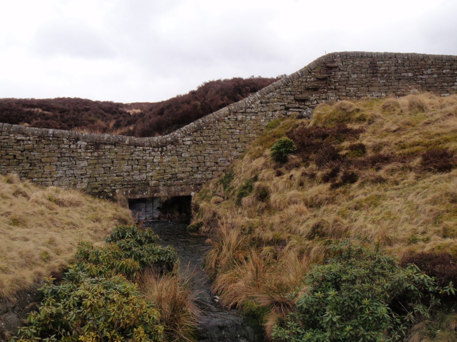
I got down to the fabulously named Pisser Rough accompanied by rumbles of thunder and was just looking at the bridge across the weir when it started to rain heavily so I abandoned that idea as it meant working a way on not very clear paths along the steep sides of the clough. I probably would have done it if someone else had been there but didn’t want to take a chance of falling into the beck and getting wet and stuck.
Instead I more or less retraced my steps. This was quite a bleak walk and I only saw a few people at quite a distance when I got off the main track.
On the way back, the torrential rain came on and was really awful in Hebden and it was easy to see how easily it gets flooded there as it looked like it was about to happen again.
We saw later on that Bradford had a big dump of hail several inches deep in places, so the weather did all turn up but a day later than forecast.
This should have been a weekend wild camping in the Lakes but the forecast was so dire we decided to just aim for a long walk instead. Yesterday morning waking to an enormous clap of thunder we had clearly made the right decision about camping. So we did household jobs and aimed for today. Today we woke to a big lot of rain. Whilst waiting for it to stop raining (mid afternoon) I amused myself by not fixing a computer and getting very cross with it. I don’t like to be beaten.
Eventually we got out and drove up to Widdop in lovely clear early evening sun. Everything crisp and clean after the rain. We walked to the parapet between Middle and Lower Walshaw Dean reservoirs and then came back. Although we were only out for a couple of hours it was a lovely walk.
I tried out my new to me Mountain King Trail Blaze walking poles. I bought these on eBay for £29 (they retail at £70). They are as good as new and fine once you get used to them. They are really really light, and fold up like a tent pole. I didn’t particularly need them for this walk, this was just a road test. They feel a bit flimsy at first but actually are strong. The tautening mechanism almost floored me but finally I worked it out. I’ll probably mainly use them when I’m very keen to keep the weight down, pleased with my bargain.
It should really be Walshaw Reservoir 2. Same route, different way round, different personnel. Just me and Anita. Better this way round as had the long flat bit to warm up on with wind behind us at the start. Lunched by a BT wireless station in the woods. Met 2 incredibly stupid women who had got miles off where they wanted to be, they had no map and no bloody sense. I could feel myself getting really irritated with them at the point where they were inviting us to take responsibility for them. We directed them as best as possible and I can only hope they are home now. These are the people who should pay for Mountain Rescue services. After A and I had left them behind and spent a good bit of time analysing their crass stupidity, we continued to find the correct path to the reservoir and saw how to cross the big drain without playing horses with the huge wall. Got back to the car, a bit wind swept and with relatively fewer knee issues than yesterday. Great walk finished off with a beer at the Packhorse.