Under the dam 2

Having looked much more closely at the OS map, I worked out where Scammonden Cotton Spinning Mill was most likely to be. It is in fact a clear outline on the map but not named. I decided to continue my quest today. The map showed several footpaths that would get me from my side of the valley to the other side, all on one of my regular walks up to the M62.

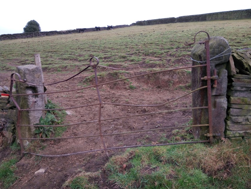
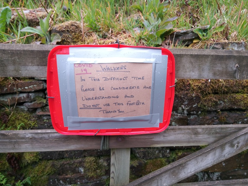
The first path I investigated was so overgrown with brambles it wasn’t a goer so I reported it to the Ramblers using their Pathwatch app. This enables me to take a photo and it automatically sends them the grid reference. The Ramblers pass all this on to the local council and it saves me trying to find out how to do that with Calderdale and works for any local authority. I took the next path along which went through the same landowner’s property, always a bit nerve wracking even if completely legal. The path was not maintained, lots of overhanging branches, long wet grass, a dodgy stile and then lots of bog. I turned back. I considered taking the next possible path but this went through a very neat farm and I decided against it.

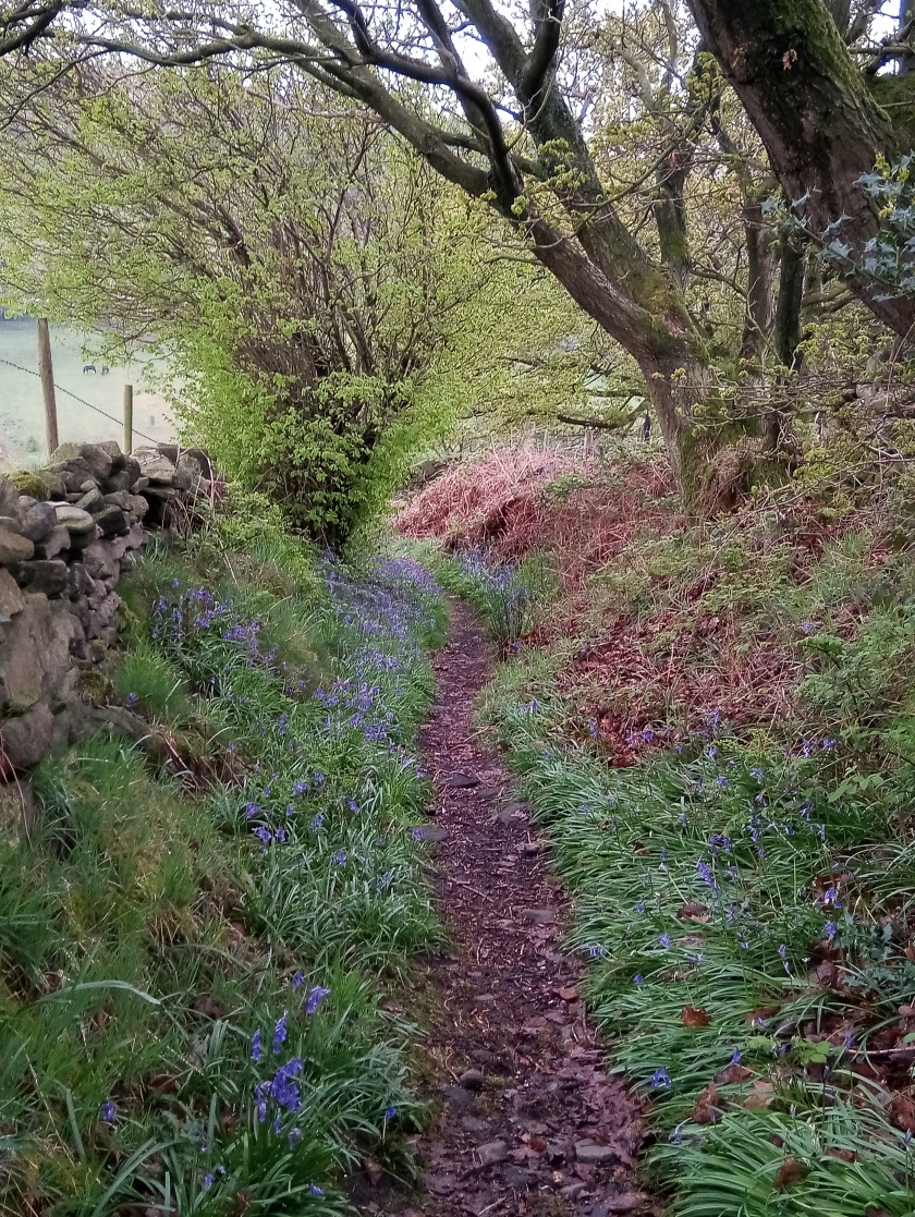
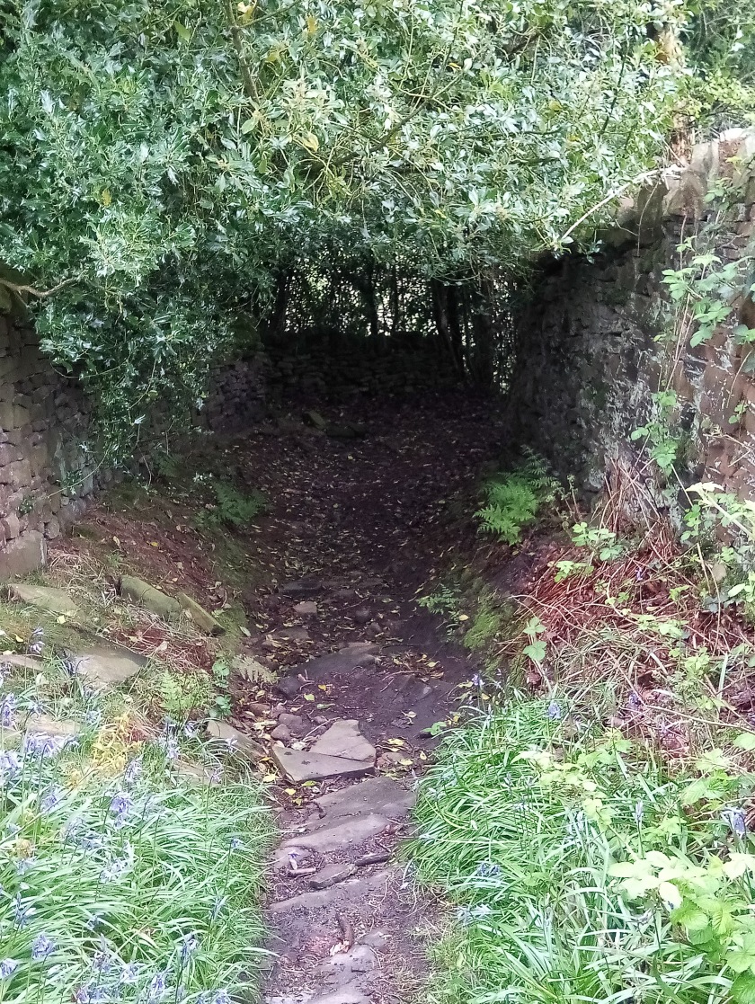
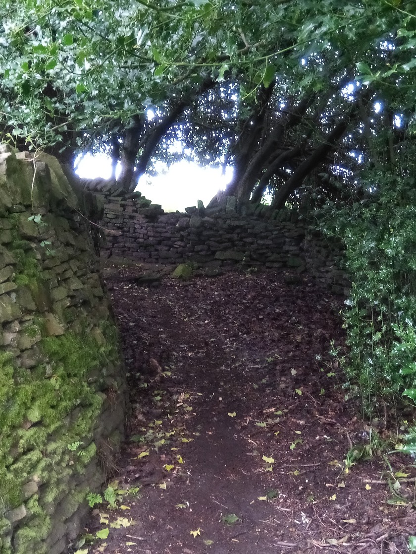
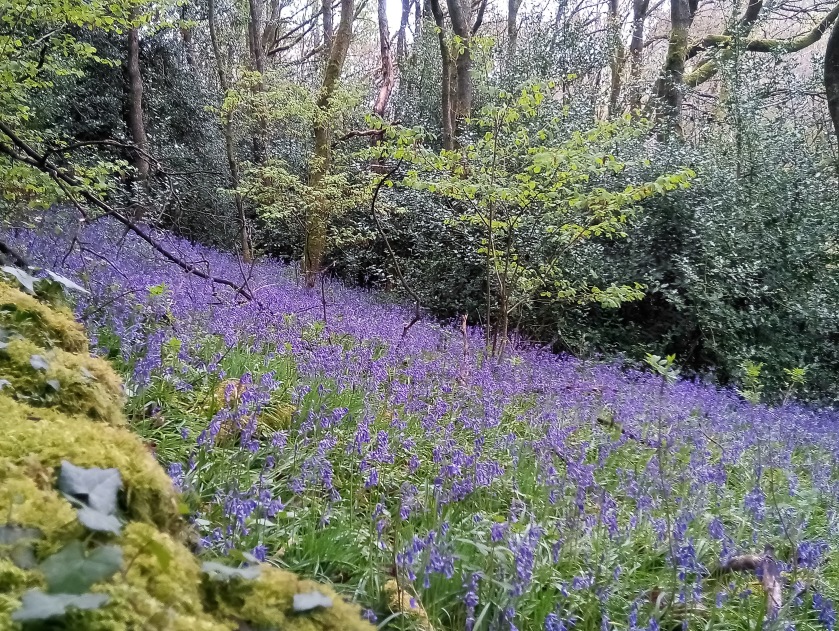
I carried on to the access path that gets you underneath the motorway via a tunnel (I don’t like the tunnel even though it’s not very long and you can see the other end). It’s a short cut to get to the Scammonden reservoir path, Chris and I used to do it on our bikes, it’s on Bike Route 68. Avoiding the tunnel I set off down the side of the dam. It is enormous and I did worry slightly having watched a movie last week called San Andreas which featured the collapse of the Hoover Dam! I then followed a track from the weir which went along the stream and whilst it isn’t a public right of way it very quickly (after 150 metres) got me to a footbridge across the brook and a proper marked footpath. The path mostly follows the water until you come to the mill after another 200 metres. It’s not far along into the wood. I found the mill a bit creepy and didn’t want to stay once I’d located it. I didn’t continue along the path because it would take me to the horrible farm with the barking dog I’d found yesterday so I retraced my steps but then went up and out of the clough along what would have been an access road to the mill which then met the new access tracks for Scammonden Dam. Back across the top of the dam amongst all the crap strewn out of vehicles and then home the usual way. Lots more traffic on the motorway today.

I was out for about 2 and a half hours, walked about 7.5 km and missed the rain. I reported the blocked path and added a photo of the mill to Geograph so other people won’t have so much hassle trying to find it. Grid reference SE 05523 17091.

It’s not totally wrong but is not to any known scale which doesn’t help. Also there aren’t any stunted oaks in Clock Face wood. There are no oaks anywhere in our locality that I’ve seen. I miss oak trees.
Scammonden Dam with M62 on top
Huge, spot the 2 people
A mysterious water building
Scammonden Cotton Spinning Mill
M62 back in business

Under the dam

The other day, one of my nice neighbours told me about a walk to Scammonden cotton spinning mill. It was built but never saw any active use and is now a ruin in some woods near to Scammonden dam. The hamlet of Scammonden was flooded to create Scammonden reservoir which was built at the same time as the M62 running along the top of the dam. The reservoir filled up in 1969 and the motorway was opened in 1970. The reservoir has good paths around it and is often busy so I haven’t tried walking there during lockdown.

I decided to make the most of the dry morning and to do a longer walk and try to find the mill. The only slight problem being that my neighbour gave me a very rough idea of where it was. I looked online and found a hand drawn map which is not to scale making this quite a challenge.

I walked down my road and onto a footpath which was delightful, almost a hollow way in parts and sprinkled with bluebells, a bit gone over but great now that I know they’re there for next year. Down to a brook, across a footbridge and onto Hey Lane. Some smart houses with manicured gardens there in a converted mill complex, but not the cotton spinning mill I was looking for. Up Hey Lane and then I took a track off to the right. Before long I was passing through a mucky farmyard that looked like something out of James Herriot. On to another farm, a crude sign saying “private keep out”, a large barking dog and a public right of way padlocked up. For once, I wasn’t at all frightened by the dog but I decided not to continue (it would have meant climbing the padlocked gate) and retraced my steps. I continued up Hey Lane which is a very pretty narrow lane running higher up alongside old woodland, with a brook and waterfalls. Marred by the litter and fly tipping as I neared the motorway. I looked along the water to see if the mill was in sight but nothing showed up and I felt I wasn’t quite in the right place. There was another footpath I wanted to try but even though it is illegal to close a public right of way I decided to observe the request of the land owner not to use the path at the moment. I don’t want to annoy anyone if they feel that strongly about it.

I got up to the motorway and was surprised that the road continued underneath it. I went under to look at the motorway from the far side and there was a wide open gate leading straight onto the westbound carriageway! I went back under the way I’d come and looked from the north side where there was a matching gate which was shut. As I looked across to the open gate, a car zoomed off the carriageway and through the gateway! I was taking some photos of the motorway when an unmarked police car came to where I was to open the gate to go onto the eastbound carriageway. I told them I’d just seen a car go through the opposite gate and they laughed and said it was them!!

That reminded me of when Chris and I returned to our flat on City Road in Bristol. There were some dodgy looking men outside the entrance and a police officer in uniform was standing on the corner so I went up to him and said those people hanging about our door look very suspicious. It turned out they were plain clothes officers raiding the flat below ours!

I went back down Hey Lane and took quite a long route back to my house. It was fun seeing my house from across the valley. I saw very few people and didn’t get rained on. I did about 9 km and was out for 2 and a half hours. I didn’t find the mill but am going to give it a go from the other side of the valley. It was lovely finding new places to explore.

Stones above Todmorden 24th June 2018

I decided to do another of the AA Walks, this one from Lydgate to the Whirlaw Stones, the Bride Stones, the Hawk Stones and the Orchan Stones. I’ve done some of this with Cath and also most of it with Chris who loved it.

The AA description is a bit out of date. I’ve sent them some amendments so hopefully they will update it on the web, they make a lot of reference to the Sportsmans pub which is long shut. The first hurdle was a very overgrown path in Lydgate but I reported this to the Ramblers via the Pathwatch app which sends the Ramblers a grid reference and a photo which they then send to the relevant local council.

It was pretty hot but the first section is nice and shady, the path is no longer sunken but a concrete track and very steep. Into the sun and then yet another dead sheep, this one very smelly and with lots of flies. I walked under the Whirlaw Rocks and sat on a bench to eat my lunch. Then up a bit more, past Windy Harbour and the stone head, past a new build called Mast Farm but no mast in sight and definitely not where the map was saying it was. Up onto the Bride Stones where someone was drumming in a cleft in the rocks. Across to the non pub and along the road passing the Hawk Stones on the right. Down Mount Road, past a very ancient stone cross that I don’t remember seeing before but maybe I just wasn’t looking. Along a section that the AA needed to explain in a bit more detail. Then down past the Orchan Rocks and back down another shady wide track to Lydgate.

Under the railway at Lydgate

At Windy Harbour

Stoodley Pike from the Bride Stones

Bride Stones

Mount Cross

Orchan Stones

Please visit Map and Compass and learn how to interpret a map and use a compass with me and my navigation partner, Cath.

MAPandCOMPASS

Oxenhope circular 17th June 2018

Babs and I did a route from the AA. Babs led the walk and I followed on the map. We did about 6 miles, good walking weather. Stopped at the Dog and Gun for the loo, on the moors for lunch. Saw a dead lamb, also what I thought was a dead fledgling but it moved so Babs put it off the track so at least it wouldn’t get trodden on.

We finished up at Oxenhope station which has nice loos and sat on the very uncomfortable seats in the stationary buffet train. I had a nice ice cream and Babs had toast and jam.

IMG_20180617_122442_9
Disused graveyard between Leeming and Sawood

IMG_20180617_135058_2
Very much alive lamb

Viewranger route

Please visit Map and Compass and learn how to interpret a map and use a compass with me and my navigation partner, Cath.

MAPandCOMPASS

css.php