MTL Widdop to Jack Bridge 04 and 05/02/17

Widdop to Jack Bridge

A) Sat 4th Feb 2017, Widdop to Gorple

Felt very tired so only walked from Widdop to Gorple reservoir and back round. I didn’t have enough light to go further plus I’d arranged to do the rest with Babs the next day. Chris and I have walked and cycled here many times. Back to weeping all the time.

img_1939
Cludders Stack

img_1937img_1933

img_1931
Gorple reservoir

B) Sun 5th Feb 2017, Gorple to Jack Bridge

We set off from the Pack Horse pub and walked to the New Delight pub and back. The New Delight name always makes me think of the Pure Drop pub in Tess of the D’Urbervilles.

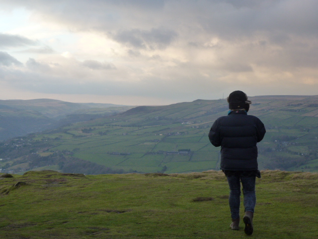
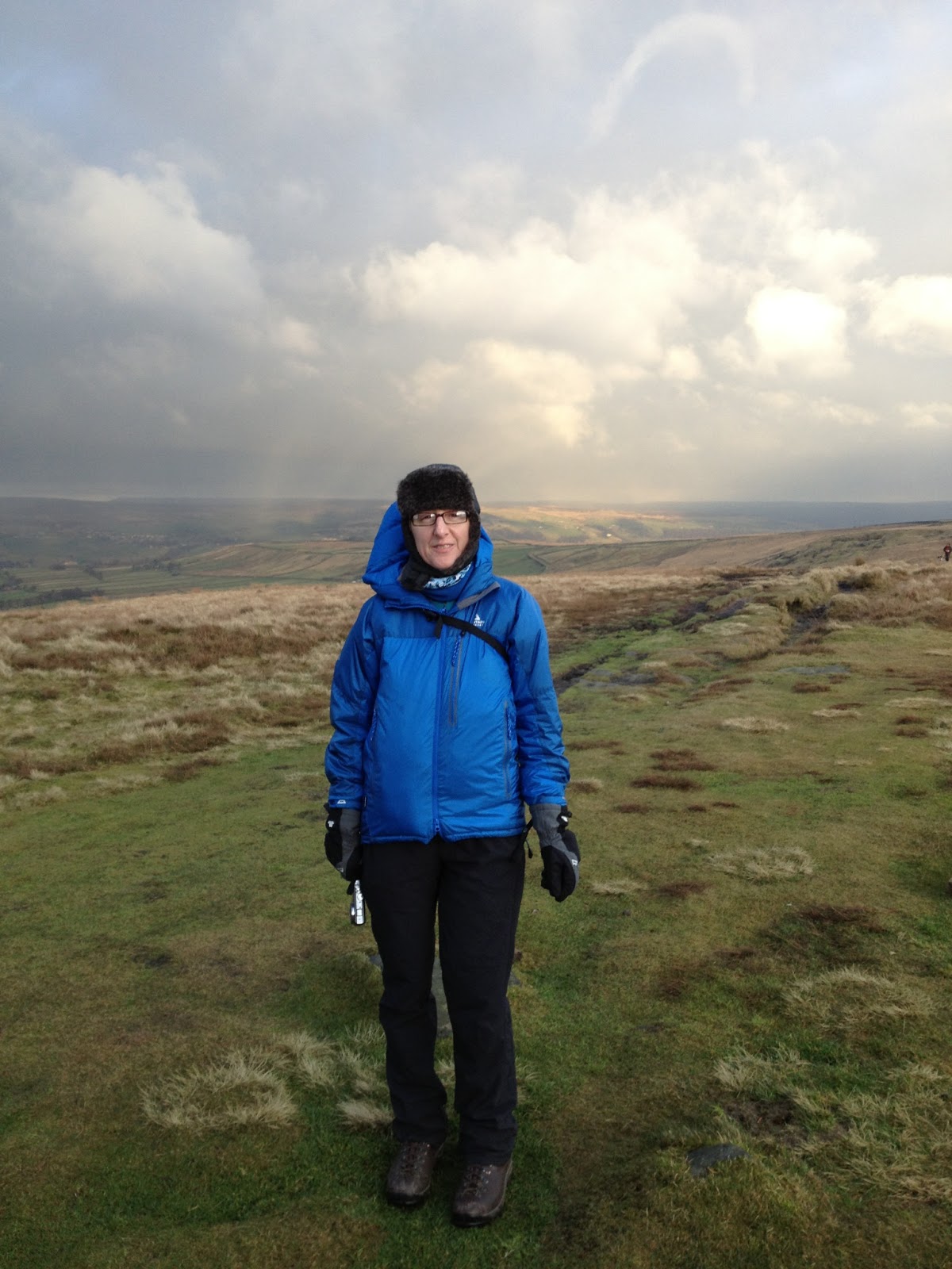
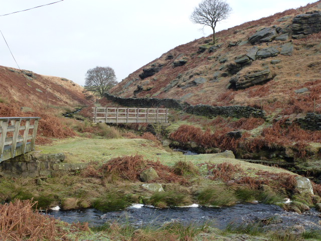
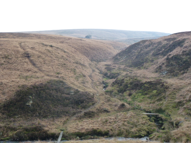
This is a lovely stretch of the walk, we climbed up to 380m which is quite high for this part of the world. Just as we got sight of the New Delight and started thinking about grub, the Mary Towneley Way whisked us away from it and took us a roundabout way to reach it. The pub itself was a bit of a let down and we had to wait ages for a bowl of soup and when it came it was disappointing, plus the staff were borderline rude. So no Delight to be had, won’t be going there again.

We returned via a quicker route. We didn’t get much sun as the day before but at least it didn’t rain on us. 8.4 miles, 13.5km.

img_1941
Gorple reservoir
img_1949
Sadly this isn’t Pisser Rough but I so wish it was. That’s just a few metres up the road.

img_1948img_1944

img_1952

Please visit Map and Compass and learn how to interpret a map and use a compass with me and my navigation partner, Cath.

MAPandCOMPASS

Save

Springy walks 2016

Stoodley Pike from Withens Clough 14th February

Fantastic bright day with deep light resolution.

IMG_0095IMG_0099

P1040596


Crimsworth Dean 25th February

Evening walk.

IMG_0137

Erringden 27th February

Bronze NNAS course.

IMG_0141

Crimsworth Dean 6th March

Chilly hill circuit, snow on the ground

IMG_0162
St. Ives that way

Brynarth near Lledrod 12th and 13th March

IMG_0176
It’s a Humphrey

IMG_0172 IMG_0179 IMG_0181 IMG_0185 IMG_0170 IMG_0189

Walsden and Quaker graveyard 25th March

From Todmorden along the canal and then up. Great walk for friend’s new hip!

Indeed
Indeed
Silly goose
Silly goose
Was not expecting this
In the Quaker graveyard

Hardcastle Crags circuit 6th April

Great route, just a small problem with horizontal hailstones. Evening walk. Too difficult for photos!

Top Withins 10th April

Reccy for the Brontes by dark, a night walk I’m planning for the South Pennines Walk and Ride Festival in September, hoping to make the most of the Bronte festivities this year. I may even have to re-enact Heathcliffe and Cathy by semaphore.

From the Bronte Bridge
Top Withins
Top Withins

IMG_0415

Widdop towards Burnley 17th April

I was looking forward to this so it was irritating that it was marred by 2 off road motorbikes and a quad bike, all without plates, using bridleways and also a footpath. They were busy illegally churning up the paths and the moor and   bog. I had planned a circuit but they were on the same route as me so I went out and came back the same way.

P1040775
Widdop reservoir
P1040749
Widdop reservoir, last bit of sun
P1040787
Sun down over Widdop

P1040762 P1040768 P1040786

Please visit Map and Compass and learn how to interpret a map and use a compass with me and my navigation partner, Cath.

MAPandCOMPASS

Winter walks

20th December 2015 – Cat Stones, Rishworth

Fine until it got too hard to cross any more bog because it became a river.

IMG_1188 IMG_1189

2nd January 2016 – Widdop

A reccy with Cath, in perfect no visibility conditions!

IMG_1242 IMG_1245

10th January 2016 – Widdop

Another reccy with Cath, much brighter and colder day.

IMG_0015
Reaps Cross

17th January 2016 – Stoodley Pike

In the snow.

IMG_0037
Stoodley Pike

IMG_0041

31st January 2016 – Widdop

With Maureen, so very soggy from every angle.

IMG_0082
Walshaw Dean reservoir (middle)

IMG_0080

14th February – Withens Clough and Stoodley Pike

Almost felt glad to be alive. Beautiful day with deeply intense light.

Song of the day: Badlands

Bruce at TempeP1040596 P1040594 P1040602 P1040599 IMG_0099

Please visit Map and Compass and learn how to interpret a map and use a compass with me and my navigation partner, Cath.

MAPandCOMPASS

Widdop and Gorple Reservoirs 15th February 2015

This is a walk I’ve done many times and cycled it too. Today I went from Widdop dam and up to the rocks at Shuttleworth Moor and Black Moor overlooking Upper Gorple reservoir. Across to Upper Gorple on a permissive path and then to Lower Gorple reservoir. It was mainly misty with the odd glimpse of sun. I took a path that was new to me to get back across to Widdop. It went through a boggy and gloomy wood where most of the trees had died. The path had been moved which I only realised because I had to check a bearing when I got out of the wood. Then crossed a good chunk of featureless moorland and came out at the top of Cludders Slack. I don’t know what that means but I like it. Some really vast rocks litter the hillsides round here.

Widdop reservoir
Widdop reservoir
Cludders Slack
Cludders Slack
Lower Gorple reservoir
Upper Gorple reservoir
Widdop reservoir
Widdop reservoir
Cludders Slack
Cludders Slack
Widdop reservoir
Widdop reservoir

Please visit Map and Compass and learn how to interpret a map and use a compass with me and my navigation partner, Cath.

MAPandCOMPASS

Winter walks January 2013

Saturday 12th January 2013
Chris and I did a quick up and down Stoodley Pike. For me this was a warm up for the following day. I coughed all the way up to the pike and it was bitterly cold in the wind. But lovely to be out and walking again after what felt like a long gap. The last real exercise I had was at the end of November on the bitterly cold bike ride from Todmorden to Mytholmroyd in the Valley of Lights. Then I was floored by the evil flu from hell and only went back to work on 7th January. Lovely to actually feel well despite the cough.

Chris and furry ear
The mighty prong of Stoodley Pike!
Mincing! I did exactly same pose when I was 19, the one and only time I’ve skied.

[googlemaps https://maps.google.com/maps?f=q&source=s_q&hl=en&geocode=&q=Stoodley+Pike+Monument,+Todmorden,+United+Kingdom&aq=1&oq=stoodley&sll=53.741347,-2.012077&sspn=0.018173,0.060339&t=p&ie=UTF8&hq=Stoodley+Pike+Monument,&hnear=Todmorden,+West+Yorkshire,+United+Kingdom&ll=53.715301,-2.07058&spn=0.015238,0.025749&z=14&output=embed&w=300&h=300]

Sunday 13th January 2013
I met Cath at Hebden Bridge railway station and we drove up to Widdop. The road past Maureen and John’s house is shut off so we had to go through Heptonstall but this was lovely for a change. The road to Widdop was very frosty.
We set off and basically did a 6 mile circuit that took in Reap’s Cross which is missing its crossbar, then Raistrick, up to the old scout hut, over to the big reservoir, around it and back along the permissive path by the side of it and back to the car, the last bit along the road.
Cath wanted to see a nice bridge that she remembered from when she’d done the Pennine Way and it was still there. We had an early lunch at Reap’s Cross (re-erected in 2002 by the people who live in the hills) and a second lunch much later on.
Fab day with lots of good conversation.

Cath’s bridge
The FBs
Cath sporting new Rab jacket and new mountain cap at Reap’s Cross
Ruin at Raistrick

[googlemaps https://maps.google.com/maps?f=q&source=s_q&hl=en&geocode=&q=Widdop+Reservoir&aq=0&oq=widdop&sll=53.715302,-2.070545&sspn=0.036369,0.120678&t=p&ie=UTF8&hq=&hnear=Widdop+Reservoir&ll=53.792387,-2.105684&spn=0.01521,0.025749&z=14&iwloc=A&output=embed&w=300&h=300]

Please visit Map and Compass and learn how to interpret a map with me and my navigation partner, Cath.

css.php