Crinkle Crags 14th October 2012

After a reasonably early but chilly start (had to scrape the ice off the outside and the INSIDE of my car windows), Chris and I got to Langdale, parked up in practically the last spot in the National Trust car park, saving £6.50 and set off at about 11.20.
Across a big flat section full of sheep, black, white and punk; cows, horses… to the charmingly named Stool End Farm, turning left to go along the side of the beck and then across to start the climb up to Great Knott.

We stopped below the Knott on the col for a quick pre lunch snack, Chris on pork pie and me on energy bar and organic fruit and nuts that were mainly nuts until I supplemented them. Then up past the Knott and our first close up of the Crinkles, at this point they seemed quite fun and exciting.
We scrambled up the first Crinkle, and even then we wondered how many there were, Chris reckoned 4 and I was thinking 5 or 6, having consulted Wainwright during our coffee break on the drive over. However my consultations were more about how to get round or over the Bad Step and I now know there are 5 crinkles. Very hard to pull out of the map as the distances are so small, even with a magnifier.
We lunched just before starting crinkle number 2 and picked the coldest, windiest spot on the walk. We watched a large group trying to get down the Bad Step and worked out that we would just skip up the side as totally unnecessary to do the Step. That said, it would be a good place to practice rope work.

By then, we’d got tired of Crinkles as there’s an awful lot of up and down and very little distance covered. A mere 3 more to do but we battled on and got to Three Tarns where we decided to return down The Band and not down Hell Gill which had been the original plan. We were both tired and needed a relatively easy and straightforward route. The path seems to have been improved since I last did it as I remembered quite a lot of hands on sections but these weren’t there any more.
Finally got back to Stool End and Chris took off on the tarmac, back to the pub for the facilities and a beer for Chris.
We whizzed home and I even got back in time for Downton Abbey! Oh dear, how very tragic!

Bark Island just before I left home
Crinkles to centre right
Playing with phone
Over to Pike o’ wotnot
How not to do the bent leg thing
No, that’s still not right
Like this!
Crinkles here we come
First Crinkle, I thinkle
Still smiling, not yet crinkled out
Big views
Homeward bound
Pike o’ wotsit and the Langdales
Feeling a bit crinkly here

[googlemaps https://maps.google.com/maps?f=q&source=s_q&hl=en&geocode=&q=Dungeon+Ghyll,+o%2Fs+Old+Dungeon+Ghyll+Hotel,+Lakes,+South+Lakeland+District,+United+Kingdom&aq=0&oq=dungeon+ghyll&sll=53.702818,-2.029493&sspn=0.01819,0.060339&t=p&g=Withens+Clough+Reservoir,+Hebden+Royd,+Calderdale+District,+United+Kingdom&ie=UTF8&hq=Dungeon+Ghyll,+o%2Fs&hnear=The+Old+Dungeon+Ghyll,+Great+Langdale,+Ambleside,+Cumbria+LA22+9JY,+United+Kingdom&ll=54.44549,-3.102608&spn=0.05989,0.102997&z=12&output=embed&w=300&h=300]

Please visit Map and Compass and learn how to interpret a map with me and my navigation partner, Cath.

Yoke, Ill Bell and Froswick 26th August 2012

I set off early and reached Green Quarter just after 9 a.m. It took a little while to park as there is very little parking in Kentmere and Green Quarter but I managed to tuck it in on a very quiet road. The forecast had said “slight chance of rain” which was why I’d picked today to whizz up some hills.
I walked down to Kentmere church and to the end of the road and then got onto Garburn Pass. This is a mountain road that goes across to Troutbeck. It rises gently for a couple of kilometres and then I headed off north on a good path across some boggy terrain. It was quite warm and a bit muggy. This path also rose gently although when I came back down it seemed much steeper so I can only conclude that I wasn’t really feeling the climb. I got all the way up to Yoke and had a short break there. The weather started to close in a bit and there was a lot of low cloud around. Then onto Ill Bell through the gloom. Ill Bell (no sickness, no bells) has 3 cairns which were reminiscent of the Nine Standards in construction.
From Ill Bell you have to drop down quite a bit and then go up again to reach Froswick, Wainwright didn’t seem to think you would go there unless you were going somewhere else but I didn’t really want to keep going as had already been to the hills you can reach easily from there, also my route was not a circuit. So I had my lunch and looked across to Thornthwaite Beacon, High Street, Mardale Ill Bell and Harter Fell.
I turned back and retraced my steps. There was a shower on Ill Bell and a much bigger one as I got back to the Garburn Pass, my head felt like it was being massaged under the hood of my coat!
The Garburn Pass had got a lot wetter and what with my thin summer socks, gave my feet a terrible pummeling. I got back to Green Quarter at last, actually much more quickly than I’d thought, and had a delicious slice of my own home made shortbread!
Feels like my exercise regime and losing a few pounds has been worth the effort. Home before 6 p.m. And 3 more Wainwrights bagged!

Cairns on Ill Bell
Ill Bell
Lake Windybum
Kentmere Reservoir, Harter Fell above
I like these cairns
All three on Ill Bell
Kentmere Reservoir looking south
Flew over my head

[googlemaps https://maps.google.com/maps?f=q&source=s_q&hl=en&geocode=&q=Ill+Bell,+Kentmere,+South+Lakeland+District,+United+Kingdom&aq=1&oq=Ill+Bell&sll=53.7924,-2.105684&sspn=0.018151,0.060339&t=p&ie=UTF8&hq=&hnear=Bell,+Illinois&ll=54.449981,-2.866745&spn=0.029942,0.051498&z=13&iwloc=A&output=embed&w=300&h=300]

Please visit Map and Compass and learn how to interpret a map with me and my navigation partner, Cath.

Helvellyn via Swirral Edge 8th July 2012

Despite getting up at 6.30, I still didn’t manage to get started walking until 10.45. I really am going to have to NOT stop at Lancaster services for a coffee in future.
I had 2 goals for the day: to do a bit of a scramble and to do a long walk to see if I’d got the stamina.
I parked up at Glenridding car park for a whopping £7 for the day, although as it turned out it was less than a pound per hour. There are clean, free loos in the car park, and a cafe and postcards if you want them.
The route goes past a camp site and then rises up alongside Mires Beck. I soon picked up 3 old men (on large Ramblers’ outing from St. Helens). They were either behind or ahead of me for half the day. I left them to climb to Birkhouse Moor (1st Wainwright of the day). A dog was roaming loose on the hillside and chasing sheep but I couldn’t see an owner, too far away for me to try to catch it too, and then what would I do with it, even if it did stay still long enough?
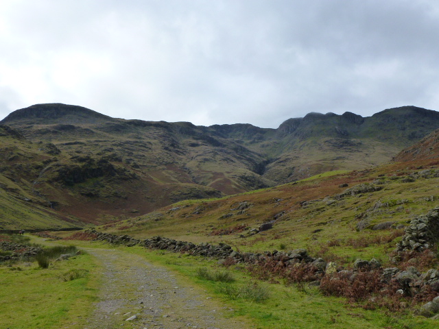
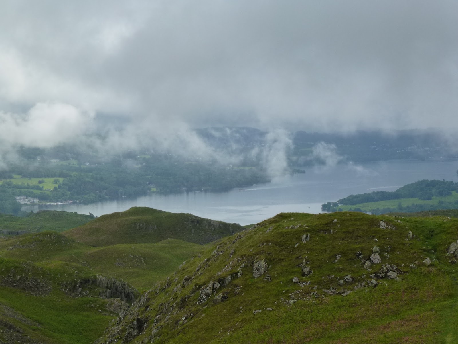
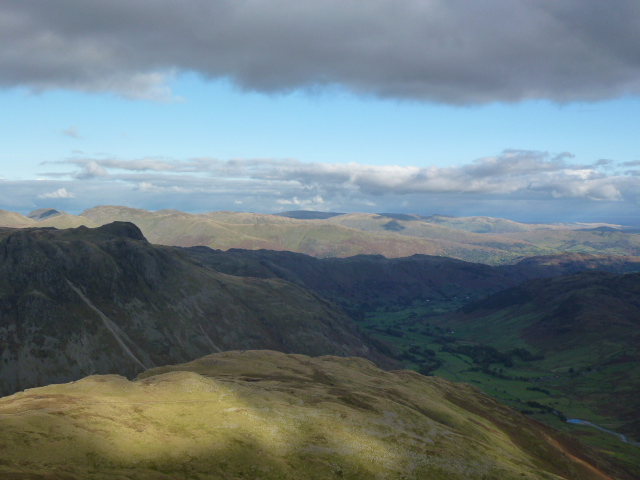
Ullswater

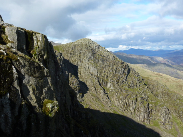
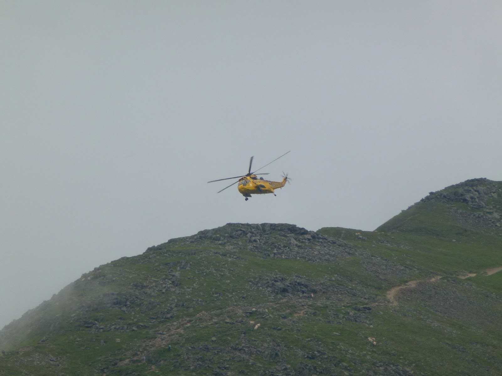
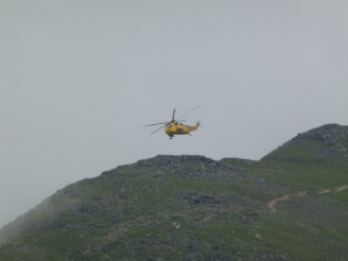
Back on the path along a big wall for a long flat section. Over on St. Sunday Crag, someone was being rescued from the cliff. When I’d walked St. Sunday Crag I’d watched a rescue of someone on Striding Edge.

Away from the wall to head across to Red Tarn, still flat so made up some time.
Red Tarn is at the base of the climb to Swirral Edge and a Mountain Leader was about to take a group of children up there too. I knew he was an ML the minute I overheard him point out Geographicum lichen! Plus he got them all to check their bootlaces and talked about foot placement and 3 points of contact.
The group commenced the climb and I stopped for my first lunch of pitta filled with hummous, tomato and basil so as to give them a good head start.
However, when I got to the hard part of the climb up the edge, there they all were again so he let me go past. It’s a short section of scrambling and does require concentration and thought as to where to put your hands and feet but there is enough room to take the numbers of people. It was more busy with people coming down but waiting for them is a chance for a breather. What it does do is get you to the top very quickly. A father coming down with his son was berating him for going down on his bum and bullying him in a very unpleasant way, such a contrast with the group coming up and I so wanted to intervene and kick dad off the mountain but anyway I kept quiet.
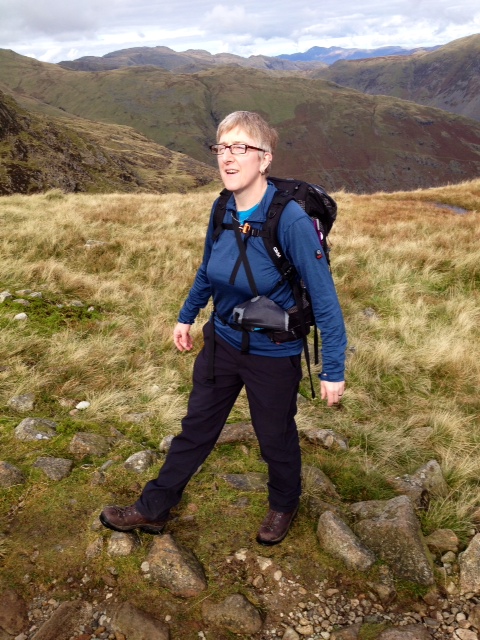
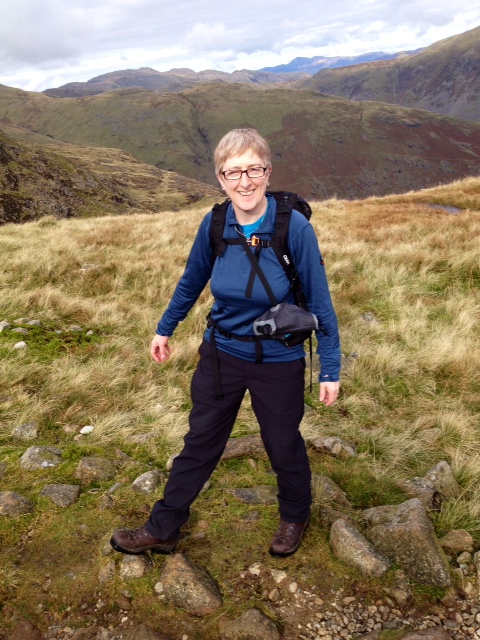
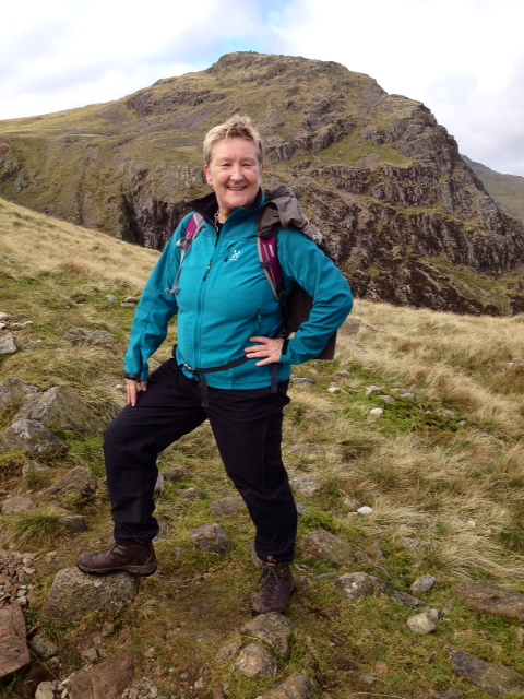
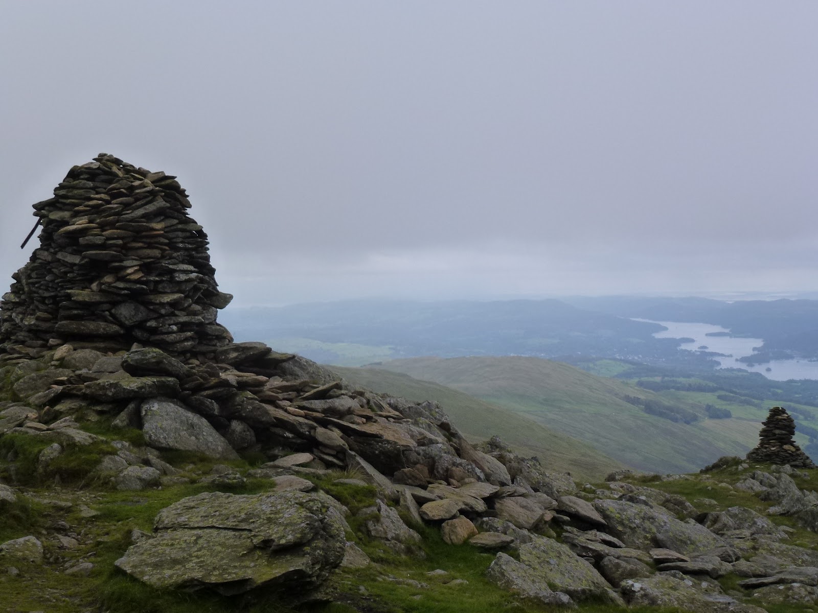
Helvellyn (2nd Wainwright) is a big plateau at 950m and I stopped at the first cairn and chatted to a couple of men about whisky. Then I moved on to the trig point and chatted to a couple of Indian men who had come up the easy way from Thirlmere with no gear, no map, no compass. They took my photo and I took theirs. My first trio had turned up by then and we all advised them how to get down and back to their car but I didn’t see them after that so they must have gone a different way, which would mean a long walk along the road.

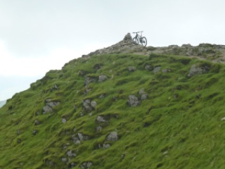
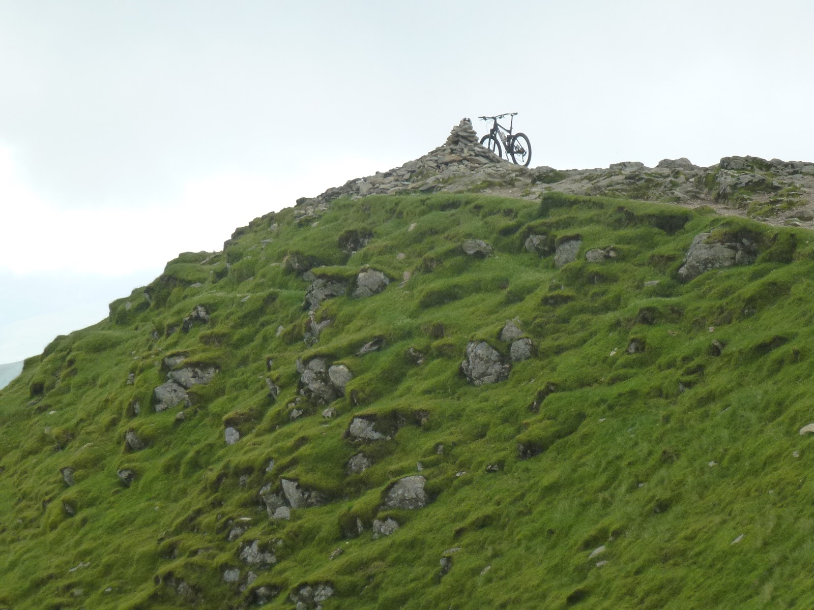
Someone biked up Helvellyn
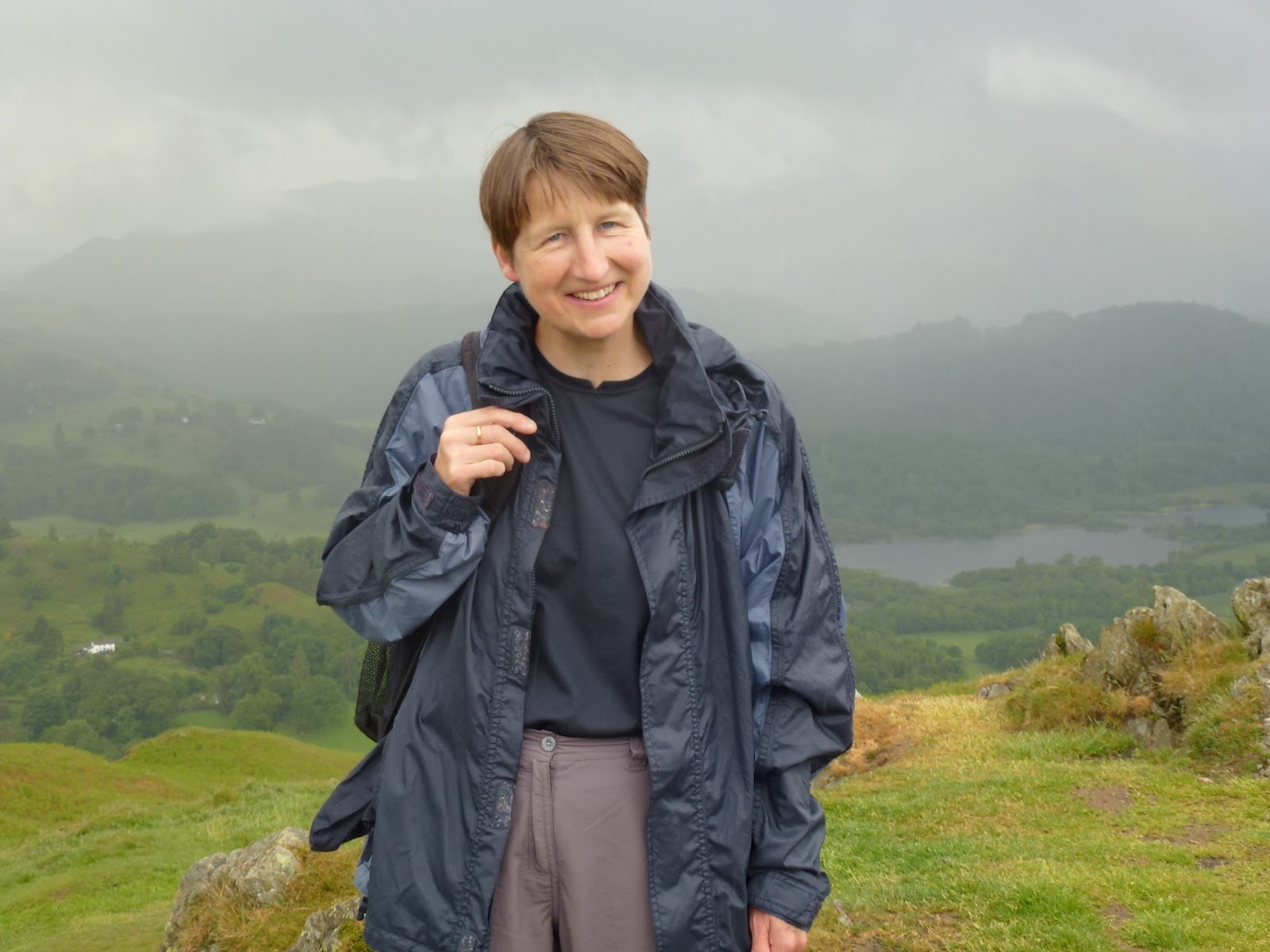
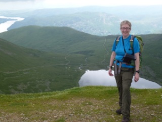
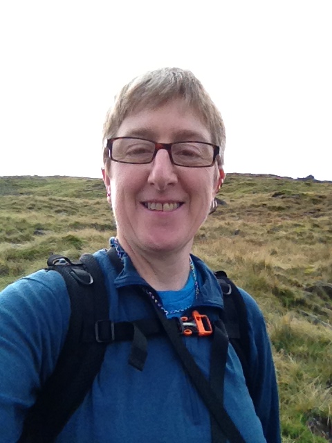
Me on the top, doing the bent knee pose!

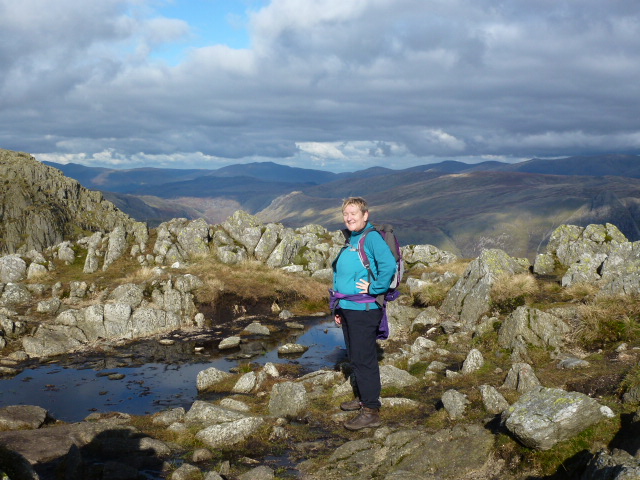
I treated myself to an energy bar in the shelter and then set off for Nethermost Pike (3rd Wainwright) and then Dollywagon Pike (4th).

Old gatepost at foot of Dollywagon Pike

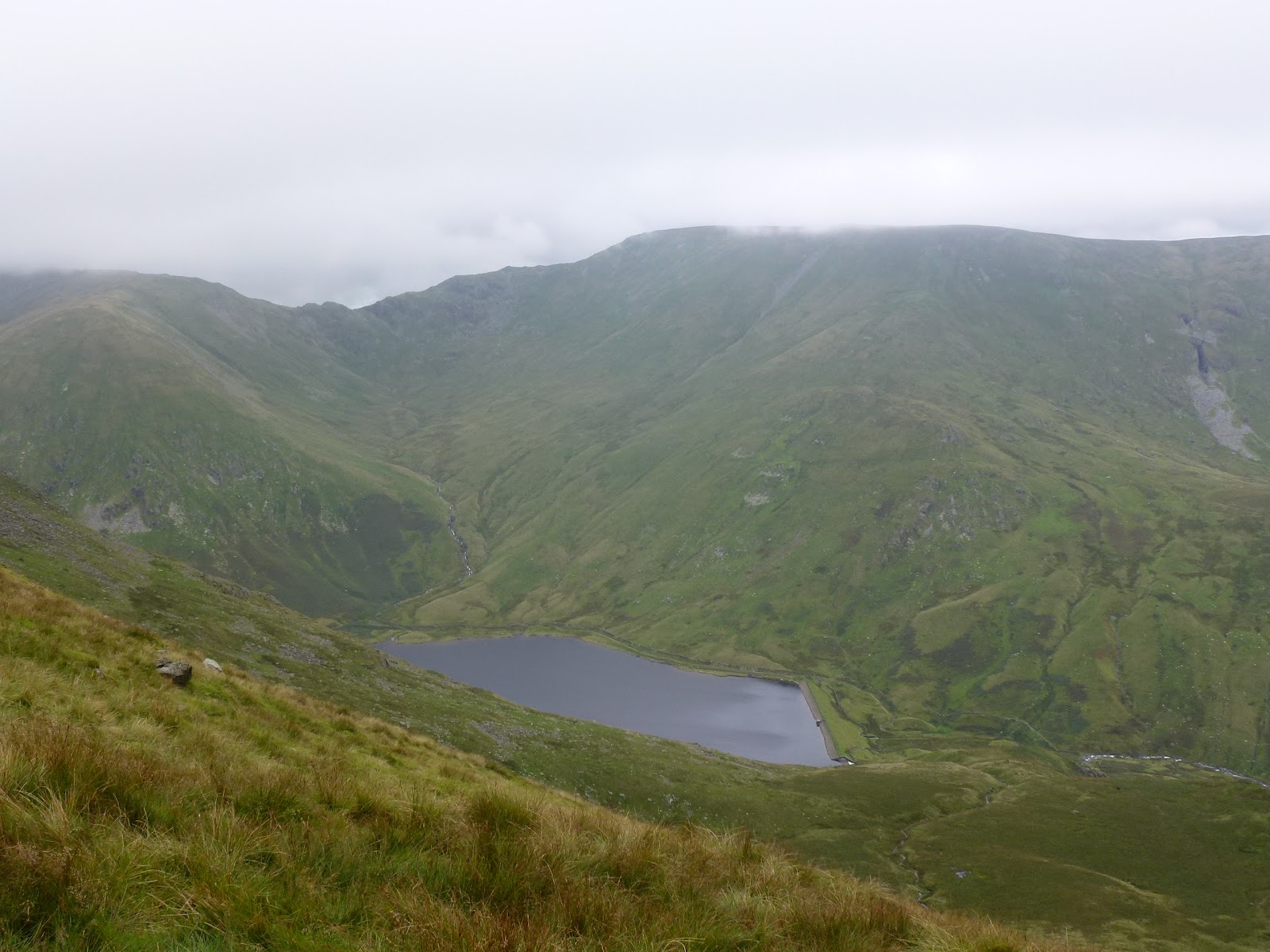
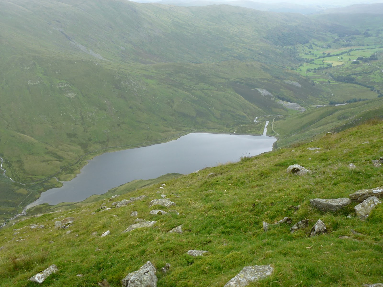
After Dollywagon it was 3/4 of an hour to get down to Grisedale Tarn, although the path is good. Here I had my second lunch, identical to the first and it rained for about 10 minutes.
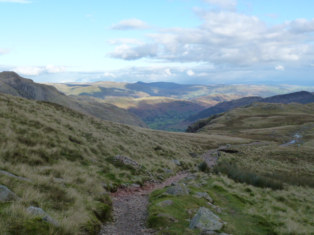
I was feeling quite tired and still had a long stretch to get back to Glenridding. I only managed to do this by setting myself intermediate goals of places to look for and aim for.

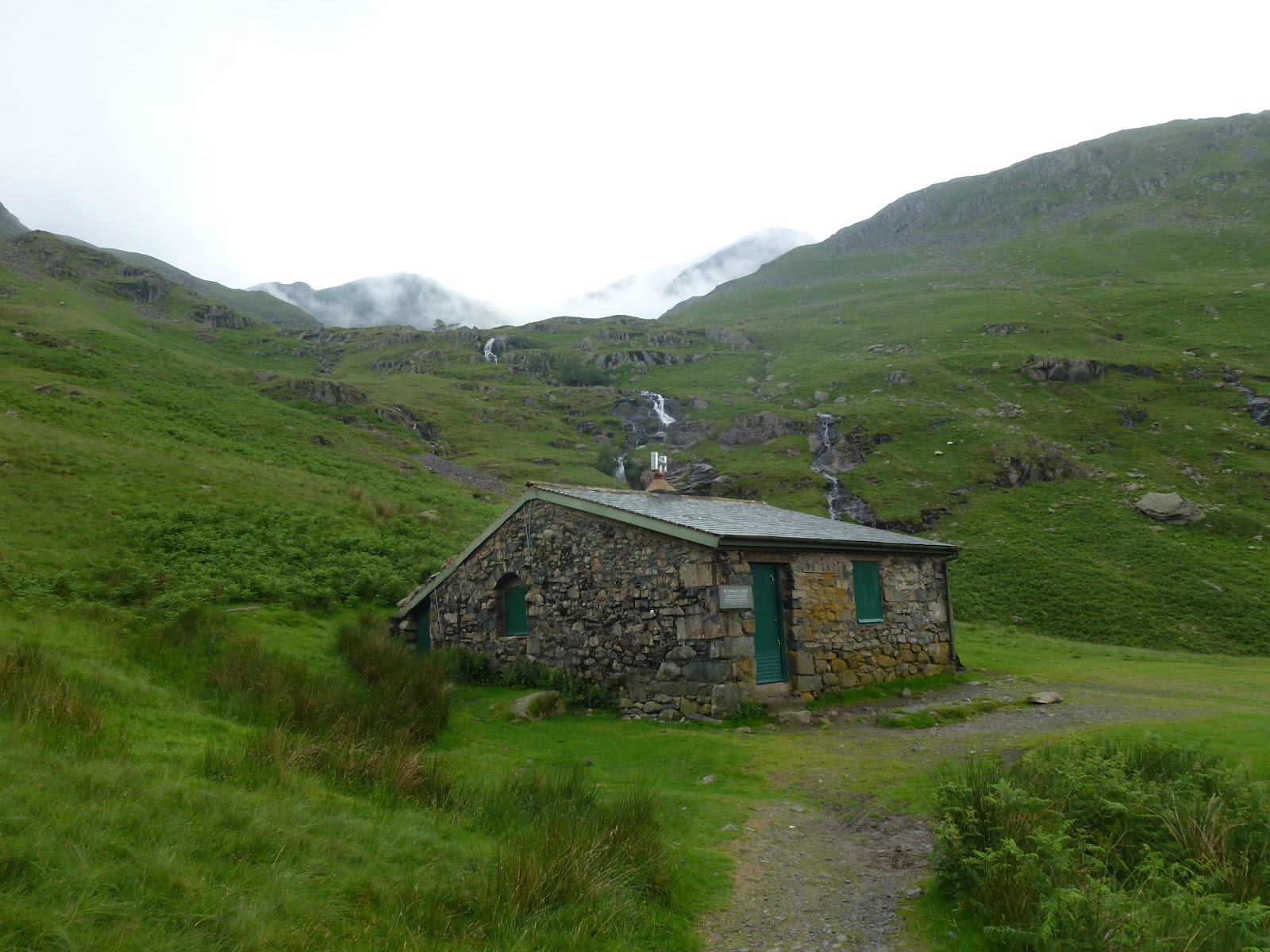
Ruthwaite Lodge climbing hut

It was a lovely walk and although I’d seen a few people I hadn’t actually passed anyone since Helvellyn. It took 2 and 1/4 hours to get back, the last section was a bit tricky. I had an option to go up in order to get back down, staying on Access Land and on Rights of Way, or to go off the Access Land and along marked paths on the contour. I chose the latter as I just couldn’t face any further up by then and was cursing every little rise. This took me across a fence with barbed wire into a mucky old wood with lots of bog and rotting trees. I slid my way out of that to go through over head high bracken which wet me through and then down onto a real track leading to a house and then onto the main road which frankly I was quite glad to see.
I left Glenridding at 6.30 and was back home at 8.30, not bad!
I did 17 km which is 10.5 miles – mountain miles! so the stamina is ok as although I felt tired and had a few leg and foot aches and pains, nothing was unbearable. And I did the lesser of the 2 Edges leading to Helvellyn, so all I need now is my pal Cath to do the other Edge!

[googlemaps https://maps.google.com/maps?f=q&source=s_q&hl=en&geocode=&q=Helvellyn&aq=0&oq=helvellyn&sll=53.115788,-4.025861&sspn=0.018443,0.060339&t=p&ie=UTF8&hq=&hnear=Helvellyn&ll=54.527059,-3.017635&spn=0.029885,0.051498&z=13&iwloc=A&output=embed&w=300&h=300]

Please visit Map and Compass and learn how to interpret a map with me and my navigation partner, Cath.

Lakeland Break 28th June – 2nd July 2012

Silver How 28th June

Carol and I arrived in Chapel Stile in time for lunch. As we drove near Windermere a big storm had started up. We got unpacked without getting too wet and the storm only caught up as I walked back from parking the car. We are staying in the annexe to Inglewood House which is Jane and Malcolm’s holiday cottage that they let out. They have very kindly allowed us to come here to the annexe. It’s compact but has all mod cons. C has a ham and a cheese sandwich lunch and I have tuna salad that I picked up on the way in M&S at Lancaster services. I sit and continue with Wolf Hall on my iPhone while lightning and thunder perform a merry dance. The rain is bouncing up about 6″. About 3 it starts to brighten and the rain stops so we quickly get out.
Just along the road is a path up to Spedding Crag which rises steeply to a col. From there we bear to the left to avoid the bog but miss the good path which is indistinct at that point. We descend a little through tall bracken and cross the first of several raging torrents. We skirt round a plantation where several big trees have been uprooted. Looks like the ground has been loosened by the vast amounts of wet and then a big wind has toppled them.
At a wall corner we turn left up a good path towards the clouds. I am expecting Wainwright’s scramble but the path continues to the top of Silver How. C says she is pleased she’s done the summit. As we turn and descend the clouds head away and we get good views to Grasmere. We return via the good path that avoids big bog and bracken to the col. Then a fast descent, all done without the use of an anorak!
We’ve got Look What We Found chicken curry with rice, sugar snap peas and ciabatta for supper. I wasn’t quite sure what the cooking facilities would be so played easy. It’s a microwave with grill and oven and 2 separate and fast heating electric rings and all work efficiently. So well that I am now thinking about getting one myself. As well as varifocal contact lenses (these would be easier for seeing up mountains in the rain.)
Carol
Down to Chapel Stile
Big cloud on top of our heads

[googlemaps https://maps.google.com/maps?f=q&source=s_q&hl=en&geocode=&q=Chapel+Stile,+United+Kingdom&aq=0&oq=chapel+stile&sll=54.527028,-3.017583&sspn=0.071327,0.241356&t=p&ie=UTF8&hq=&hnear=Chapel+Stile,+Cumbria,+United+Kingdom&ll=54.4397,-3.049049&spn=0.014975,0.025749&z=14&iwloc=A&output=embed&w=300&h=300]

Townend and the Grasmere Hotel 29th June

We got into the Nat Trust’s Townend on a “bring a friend for free” offer (NT BOGOF!). It’s a 17th century farmhouse that stayed in the Browne family for yonks and then one of them went mad for wood carving in Victorian times. Beatrix Potter knew the family and was scathing about the carving. Nearly everything oak had been attacked so you can see her point. I liked the house and old barn opposite. Mr B had made up his own coat of arms and installed his own pew in the church but the other parishioners said “stuff that” and ripped it out and burnt it.
Picnic lunch in car. Pitta bread with salami, tomatoes and crisps for me, ham roll, crisps and tangerine for C.
We went to Grasmere and Ambleside shopping.
Dinner at the Grasmere Hotel run by poofs. 4 course dinner for 2 for £45. Pâté appetisers. C had duck and orange pate, then tarragon chicken then Grasmere gingerbread and meringue. I had sardines (3) because had only the other day said I’d never had one. The fish was nice but very fiddly to eat so won’t bother again but might try tinned to see if they don’t have bones. Then beef in beer with spuds and veg. Sorbet in between first and second courses. Then almond frangipani with almond and brandy ice cream. C made friends with everyone. So we heard all about the people who got soaked to their underwear. Coffee which came with mini choc coated Kendal mint cake. Finding it hard to move….
Down the street from our door
Townend, fab chimneys
Very old barn at Townend

Holme Fell 30th June

We parked in a NT car park at Tarn Hows on the road from Ambleside to Coniston. A short stretch along the busy main road to Yew Trees Farm which was used in the Renee Zellweger film about Beatrix Potter and although BP didn’t live in it, the farm was one that she bought and gave to the NT. The walk goes along a flat section above Yew Trees Tarn and then rises through Harry Guards Wood. The path follows the stream up to Uskdale Gap which is a col with views across to the Langdale pikes. We then climbed a bit more to the cairn which gave us views to Coniston Water. We descended to get out of the wind and nipped down to “Reservoirs (disused)” to sit on a rock for our picnic lunches. Mine was the same as yesterday’s and I think C’s was too. Some Belted Galloways were munching about 100m away which was fine but then they gathered on our path back. They belonged to Yew Trees Farm who sell the meat. The cows mostly moved away but as we set off about 5 of them were on the path and we had to walk between them. Ahead of us was a party of 5 people who watched our fearlessness in the midst of cattle!
We got down quite quickly meeting only a group of DoE silver medal candidates. I considered getting some beef but the logistics of keeping it cool, fresh etc. not so easy.
We popped into Coniston and popped out again so took a circuit drive round the lake going past Brantwood, John Ruskin’s house which looked interesting and now thinking about going there.
Home for lamb dinner whilst the locals bang away at the pre gala dance. Grilled lamb steaks from our farm shop with spuds and steamed broccoli and carrots.
Across to Pavey Ark and some Stickles
Reservoir (disused)
Coniston Water

[googlemaps https://maps.google.com/maps?f=q&source=s_q&hl=en&geocode=&q=Holme+Fell,+Coniston,+South+Lakeland+District,+United+Kingdom&aq=0&oq=holme+fell&sll=54.43972,-3.049031&sspn=0.01787,0.060339&t=p&ie=UTF8&hq=&hnear=Holme+Fell&ll=54.396251,-3.056517&spn=0.014991,0.025749&z=14&iwloc=A&output=embed&w=300&h=300]

Tarn Hows and Iron Keld 1st July

We survived the pre gala dance by playing Scrabble in the kitchen downstairs where mercifully the noise was less. I was beaten. But very tired so drank wine and whisky. Just after getting into bed it stopped promptly at midnight.
This was a day for trying to dodge the rain so we had a look in Rock Bottom in Grasmere whilst firming up our plans. Decided to park in same NT car park as yesterday (this weekend I’ve recouped nearly half my NT membership fee!). Just as we set off a man asked us to keep an eye out for his camera so we took his phone number and promised to do so but we didn’t find it. The footpath to Tarn Hows goes through woodland up the side of a stream that turns into a waterfall and then Tom Gill which is quite a high fast force. Tarn Hows itself is a man made lake with manicured paths but also ducks, geese and water lilies and islands.
Usual lunch on a wet bank looking at the rain on the lake.
Then we got away from the main drag and onto AW’s “rough old road” to the Iron Keld plantation. Here we headed north to Iron Keld. A keld is a source or spring. We then turned back and retraced our steps. We saw 2 stoats running along a wall for a good few metres.
Finished off the day at the Jumble Room in Grasmere. Great resto and recent diners have been Vint Cerf (our waiter said he was the head of Google, but as a founder of Arpanet he goes back before Google was even thought of and without which Google would not exist) and Sting! I had gnocchetti with cheese sauce and truffle for starter. Never had truffle before but am a convert – totally delicious. C and I both had lamb koftas served with couscous, cherry tomatoes, cucumber yoghurt sauce and rose petals (another first!) C had sticky toffee pud and I had pannacotta with strawberries and shortbread. All very delicious. If you go there, which we both heartily recommend, the upstairs is quieter.
Tom Gill
Many gloves for foxes
Near Iron Keld
Iron Keld plantation

[googlemaps https://maps.google.com/maps?f=q&source=s_q&hl=en&geocode=&q=Tarn+Hows,+Coniston,+South+Lakeland+District,+United+Kingdom&aq=4&oq=tarn+ho&sll=54.375663,-3.053343&sspn=0.143182,0.482712&t=p&ie=UTF8&hq=Tarn+Hows,&hnear=Coniston,+Cumbria,+United+Kingdom&ll=54.378008,-3.057461&spn=0.014997,0.025749&z=14&output=embed&w=300&h=300]

The Monday was too wet for anything much so we drove around a bit, Brantwood looked too busy so we had our sandwiches in the car looking at some wet cows and then headed home.
We had a lovely few days eating our way round Grasmere. We had some good walks up the smaller fells and managed not to get badly wet. I now need to not eat for several weeks to get this belly down!
Please visit Map and Compass and learn how to interpret a map with me and my navigation partner, Cath.

Loughrigg Fell 8th June

We ended up with a day trip to the Lakes and climbed this fell. It turns out that despite its compact size it is a Wainwright. We had fortuitously parked the car in a place with good access to the fell. It’s a short walk up with great views across to Grasmere but also fab all round views. We picked a small one because the weather had just been awful all the way across to the Lakes and we managed to get to the top without getting wet. It only started up again for the long haul as we descended. All very atmospheric and it’s pronounced Luff-rigg.

Grasmere
CB
Oh that’s where the chocolate went!

[googlemaps https://maps.google.com/maps?f=q&source=s_q&hl=en&geocode=&q=Loughrigg+Fell,+Lakes,+South+Lakeland+District,+United+Kingdom&aq=0&oq=loughrigg+fe&sll=50.965633,7.157032&sspn=0.077407,0.241356&t=p&ie=UTF8&hq=&hnear=Loughrigg+Fell&ll=54.437504,-3.008366&spn=0.014975,0.025749&z=14&output=embed&w=300&h=300]

Please visit Map and Compass and learn how to interpret a map with me and my navigation partner, Cath.

css.php