Lady Anne’s Way (LAW) Part One

Skipton to Barden Tower

Not my most successful day. Started with the alarm not going off. I set off from Skipton after forking out £4.50 to park the car at 9.20. The first thing I came to was a woman and 2 lurchers, one of whom had just killed a rabbit, not a good start to the day. I followed the route crossing the bypass and the golf course and tried to imagine LA doing same and failed.
The route takes you round the backs of Embsay and Eastby but I just wanted to get away from settlements with their dog crap, litter, barking dogs and cars etc. The route is generally ok just a few bits out of date like disused rly which is in use by Embsay steam railway and the Mason’s Arms in Eastby which is not open all day and is sadly shut forever.
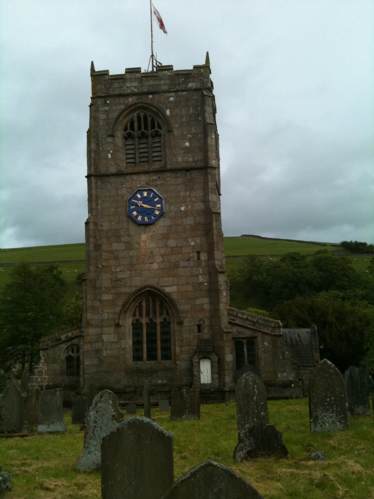
Skipton parish church, next to Skip Castle
It was very hot and humid. I got out of Eastby going along Bark Lane, passing over a stream with a duck and baby duck, so sweet. Then I had to cross a field. The occupants didn’t want me in there and came running towards me so I nipped back over the wall. I tried to find a quick way round the young frisky bullocks but in the end had to quit LAW and go up to the road, they kept watching me even though I was the other side of the wall from them. I had to climb over some walls and fences and it was quite steep, I saw some live rabbits quite close to. It was so hot I felt quite unwell and knew I would not make it to either Hebden or Grassington, I’d also developed sausage fingers, I think these are to do with heat and hydration. I was reminded of when I’d walked in Switzerland in terrible heat and had sausage fingers. I stopped for lunch just inside the National Park and put a plaster on my blister and watched the Embsay steam train chuffing along.
Embsay steam train
Lunch spot
I headed for Barden Tower picking up the route again. It felt much easier once the pressure was off although still very sweaty and sticky. I had a chat with a Ranger about bus times and he told me how even with access land rights the Duke of Devonshire who owns all Barden does not allow dogs and the Rangers have to enforce this on weekends when the Duke’s men are not at work. I stopped at the tower and had a drink (fizzy water with ice and lime for £1.90) outside at the Priest’s House which is posh resto and not the caffy where the book says you can get a Lady Anne Special, which sounds very fruity to me! I didn’t sit at the table with candles etc. Maybe I was a bit too dirty and sweaty anyway I had my drink but did not feel they wanted me to linger. I went to the loo, this involved getting the key, walking across the grassy expanse to a door in wall so everyone knew where you were going by now and then down some very wet and slippery steps into Lady Anne’s privvy which was v wet and damp. I walked around tower as that’s all you can do and then back up the horrible busy road to the bus stop getting yelled at on the way from a van. Then I sat sitting on my map at the bus stop with no seat for 50 minutes waiting for the bus at 3.05 which turned up at 3.12 so having made me anxious again.
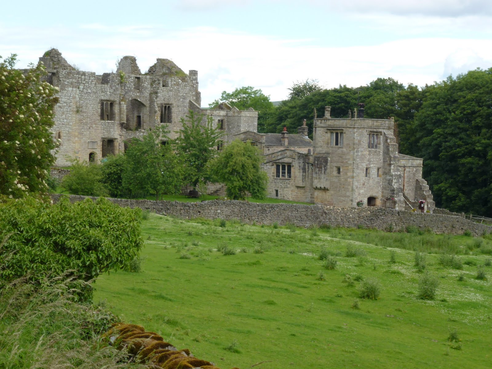
Barden Tower
The ancient bus then went back up the hill in first gear and dumped me out in Skipton twenty minutes later.
I shoved my bag back in the car, took a photo of the castle, didn’t go in for £6.50 but went to M&S for some water. In the car, drank my old bottle of water which was hot and fizzy, hmm.
Skipton Castle – Henceforth
Then drove home. I listened to a Dick Kingsmith story on R4Extra called The Queen’s Nose where the moral of the story was “be careful what you wish for”. Yesterday I had made a joke with Chris about wishing it was hotter. I got my wish alright, the temp in the car was 28.5 degrees C.
I’ve decided this walk needs chunking up into smaller segments, I need to sort out my alarm clock and I am not good walking in the heat, especially when I’m pushing myself hard.

[googlemaps https://maps.google.com/maps?f=q&source=s_q&hl=en&geocode=&q=barden+tower&aq=&sll=54.057096,-2.00273&sspn=0.018036,0.060339&t=p&ie=UTF8&hq=barden+tower&hnear=&radius=15000&ll=54.010593,-1.924324&spn=0.060525,0.102997&z=12&iwloc=A&output=embed&w=300&h=300]

Please visit Map and Compass and learn how to interpret a map with me and my navigation partner, Cath.

Theatre in the Dales 180611

This wasn’t a walking trip as such. We set off just after 3 to arrive in Linton with time for a short walk out of the village to a disused railway, avoiding some rather large bulls.
Linton
Disused rly bridge
Linton
Then it was straight to the Fountaine Inn for gammon, double egg and chips for C, and braised beef with mash and a Yorkshire pud for me, served up with braised red cabbage and ratatouille. Although it was early even for me, I was really hungry and wolfed it down. Then followed it with a couple of scoops of ice cream. Very nice too.
A short drive took us to Burnsall village hall where we watched a play called Sward by Simon Corble as part of the Grassington Festival. C and I have been to lots of Simon Corble‘s productions and I really like his work. We’ve seen Midsummer Night’s Dreame, The 39 Steps, The Hound of the Baskervilles, Of Mice and Men and The Signalman. And Sward did not disappoint us.
Burnsall primary school
Battered church clock, Burnsall
Lovely drive back, past Barden Tower which we are saving for another evening, free entrance during daylight hours. The sign said this was one of Lady Anne Clifford’s towers, she didn’t half get about, we saw her last in Kendal and then there is Clifford Castle down near the Wye.
As of yesterday, I was pitching to walk the Coast to Coast which I may still do but have now got interested in Lady Anne’s Way as she does just keep popping up!

[googlemaps https://maps.google.com/maps?f=q&source=s_q&hl=en&q=Linton,+North+Yorkshire+BD23,+United+Kingdom&aq=0&oq=linton&sll=54.147208,-2.047547&sspn=0.017997,0.060339&t=p&ie=UTF8&geocode=FQDcOAMdqGDh_w&split=0&hq=&hnear=Linton,+North+Yorkshire,+United+Kingdom&ll=54.057977,-2.006893&spn=0.015114,0.025749&z=14&iwloc=A&output=embed&w=300&h=300]

Please visit Map and Compass and learn how to interpret a map with me and my navigation partner, Cath.

Kettlewell to Arncliffe and back 050611

Started off brightly from Kettlewell at 12.30 after a journey of an hour and 25 minutes to get there. I paid £4 for the car park and only spotted the one across the road for £2 when we got back. Straight into a steep climb up the cliff and then most exciting, actually into the cliff and out of the top of it. Great views across to Great Whernside which is really just a long flank with a little bit of high stuff in the middle. We carried on across the moor gently rising and then dropped down to Arncliffe, also down quite a steep section with water running through it. We then toddled along the road and decided not to go into the village as one of the party was feeling a bit tired. So we took the next path back up, skirted round any cliffs and plodded on back to Kettlewell. The tired party became very tired indeed and I did worry at one point about whether we would have to call out MR. However willpower beat fatigue and we got back all in one piece. It was quite windy which always makes it harder going. Although not as big as winds on Grisedale Pike, or on Jura, still windy enough to make a difference. It also kept raining in heavy showers so we wasted a lot of time taking anoraks on and off, which always drives me mad! We only did about 9km in distance but we managed to do about 600m of climbing so not surprising this was taxing. A small walk that turned out quite big.

[googlemaps https://maps.google.com/maps?f=q&source=s_q&hl=en&geocode=&q=Kettlewell,+United+Kingdom&aq=0&oq=kettlewell&sll=55.66423,-3.782755&sspn=0.017332,0.060339&t=p&ie=UTF8&hq=&hnear=Kettlewell,+North+Yorkshire,+United+Kingdom&ll=54.147205,-2.047577&spn=0.015081,0.025749&z=14&iwloc=A&output=embed&w=300&h=300]

Please visit Map and Compass and learn how to interpret a map with me and my navigation partner, Cath.

Smardale Gill 290411

After a small breakfast of muesli and yoghurt and then a boiled egg, I left High Chapel House and parked up at Smardale Hall. There is a path through the National Nature Reserve which has pretty flowers but runs along a disused railway track and is quite boring and hard on the feet being Tarmac. You go past the site of the 1955 Smardale crash – apparently they only removed the remains in 2004!  You also go under the Settle Carlisle Smardale viaduct and then you come to the Smardale Gill viaduct which is on the dismantled line. I went round it so as to get better photos. The path off the line is pretty and winds along the beck to Smardale Bridge – a packhorse bridge. Then back up onto the line, over the viaduct itself and back. I liked the bits that were off the line better.

I then drove home, stopping to eat my sandwiches in sight of Wild Boar Fell and the cairns very prominent looking like people on the top.
I stopped in Hawes on the way but too full of motorbikes so left without lingering. I went past Pen-y-Ghent which I climbed on the day that Charles and Di got married and tried to drive through Settle but had to take a longer way round as they were having a street party. They had a street party there for Charles and Di back in 1981 but didn’t shut the road then. One of the Pen-y-Ghent party was craving a steak sandwich and this seemed an unlikely thing to find in the middle of the Dales on a bank holiday but actually she was in luck in Settle 30 years ago. Oh I can’t believe it was that long ago.
I skipped the steak sandwich for this royal wedding and got back with lots of time to prep the next day’s outing.
 
Smardale Gill viaduct
Smardale Bridge
 Please visit Map and Compass and learn how to interpret a map with me and my navigation partner, Cath.

Swinsty Reservoir and Timble

March 14th, 2011
I took the day off for my birthday (13th). Mr B and I drove to Harrogate in the motor. Had a pootle around the shops and then went to nice Italian for lunch called Sasso.
We then went a short distance to Swinsty and parked up in the water board car park. The whole area is overlooked by the sinister golf balls on Menwith Hill.
We did this walk and managed to make it take forever, but the weather was good and although not madly hilly, a good walk to get my eye back into navigation and for Mr B to test out the new boots and his knees. The walk goes along one of the reservoirs, then a beck (lots of mud), up to a farm and up to village of Timble which is very des res.

Building contains some ancient water machinery

[googlemaps https://maps.google.com/maps?f=q&source=s_q&hl=en&geocode=&q=Swinsty+Reservoir&aq=&sll=51.375852,-2.359829&sspn=0.016877,0.052314&ie=UTF8&hq=&hnear=Swinsty+Reservoir&t=p&ll=53.97613,-1.702108&spn=0.015144,0.025749&z=14&iwloc=A&output=embed&w=300&h=300]

Please visit Map and Compass and learn how to interpret a map with me and my navigation partner, Cath.

css.php