Barden reservoirs 27th May 2018

Warm and sunny day. Parked at Halton Moor.

I started off by taking a sight bearing to what I thought was a trig point quite a long way away. Mulled this over as the 290 seemed a bit short angle wise of where the trig was on the map. Worked it out, my sight bearing was actually to an obelisk on Watt Crag which was at 290.

Down to Barden Lower reservoir, on access land but following a permissive path. Some confusing signage like don’t go this way and do go this way both at the same place. I just did what the map said I could do. Up to Barden Upper reservoir where there is a big old waterworks house, very remote feeling and exposed, seemed empty but was in good nick with non broken windows and new ridge stones, looking like they’d only recently been bedded in. Slightly spooky because there was no-one around.

Had some lunch and stood up only to see a man’s grey head in the sheep fold. Slightly surprised as I’d had no idea there was anyone around.

I then took a bearing to ensure I was on the correct path for the return. The bridleway wasn’t very clear on the ground so this helped. No dogs or cycles are allowed on it despite it being a bridleway because it’s part of the Bolton Abbey estate.

img_20180527_132226_7
Barden lower reservoir
img_20180527_135414_8
Just liked the shape of these walls
img_20180527_135558_1
These are posh grouse butts
img_20180527_143304_0
House on the res
img_20180527_144046_0
Barden upper reservoir

Link to Viewranger route

Please visit Map and Compass and learn how to interpret a map and use a compass with me and my navigation partner, Cath.

MAPandCOMPASS

Malham 19 May 2018

When Charles and Di got married in 1981 I was 23 and walked up what must have been my first mountain, Pen y Ghent, from Horton in Ribblesdale. Two things I remember about that day – my Greek American friend M, stayed back to watch the wedding on a portable TV brought up from Cardiff just for the wedding, and someone wanted a steak sandwich, which most days in 1981 would have been quite a challenge in the Yorkshire Dales but because of the wedding was amazingly an easy find. These were the days when avocado was a colour for bathroom fittings. We’d moved on from buying olive oil in a chemist but opening hours and food choices were nothing like today.

I drove up to Malham and parked near the tarn. I did a 15km circular walk avoiding the cove and all the busy places. At first there were quite a lot of people but I soon got away from them and had the place pretty much to myself.

Passed Victoria and Jubilee caves. Didn’t go in because I reckon the interesting bones of elephants, rhinoceroses and bears discovered by the Victorians are long gone (and so they are, see the link) and I don’t much like caves.

It was warm and sunny and great weather for walking.

Towards Malham Cove
Belted Galloways
Rye Loaf Hill, my rye loaf doesn’t quite look like this.

Jubilee Cave, I didn’t go in it
Pen-y-Ghent


Link to Viewranger route map

Please visit Map and Compass and learn how to interpret a map and use a compass with me and my navigation partner, Cath.

MAPandCOMPASS

Near Dunsop Bridge June 10th

Rather a long drive to get to the start just past Dunsop Bridge but then we spent a pleasant few hours on good paths looking for non-existent castles. Neither Holdron Castle nor Longden Castle are any more than a few piles of old stones. In fact, Longden, which has the words “ruin” on the map seemed to have even fewer stones than Holdron which I at least managed to make out where it had been. We reckoned Longden had been turned into the shed that was on its spot. We saw a hare at close quarters, a delight as it ambled away on long legs. Lovely sunny day and warm. Much quicker to get back! We knocked off half an hour somehow.

Not sure what this tree is.
The hare
We got up to a bit of height
One of several solitary oaks
CB

[googlemaps https://maps.google.com/maps?f=q&source=s_q&hl=en&geocode=&q=Dunsop+Bridge,+United+Kingdom&aq=0&oq=dunsop+brid&sll=54.4375,-3.008361&sspn=0.017871,0.060339&t=p&ie=UTF8&hq=&hnear=Dunsop+Bridge,+Lancashire,+United+Kingdom&ll=53.944973,-2.520847&spn=0.015155,0.025749&z=14&iwloc=A&output=embed&w=300&h=300]

Please visit Map and Compass and learn how to interpret a map with me and my navigation partner, Cath.

Dales 16-18 September

Friday
Set off at 2.30 and meandered our way to Keighley where I bought Optrex for one of Carol’s ailments. It took forever in dithery Friday traffic to get to Ravenstonedale partly because of an excessive monsoony downpour which came north with us causing lots of standing water and some mini floods, the worst of which was 2 mins from our destination at High Chapel House. That sentence is long enough to challenge Lucy Mangan!
We settled in to the same room I had when I came here back in April. The rain had now stopped so off to Kirkby Stephen to the Old Forge for dinner. I had lamb koftas and chick peas for a starter – very tasty. Followed by pea risotto while Carol had pork escalopes with black pudding mousse with honey and mustard sauce. All served up with mashed spuds, mashed swedes and leeks with peas and chips in case anyone had room for them. All very good fare. This resto is recommended!
Saturday
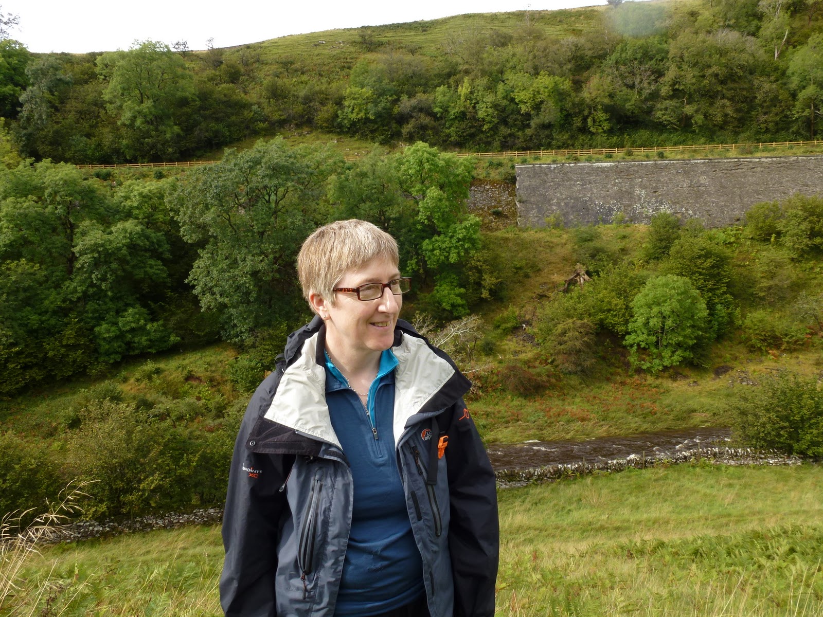
Both very hot in the night. Brilliant powerful shower. Breakfast was cooked by John as Yelly was out doing a cookery demo at a nearby country show or fair. Full English for C and omelette for me. Just for a change it was very wet so we went into Kirkby Stephen which was having a horse fair. This meant it was hard to park and the town was full of rough looking horse traders. Went round the whole town and stopped for a coffee in the post office and deli. C was the one on coffee and me on tea so a bit of reversal there. I sniffed Carol’s Americano but still didn’t want it. It’s a bit like giving up fags as I think I should be having coffee. Then the rain actually stopped and we decided to give our walk a go so back to Ravenstonedale to park near the school and get fully togged up against the wet and off across the field to the main road. We followed a track and then charged up over pillow mounds, through a herd of non combattant cows and down to Smardale bridge hearing the sound of a hunt all the while.
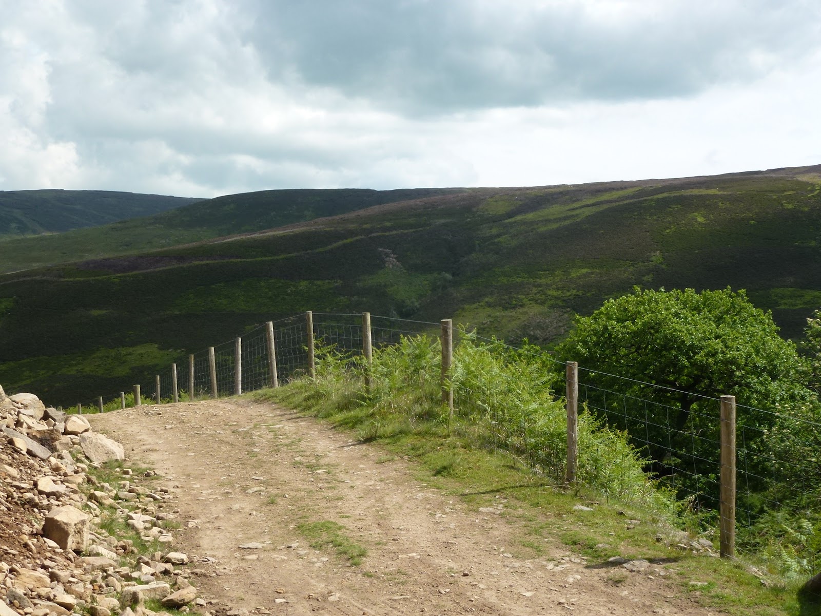
From the bridge through some old quarry pits along an exposed section and up to Smardale Gill viaduct. It was well into the afternoon so I had my pork and apple pie and C a ham sandwich with some of my best flapjack.
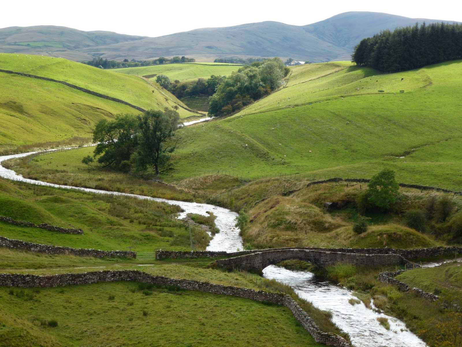
Across the viaduct and along the old railway track, through some mud and down to a fast flowing section of Scandal Beck at Smardale bridge. We managed to get across and then I remembered we were going back a slightly different way so back through the river again!
Various muddy bits but soon back in Ravenstonedale in time to freshen up before going out to the Cross Keys near Cautley Spout.
The Cross Keys is a temperance inn and is run by Alan and Chrstine who are Quakers. No corkage charge so C provided a nice bottle of Fitou. Great coal and wood fire blazing in the range in the sitting room.
I had mozzarella and sun dried tomatoes in filo parcels followed by steak with onions and mushrooms with mixed roast veg and potato wedges – they make a point of telling you they don’t serve chips but the wedges are the thick end of. I finished off with crunchy caramel ice cream. C had a stack of chicken and bacon followed by crundle which is like cake with jam and cream. It was all very nice indeed.
I was pleased to see Alan he is a proper maitre d’ and comes to see each table is ok. We sat briefly in the sitting room then paid up and said goodbye to Christine. They both said they remembered me from April.
Home to finish off the bottle. Oh and raining again. We have now met the entire family at High Chapel House.
Through the window
Smardale Gill viaduct
Smardale bridge over Scandal Beck

[googlemaps https://maps.google.com/maps?f=q&source=s_q&hl=en&geocode=&q=Smardale,+United+Kingdom&aq=0&oq=smardale+&sll=54.340598,-3.023558&sspn=0.017538,0.052314&t=p&ie=UTF8&hq=&hnear=Smardale,+Cumbria,+United+Kingdom&ll=54.468192,-2.39974&spn=0.014964,0.025749&z=14&iwloc=A&output=embed&w=300&h=300]

Sunday
Yelly was on breakfast duty today. I had the full English without the black pudding and Carol had scrambled egg and smoked salmon. I haven’t told C how I feel about scrambled eggs but it is quite a violent antipathy.
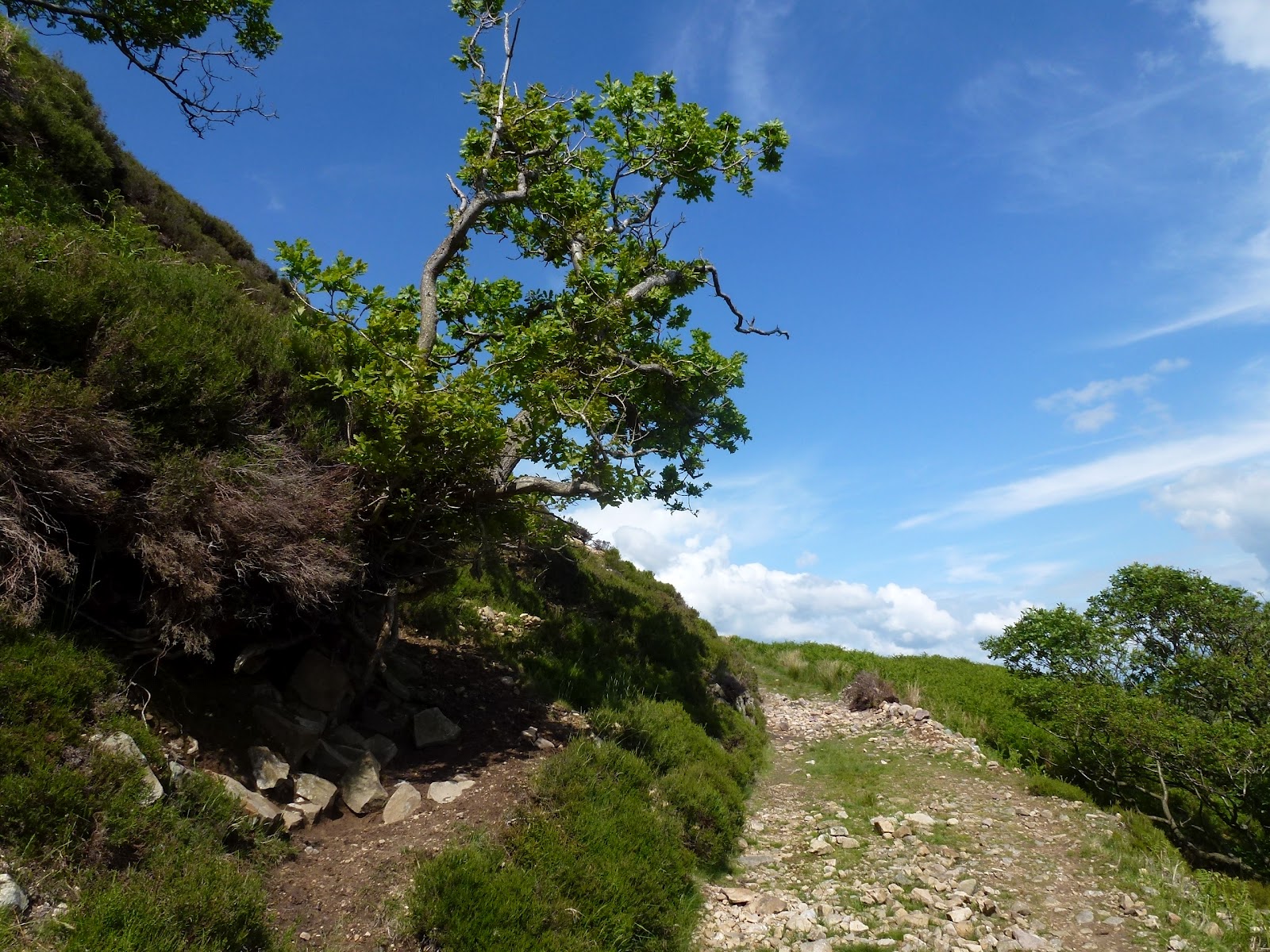
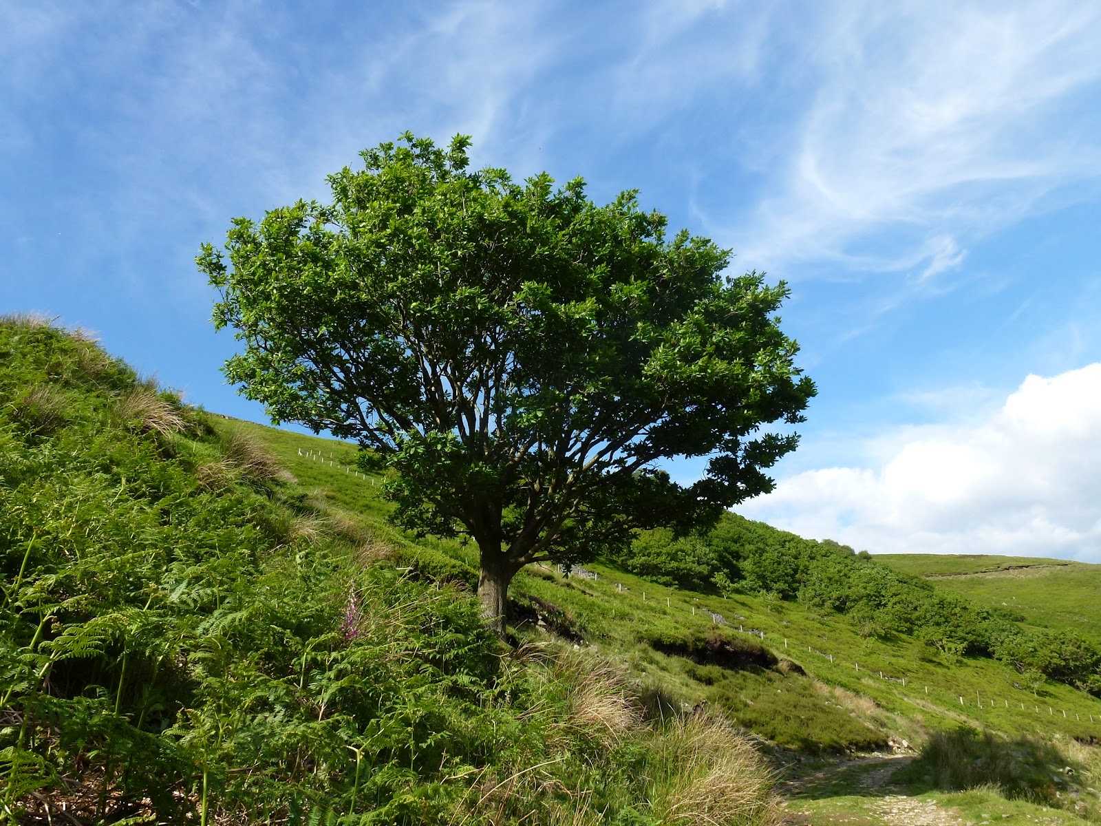
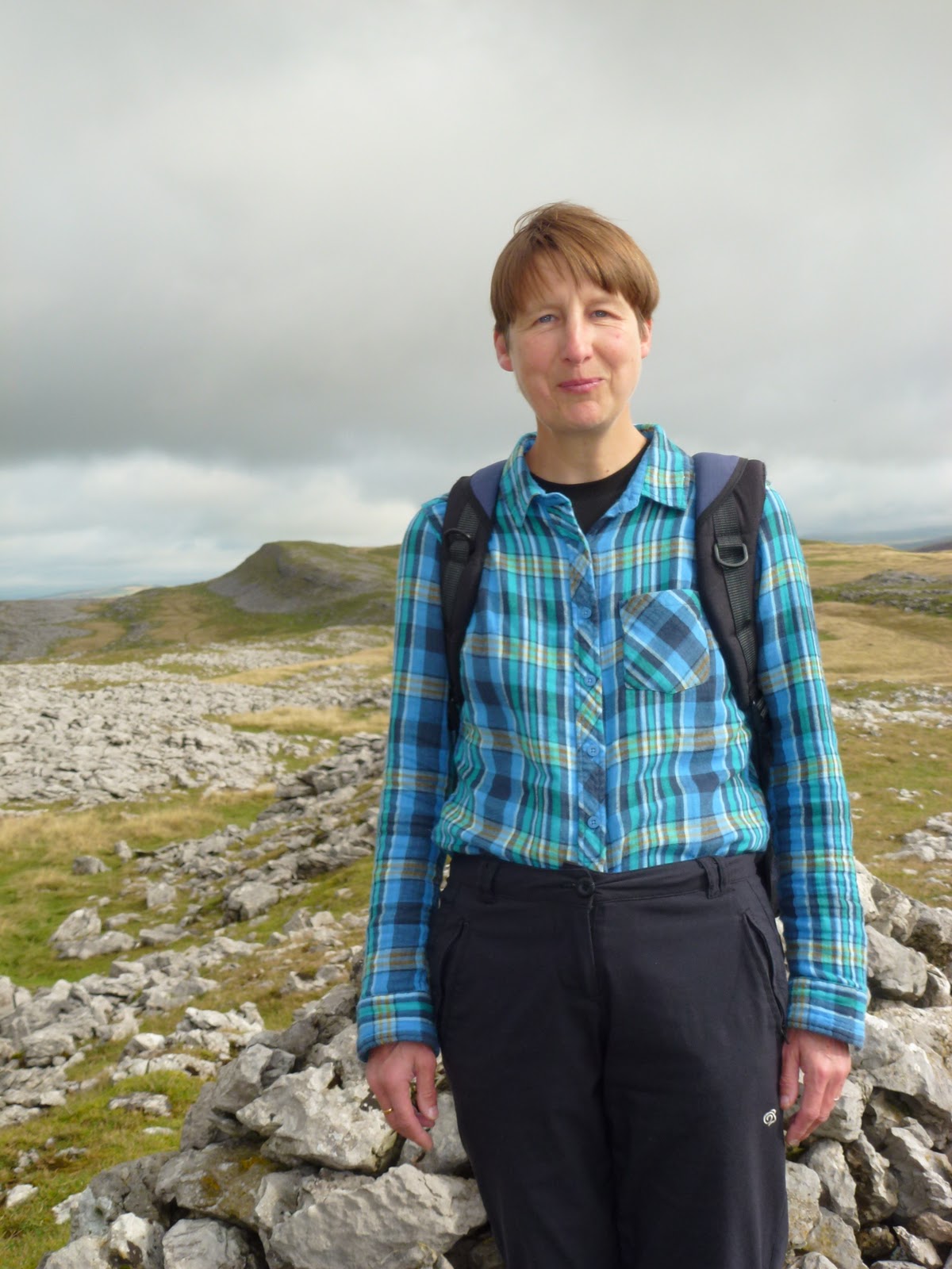
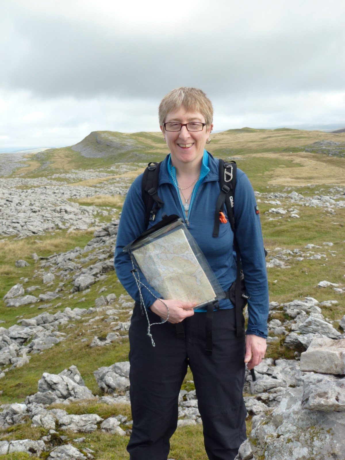
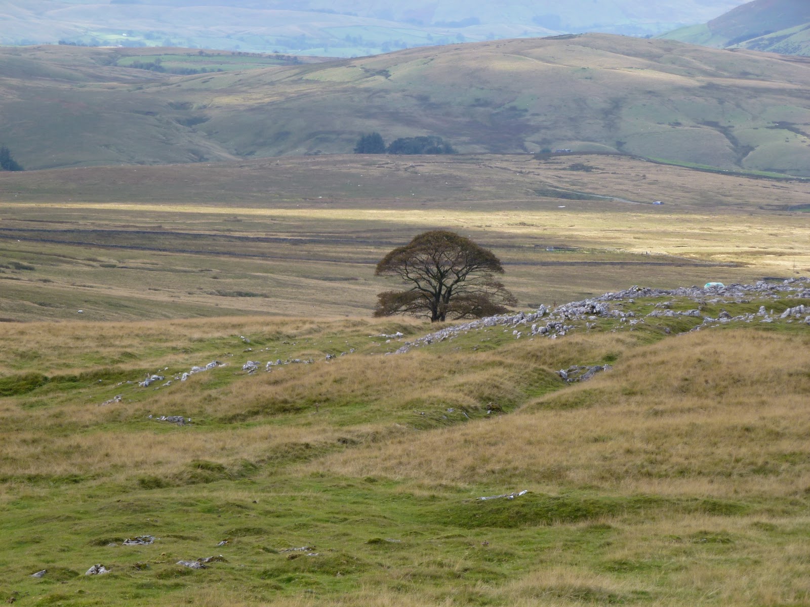
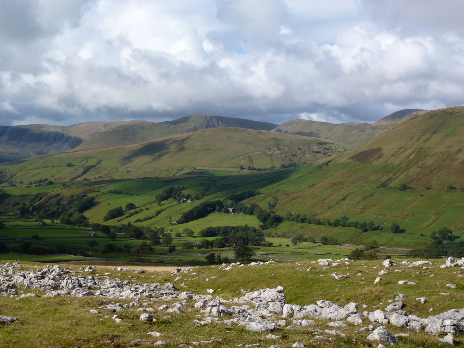
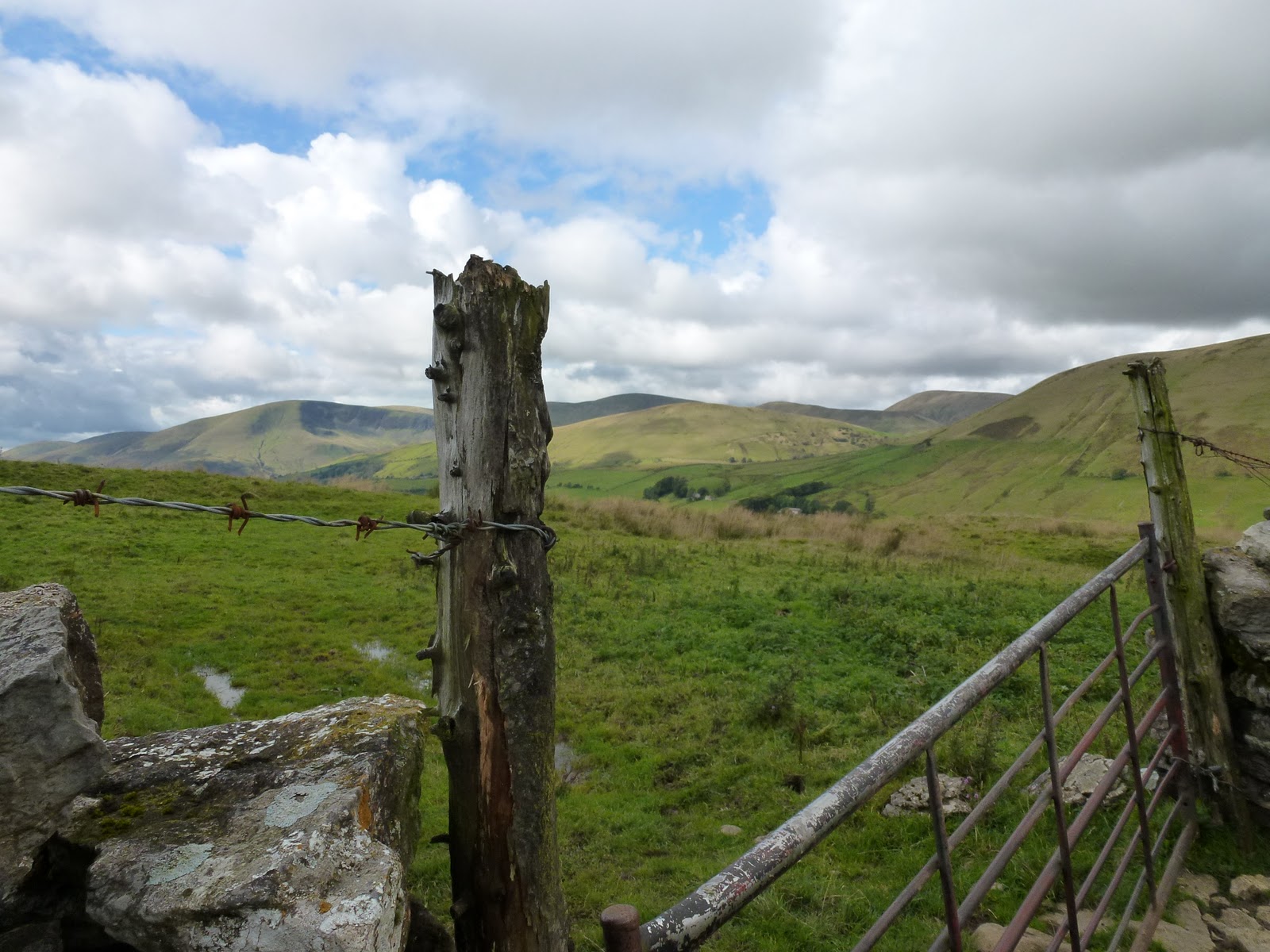
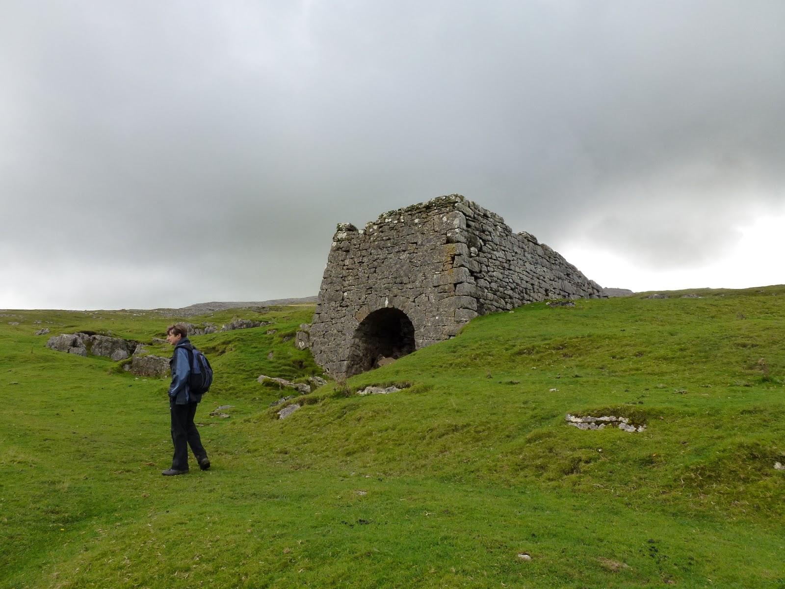
We packed up and wanted to take advantage of the lack of current rain so managed to get out early. Drove just a few miles to park in an old quarry and then walked up to Fell End Clouds which is a lovely walk ambling through limestone moraine and then bits of limestone pavement. We’d picked a lower level walk in case of more rain but it stayed fine and took us up high enough to get good views across to Wild Boar Fell which still draws me to it. We found Wainwright’s “conspicuous, solitary tree” and wandered back to the road passing 2 old lime kilns.
Then to Sedbergh for a bit of book shopping, grabbed a bread roll in Spar and off on a very quiet single track road to Dent. Stopped a bit further on next to a gushing waterfall to eat our lunches, it now being mid afternoon. Then continued on this road a little way and then I realised it was Whernside on our left and we passed where I’d climbed it from on my super fast ascent a year ago Easter.
From there it was a straight drive back to Ingleton and the main road home. And it didn’t rain on us all day. Super.
Limestone bits and bobs
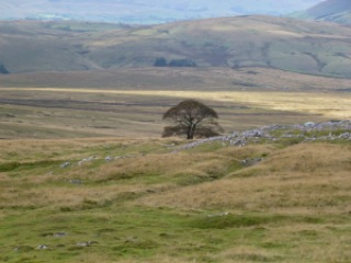
“conspicuous solitary tree” (AW)
“Who’s going to ride your wild horses?” (U2)
That tree again
Lime kiln
Waterfall on Dent to Ingleton road

[googlemaps https://maps.google.com/maps?f=q&source=s_q&hl=en&geocode=&q=cautley+spout,+Sedbergh,+United+Kingdom&aq=0&oq=caut&sll=54.476023,-2.404804&sspn=0.03496,0.104628&t=p&ie=UTF8&hq=cautley+spout,+Sedbergh,+United+Kingdom&ll=54.372259,-2.493038&spn=0.014999,0.025749&z=14&iwloc=A&output=embed&w=300&h=300]

Please visit Map and Compass and learn how to interpret a map with me and my navigation partner, Cath.

Lady Anne’s Way (LAW) Part Two

Barden to Grassington
I parked just below Barden Tower for nothing at 10.00. Straight onto the Dales Way and along the bank of the Wharfe to Burnsall. As it was a lovely warm day with a little breeze but not horribly hot, there were lots of people out. Various groups of DoE Award chasers all very loaded up and some Ramblers groups. Every little place where people could get access to the river was occupied.

The Wharfe near Barden
Ducklet

At Burnsall there is a huge car park which when I got to it was fairly quiet, but it was clearly going to get busy, the ice cream van and the burger man all gearing up for mega sales. I left the Dales Way and took the other side of the river, climbing up and leaving most of the people behind, even bringing my legs out for their annual airing. This section was much nicer for that and as always I helped some DoE young people to find out where they were. After a while I reached Hebden, and then it was through that village and out towards Grassington. The route passed through where there had been a not very old hospital but which has been taken down and luxury homes are in its place. This bit was also quite pleasant and quiet and I stopped before dropping into Grassington for my lunch.

Grassy ass was a bit busy and not at all how I remembered it, it must be 20 years since I last went there and it was winter and dark then. I had decided not to wait for the bus as it would be 3 and a half hours of waiting so I headed back going all the way along the river. The section near Grassington was madly busy and didn’t really get quiet, Burnsall was even worse, full of young lads jumping off  a high ledge into the river. I didn’t stick around as didn’t want to have to do first aid on one of them. Children getting sunburnt. Endless dogs shaking the wet off. Occasional smell of cannabis. The car park was now a sort of mini Blackpool with loads of people in the river, barbeques….After Burnsall it quietened down although some people were in inflatable dingies which seemed fairly stupid, considering the number of rocks and the river being low. The last bit back was quite nice as hardly any people.

The Wharfe near Hebden
Hebden Suspension Bridge
Barden Tower from the river
Are these purple poppies?

At the car, I treated myself to an ice cream.
I just hope there are some really nice bits of Lady Anne’s Way as so far, it’s felt quite hard. Last week was too hot, this week was just too full of people. I think I hate people. Wish it had been a lovely quiet fell in the Lakes. It took me 3.5 hours to get to Grassington and 3 to get back. About 12 or 13 miles.

[googlemaps https://maps.google.com/maps?f=q&source=s_q&hl=en&geocode=&q=grassington&aq=&sll=54.010631,-1.924442&sspn=0.072226,0.241356&t=p&ie=UTF8&hq=&hnear=Grassington,+North+Yorkshire,+United+Kingdom&ll=54.06921,-1.999426&spn=0.01511,0.025749&z=14&iwloc=A&output=embed&w=300&h=300]

Please visit Map and Compass and learn how to interpret a map with me and my navigation partner, Cath.

css.php