Hartsop above How, Hart Crag, Dove Crag, Little Hart Crag and High Hartsop Dodd, 11th August 2013

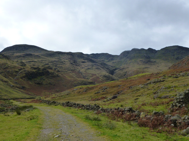
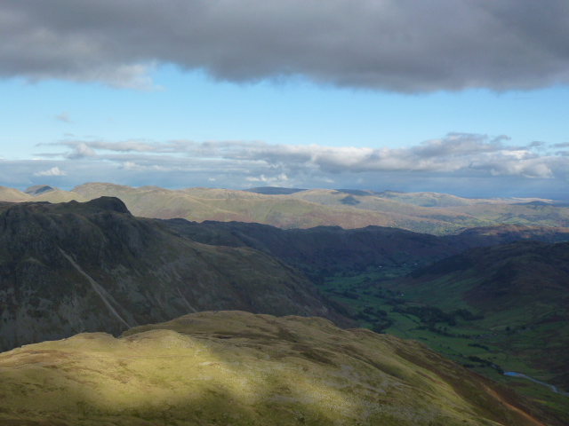
I parked up at the FREE Cow Bridge car park in Hartsop at just after 9.30. I got going quickly or rather I didn’t as immediately on leaving the car park it’s a near vertical climb to get up the first couple of hundred metres through old deciduous woodland. A good warm up and a fast height gain which brings you out nearly on the top of the ridge. The path winds its way along the ridge with some knobbly bits to either circuit or crest. I did a mixture. The first Wainwright is Hartsop above How which is really just a high bit on a ridge but it’s in the book.

There were a couple of showers along the way but so brief that it wasn’t worth getting the hard shell or anorak out (Cath laughed at me last week for calling it an anorak!) Towards the end of the ridge there’s a short section of scree and then it’s a quick move across to reach Hart Crag. By the time I got there I was in the full force of the wind and it was chilly so I ended up wearing t shirt, merino long shirt, soft shell, hard shell, buff over my head and gloves. Wet, wind and cold.

I didn’t stop long on Hart Crag and carefully levered myself down the somewhat treacherous big lumps of rock and across to Dove Crag. At this point I actually saw some people. There were some people behind me going along the ridge earlier but even though we’d said hello they became spots in the distance before long. A quick lunch sheltering behind a rock and then on to find the wall or fence to follow down to Little Hart Crag.

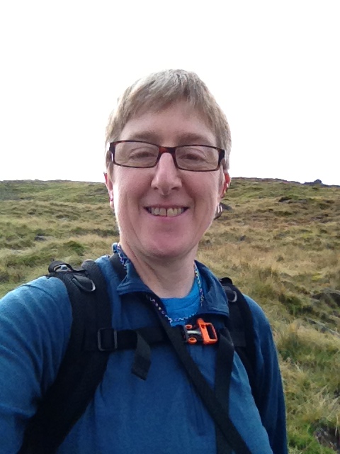
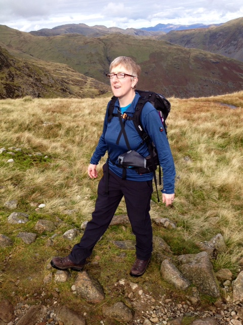
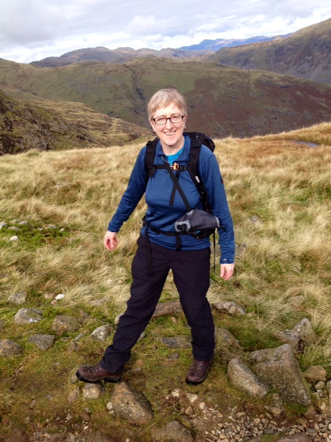
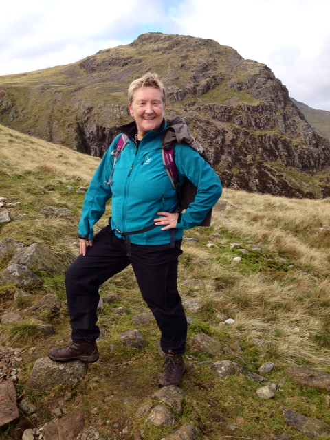
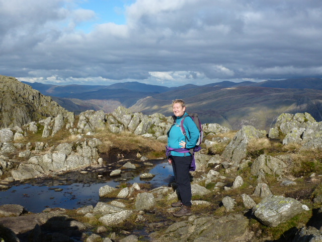
The fence turned out not to exist except for the uprights but they were still there slowly rotting. I basically followed them all the way to Scandale Pass at which point I went up onto Little Hart Crag, where I had a wee thinking that I was quite alone as had seen no-one coming in any direction. So I was a bit surprised when a couple and a dog turned up shortly afterwards. I asked the woman to take my photo so that Brothers Water was in the background but as you will see, she didn’t manage to do this and it’s just as well I had my iPhone to piddle around with! By this time it was very hot and sunny and I was back in just my t shirt.

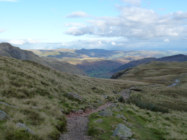
Little Hart Crag is at the top of High Hartsop Dodd so I just got going along a nice grassy path which ends in a truncated spur and is thus very steep to descend but fast. The couple with the dog went off the hill at top speed.

At the bottom there was a field to cross and I’d been wondering what the large brown thing was. It turned out to be a sleepy bull so I was glad that the hopeless photographer’s dog had not upset it.

Then it was a quick walk along a good flat gravel path by the side of Brothers Water and back to the car by about 3.15 and home by 5.30.

Please visit Map and Compass and learn how to interpret a map with me and my navigation partner, Cath.

IMG_1556
With Brothers Water in the background
P1020180
Hart Crag on the way up
P1020182
I think this is an example of sedimentary rock, any geologists out there?
P1020185
Clear water tarn on Little Hart Crag
P1020188
Brothers Water
P1020189
Me without Brothers Water
P1020191
Brothers Water
P1020194
The whole horseshoe

Hellvellyn via Striding Edge and Catstye Cam 3rd August 2013

Cath and I met up at Glenridding car park. We set off at about 10.45 after I’d done some pfaffing about. The car park still costs £7 for the day.

We went up to Hole in the Wall which doesn’t dispense anything and has possibly been filled in as can’t say I even noticed it. This is the point for starting Striding Edge. The first part is a inevitably quite gentle and just starts to ease you in to a bit of exposure, we stayed to the right just under the ridge. We saw a young man in jeans who was clinging to the path and obviously very terrified. We gave some words of encouragement but we didn’t see him later on so I reckon he’d backtracked which would probably have been the right thing to do as he wasn’t in a particularly terrifying spot when we saw him.

Mostly we stayed to the right on the path just below the ridge. At one spot you have to make a move down and most people were just doing this in their stride but we stopped to weigh it up and Cath was getting a bit anxious. Instead of following the crowd I moved to the left and got to a steady spot and I think this encouraged Cath to do the same as she soon followed me. We hadn’t liked the look of the drop to the right. Some guys were being helpful and making suggestions but we didn’t really follow them. We reckoned on making our own decisions and doing what was right for us.

The next tricky spot was soon after where we had to get down a narrow gully. I like doing these but Cath felt a bit less sure so she told me and one of our new friends to stay at the bottom to spot her. Just when her foot was at my eye level I started to move away but she told me and the chap that we were to stay in place, so we did! I told Cath that she had girl balls and this seemed to help!

That was the worst of it and we next took a path that went round the side of the big outcrop that most people were going over. This was a good route and we climbed up easily. After that we were practically at the top. Once we got to the shelter, a man came round and sold us cake for the British Horse Society which I didn’t even know existed. The lemon drizzle cake was just the ticket at that point. It was pretty cold and breezy on the top which meant the photos were a bit bonkers, and no-one there at that time to take one for us.

Next we went down Swirral Edge which seemed nothing like as scary going down it as it had going up it last year. There wasn’t anyone on it this time which helped. Then along and up to Catstye Cam where we were the only people. It’s quite a small summit so this was just as well. Then down off the top and back along a good path all the way to Glenridding via the Youth Hostel which looks great and is in a good location. Cath said it was nice as she’d stayed there with Lee earlier on this year.

We got back at about 5.30, went and had some not so nice cake in the wrong cafe. I’d forgotten Fellbites. But the tea was fine and just what was needed.

A Quality Mountain Day with a fab companion!

P1020158
Start of Striding Edge
P1020162
Intrepid Cath on the top of Striding Edge
P1020163
Cath in movement on the Edge
P1020164
Buttress after the hard bit
P1020166
Looking back along the Edge from the top
P1020167
Despite appearances I am not about to punch Cath in the head!
P1020175
Happy Christmas
P1020177
Cath all cool and relaxed
photo(2)
On summit of Helvellyn

Please visit Map and Compass and learn how to interpret a map with me and my navigation partner, Cath.


Wetherlam, Swirl How and Great Carrs 7th July 2013

Left the car at Tilberthwaite (150 m) and started walking at 10. The plan was to climb Wetherlam, Swirl How, Great Carrs, Grey Friar and Brim Fell. It’s a very pretty walk along the side of the gill, this time I took the shorter route by going down to the beck and crossing over on the footbridge and up the other side. I managed to keep up a reasonable pace all day but within half an hour I was soaked through and panting as it was incredibly humid. My new levels of fitness certainly paid off as the day involved a lot of ascent and stamina. I passed where Carol and I had lunched the week before after 40 minutes. The path then goes up to the ridge overlooking Langdale, this is a pretty route and passes a stand of pines which is a haven of cool loveliness. I greased up to counteract the sun but then walked through a section with lots of horse flies. Horrible, the humidity must have brought them all out but at least they didn’t bite me. Then it was time to start the serious climb which was quite scrambly, although nothing like the north face of Tryfan as only short but still good fun. I reached the summit at 12 and stopped to eat a piece of flapjack. The summit is at 762 m.

Then on to Swirl How, this meant descending to Swirl Hause at 620 m and ascending Prison Band to reach the summit at 790 m. I stopped here to have my pork pie and then it was a quick whizz over to Great Carrs at 780 m. On the way across there is the wreck of a Halifax bomber which crashed here in 1944, killing all 8 on board. There isn’t much wreckage to be seen, but apparently there is more that got chucked over the side of the mountain that’s still on the hill. It was a little cooler over this side which was very welcome. A semi naked runner and his dog passed me. He looked very hot and very pink just in his knickers. I saw a lot of very pink people and one man who asked me if he was nearly there yet! I also met a couple I’d been leapfrogging with for about the 4th time, we had a little chat and then it was time to return as I was too hot to face doing any more ascents than necessary.

Back to Swirl How, back down the Prison Band, passing a poor dog who looked like he’d had enough, and then back up to Wetherlam. I’d been slightly nervous about descending the Wetherlam scramble but I’ve no idea why as it was just a walk, with only a couple of places where I had to lever myself down. I got back down quickly to the car before 5. I was so hot, I got a bottle of water I wasn’t planning to drink and tipped it over my head, neck and back. Instant relief!

I climbed about 980 m in total which given the heat of the day is pretty damn good and I know I wouldn’t have been able to do that without the running regime, I was tired but my legs have been fine today. I got home a bit late as traffic was slow on the motorway.

P1020106
This spot calls to me
P1020111
Crinkle Crags and Bowfell
P1020115
Crash site
P1020127
I do like this spot
P1020129
Still want to walk up here

P1020117

Please visit Map and Compass and learn how to interpret a map with me and my navigation partner, Cath.

Crinkle Crags 14th October 2012

After a reasonably early but chilly start (had to scrape the ice off the outside and the INSIDE of my car windows), Chris and I got to Langdale, parked up in practically the last spot in the National Trust car park, saving £6.50 and set off at about 11.20.
Across a big flat section full of sheep, black, white and punk; cows, horses… to the charmingly named Stool End Farm, turning left to go along the side of the beck and then across to start the climb up to Great Knott.

We stopped below the Knott on the col for a quick pre lunch snack, Chris on pork pie and me on energy bar and organic fruit and nuts that were mainly nuts until I supplemented them. Then up past the Knott and our first close up of the Crinkles, at this point they seemed quite fun and exciting.
We scrambled up the first Crinkle, and even then we wondered how many there were, Chris reckoned 4 and I was thinking 5 or 6, having consulted Wainwright during our coffee break on the drive over. However my consultations were more about how to get round or over the Bad Step and I now know there are 5 crinkles. Very hard to pull out of the map as the distances are so small, even with a magnifier.
We lunched just before starting crinkle number 2 and picked the coldest, windiest spot on the walk. We watched a large group trying to get down the Bad Step and worked out that we would just skip up the side as totally unnecessary to do the Step. That said, it would be a good place to practice rope work.

By then, we’d got tired of Crinkles as there’s an awful lot of up and down and very little distance covered. A mere 3 more to do but we battled on and got to Three Tarns where we decided to return down The Band and not down Hell Gill which had been the original plan. We were both tired and needed a relatively easy and straightforward route. The path seems to have been improved since I last did it as I remembered quite a lot of hands on sections but these weren’t there any more.
Finally got back to Stool End and Chris took off on the tarmac, back to the pub for the facilities and a beer for Chris.
We whizzed home and I even got back in time for Downton Abbey! Oh dear, how very tragic!

Bark Island just before I left home
Crinkles to centre right
Playing with phone
Over to Pike o’ wotnot
How not to do the bent leg thing
No, that’s still not right
Like this!
Crinkles here we come
First Crinkle, I thinkle
Still smiling, not yet crinkled out
Big views
Homeward bound
Pike o’ wotsit and the Langdales
Feeling a bit crinkly here

[googlemaps https://maps.google.com/maps?f=q&source=s_q&hl=en&geocode=&q=Dungeon+Ghyll,+o%2Fs+Old+Dungeon+Ghyll+Hotel,+Lakes,+South+Lakeland+District,+United+Kingdom&aq=0&oq=dungeon+ghyll&sll=53.702818,-2.029493&sspn=0.01819,0.060339&t=p&g=Withens+Clough+Reservoir,+Hebden+Royd,+Calderdale+District,+United+Kingdom&ie=UTF8&hq=Dungeon+Ghyll,+o%2Fs&hnear=The+Old+Dungeon+Ghyll,+Great+Langdale,+Ambleside,+Cumbria+LA22+9JY,+United+Kingdom&ll=54.44549,-3.102608&spn=0.05989,0.102997&z=12&output=embed&w=300&h=300]

Please visit Map and Compass and learn how to interpret a map with me and my navigation partner, Cath.

Yoke, Ill Bell and Froswick 26th August 2012

I set off early and reached Green Quarter just after 9 a.m. It took a little while to park as there is very little parking in Kentmere and Green Quarter but I managed to tuck it in on a very quiet road. The forecast had said “slight chance of rain” which was why I’d picked today to whizz up some hills.
I walked down to Kentmere church and to the end of the road and then got onto Garburn Pass. This is a mountain road that goes across to Troutbeck. It rises gently for a couple of kilometres and then I headed off north on a good path across some boggy terrain. It was quite warm and a bit muggy. This path also rose gently although when I came back down it seemed much steeper so I can only conclude that I wasn’t really feeling the climb. I got all the way up to Yoke and had a short break there. The weather started to close in a bit and there was a lot of low cloud around. Then onto Ill Bell through the gloom. Ill Bell (no sickness, no bells) has 3 cairns which were reminiscent of the Nine Standards in construction.
From Ill Bell you have to drop down quite a bit and then go up again to reach Froswick, Wainwright didn’t seem to think you would go there unless you were going somewhere else but I didn’t really want to keep going as had already been to the hills you can reach easily from there, also my route was not a circuit. So I had my lunch and looked across to Thornthwaite Beacon, High Street, Mardale Ill Bell and Harter Fell.
I turned back and retraced my steps. There was a shower on Ill Bell and a much bigger one as I got back to the Garburn Pass, my head felt like it was being massaged under the hood of my coat!
The Garburn Pass had got a lot wetter and what with my thin summer socks, gave my feet a terrible pummeling. I got back to Green Quarter at last, actually much more quickly than I’d thought, and had a delicious slice of my own home made shortbread!
Feels like my exercise regime and losing a few pounds has been worth the effort. Home before 6 p.m. And 3 more Wainwrights bagged!

Cairns on Ill Bell
Ill Bell
Lake Windybum
Kentmere Reservoir, Harter Fell above
I like these cairns
All three on Ill Bell
Kentmere Reservoir looking south
Flew over my head

[googlemaps https://maps.google.com/maps?f=q&source=s_q&hl=en&geocode=&q=Ill+Bell,+Kentmere,+South+Lakeland+District,+United+Kingdom&aq=1&oq=Ill+Bell&sll=53.7924,-2.105684&sspn=0.018151,0.060339&t=p&ie=UTF8&hq=&hnear=Bell,+Illinois&ll=54.449981,-2.866745&spn=0.029942,0.051498&z=13&iwloc=A&output=embed&w=300&h=300]

Please visit Map and Compass and learn how to interpret a map with me and my navigation partner, Cath.

css.php