Saturday 26th March
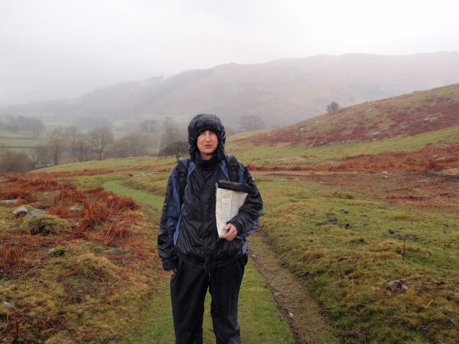
Arrived in Longsleddale in the early afternoon. We are staying in the Coach House at Capplebarrow which is near the middle of the dale, just a few yards from the church and the village hall which are the only things in the dale apart from farms and houses. The River Sprint runs along the side of the single track road and we can see it from the Coach House. The Coach House is small and compact. There is the most enormous bed meaning we will have to send semaphore signals to each other. Very neat Morso wood burner that kicks out huge amount of heat, it compensates for the fan heater that only gives us 3 minutes in the shower room. After getting settled in we went for a short circuit along towards the head of the valley and then back along the far side of the river.
[googlemaps https://maps.google.com/maps?f=q&source=s_q&hl=en&geocode=&q=Longsleddale,+South+Lakeland+District,+United+Kingdom&aq=1&oq=longsleddale&sll=53.976128,-1.702121&sspn=0.015901,0.052314&t=p&ie=UTF8&hq=&hnear=Longsleddale,+Cumbria,+United+Kingdom&ll=54.440399,-2.790184&spn=0.029949,0.051498&z=13&iwloc=A&output=embed&w=300&h=300]
Sunday 27th March
Green Quarter
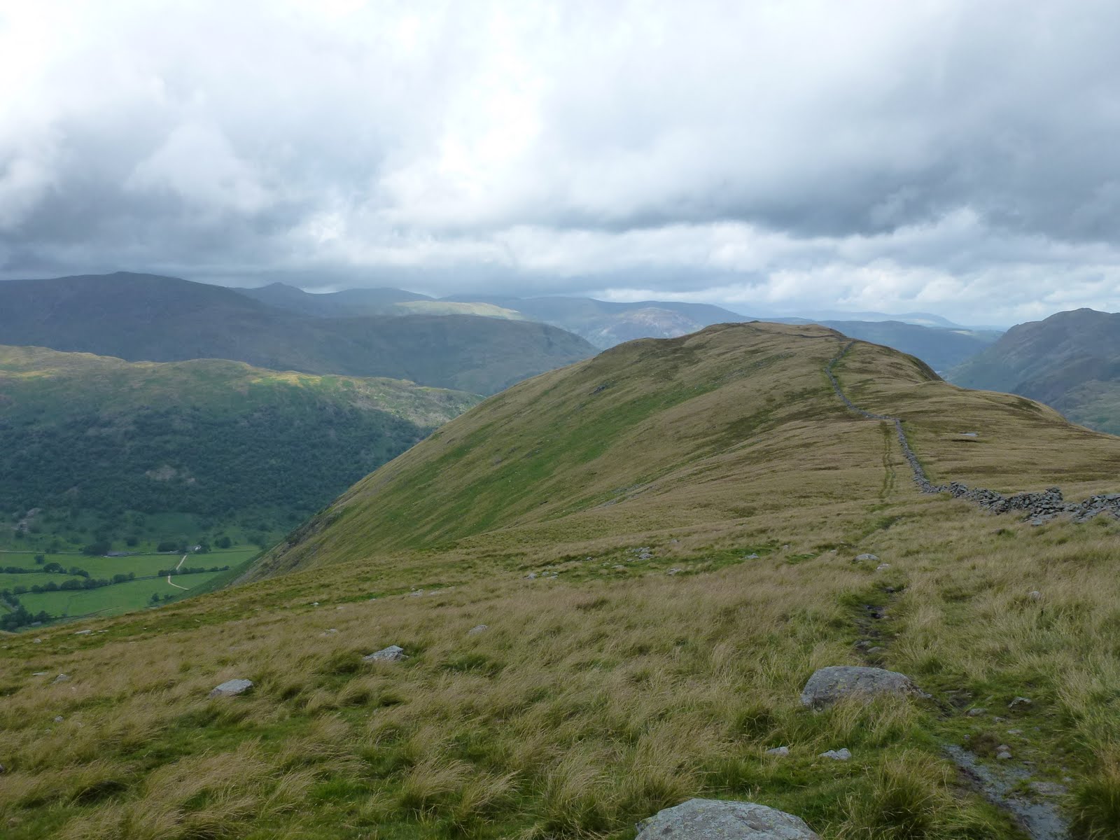
First day of forward clocks. We drove the first 3.5 km from our lodgings to Sadgill. Parked up. Lots of cars where before when I’ve been here there were none. Up a lovely stony track with burbling streams. Came across a vintage Land Rover mini rally. About 6 of them all trying to come down very steep bouldery part of path. Bloody bonkers but they seemed to be enjoying themselves. Seemed a risky thing to do to such beautifully preserved vehicles. Short stop where junction to Shipman Knotts and Kentmere Pike turns off. Then away across the fell to Green Quarter. This is tiny hamlet next to Kentmere village. Out the other side and back onto the fell. Stopped for lunch looking over to Kentmere Tarn in the vale. On up to Green Quarter Fell. Passed Skeggles Water. This bit was quite bleak. Then on up Cocklaw Fell now overlooking our Longsleddale valley which is nice and green. On the homeward stretch with car in sight. Flapjack made by me v. good for keeping up energy levels as v. delicious.
[googlemaps https://maps.google.com/maps?f=q&source=s_q&hl=en&geocode=&q=Green+Quarter,+United+Kingdom&aq=2&oq=green+quarter&sll=54.424922,-2.784004&sspn=0.062916,0.209255&t=p&ie=UTF8&hq=&hnear=Kentmere,+Cumbria,+United+Kingdom&ll=54.430165,-2.840137&spn=0.014978,0.025749&z=14&iwloc=A&output=embed&w=300&h=300]
Monday 28th March
Harter Fell
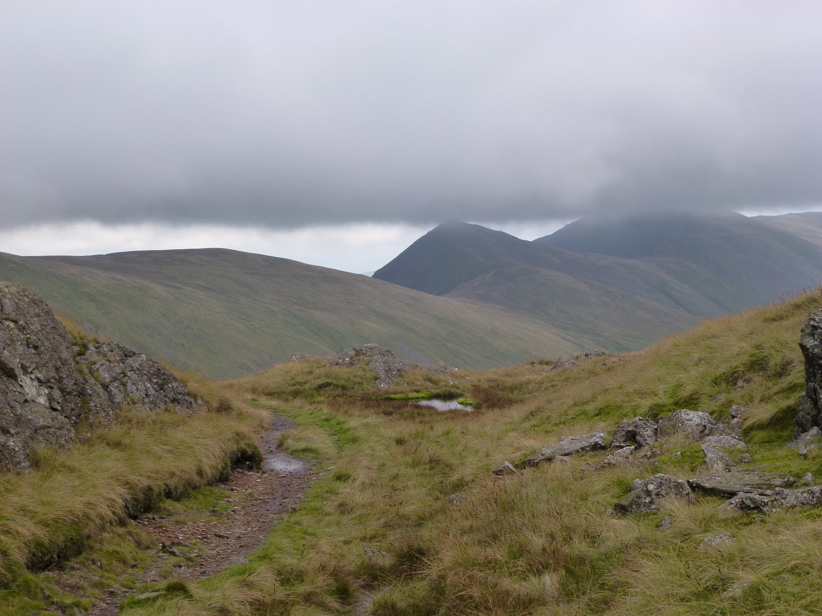
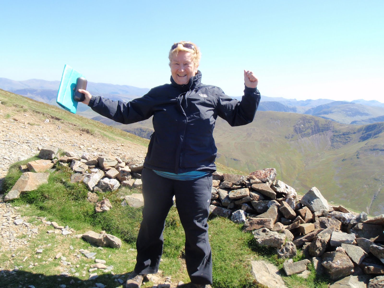
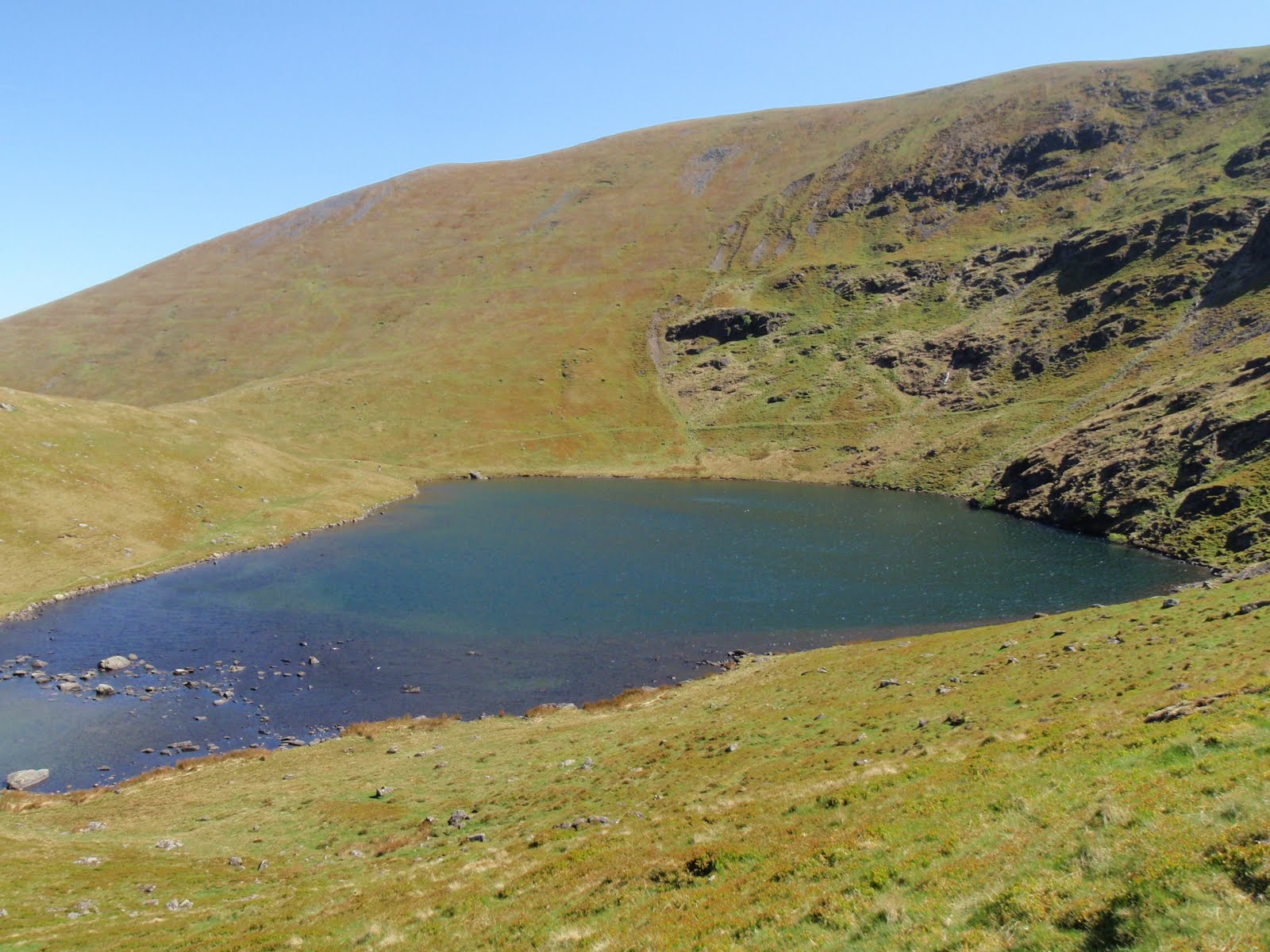
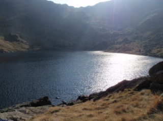
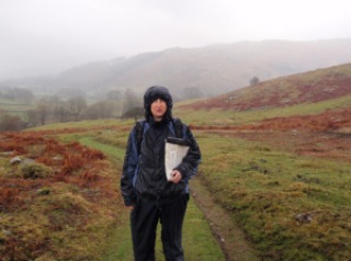
It’s about an hour and a bit to drive a mere handful of miles because we are not crows. Parked up at Mardale Head. Free car park. Set off up Gatescarth Pass. After 20 mins I realised I’d left my iPhone on full view in the car. I left Mr B and raced down and back in 22 mins! We plodded on and eventually arrived at the head of the pass. I also realised half way up that I’d left my lunch in the kitchen at the cottage. I considered pretending I’d only just found out when we sat to eat but instead fessed up feeling now very very stupid. Mr B kindly agreed to share his lunch with me and I gratefully accepted. We found a little hollow out of the wind and I ate half his lunch. After a bit more climbing we reached the summit of Harter Fell. Much colder on the tops. Headed off west to find the Nan Bield Pass. Some fairly challenging sections for Mr B height and exposure wise. It all went fine and we easily found the head of the pass. Mr B shared his Twix with me to give us a boost for the descent. It took a while but we got back down without further incident. Mr Bs first Wainwright and a jolly good one in perfect weather.
 |
| Towards High Street |
 |
| Haweswater |
 |
| On top of Harter Fell |
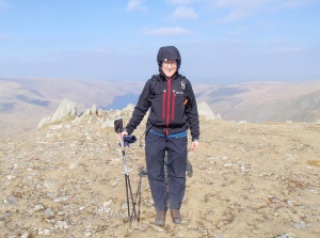 |
| Me too |
 |
| Smallwater |
 |
| Smallwater from the Nan Bield Pass |
 |
| On the Nan Bield Pass |
[googlemaps https://maps.google.com/maps?f=q&source=s_q&hl=en&geocode=&q=Harter+Fell,+Longsleddale,+South+Lakeland+District,+United+Kingdom&aq=0&oq=harter+fell&sll=54.430176,-2.840161&sspn=0.015727,0.052314&t=p&ie=UTF8&hq=&hnear=Harter+Fell&ll=54.476023,-2.834988&spn=0.029923,0.051498&z=13&iwloc=A&output=embed&w=300&h=300]
Tuesday 29th March
Not a very good day for walking so we went to Kendal and wandered round a lot, then went on to Sedbergh and looked at second hand bookshops
 |
| Kendal |
Hugill Fell
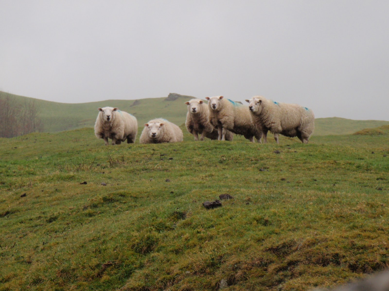
This is an “outlying fell” according to Wainwright. Very wet so kept it short. Managed to stay dry with all the gear. Annoyingly it seems to be drier in afternoon which is not what forecast said. We didn’t bother looking at Williamson’s monument as it was too hard to get over wall plus high fence.
 |
| Wet |
 |
| Very wet |
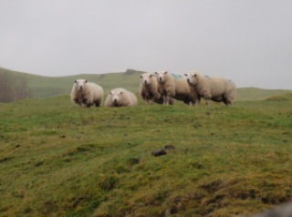 |
| Mafioso sheep |
Thursday 31st March
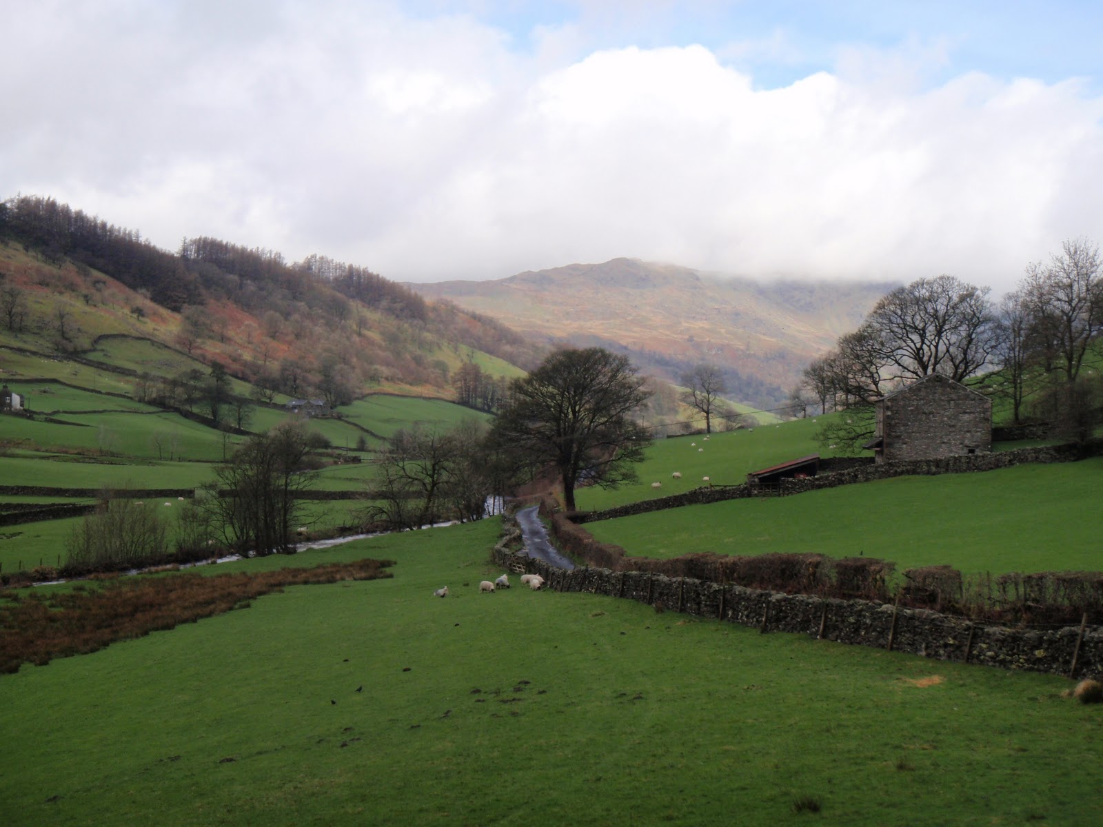
It was so wet the Sprint had burst its banks in several places. Neither of us feeling like walking in the downpour so we went to Ambleside and Windermere for the day. It had finally brightened up in the evening enabling us to do a longer circuit in Longsleddale going further towards the head of the valley, looking up at Harter Fell.
More rain in the morning so we went to the
Abbot Hall Gallery in Kendal which was good. Too early for the Sheila Fell exhibition though.
Eating Out
The Wheatsheaf at Brigsteer
The food was quite good but we had to wait oh so long for it I was nearly climbing the wall.
Both had braised beef, why this has to come in a little round I don’t know. Horseradish mash was good. Not enough gravy as meat a bit dry. Mushrooms and shallots tasty. Braised red cabbage so vinegary I coughed on every mouthful. But cauli and broccoli cheese yummy.
Deja Vue in Kendal
My meal was fine, I had celeriac for a starter and then a filo pastry and beetroot mille feuille. Mr B ordered tuna and it came and just was not right so he sent it back. He ate some chips and then we went home and he had a nice sandwich with ham. So a mixed bag, suspect it’s best not to bother with this one again.
Eating In
We cheated on the first evening and had pots of risotto which were fine and did the job.
I made Green Thai chicken curry with basmati rice. Fab!
Also an omelette with various bits and pieces, this was a bit dry as I had not quite got the measure of the electric cooker.
We had pasta bolognese twice, slightly different each time, but very nice.
Oh and I made more flapjack this time with apple and it didn’t really stick together so more like sticky granola. I will continue to experiment with the flapjack recipe as it’s so much nicer than buying an energy bar and a lot cheaper.
Please visit
Map and Compass and learn how to interpret a map with me and my navigation partner, Cath.