Stanza Stones Trail 30th August 2015

I forgot to make myself coffee. My biggest mistake of the day!

Cath and B and I met up at Hebden Bridge station with our cars at 7.40. Cath drove us to Marsden and we set off at 9.00 at a brisk pace to ascend Pule Hill and see the first of the Stanza Stones. Our walk was a reccy for a walk Cath is leading for the Walk and Ride Festival so we needed to check the projected timings and keep up the pace.

We headed north to the Pennine Way and the A640. Across White Hill and then to the rubbish dump on the A672. Cath was very incensed by this and took a photo. I have reported it. On my 3 drives along Turvin Road there was some fly tipping and this has also been reported.

Across the M62 and then to Blackstone Edge where we stopped for our lunch. Across the A58 and into the White House for drinks. The half way point. I had a coffee which seemed fine, a very inky black espresso. About half an hour later I started feeling queasy and this continued until the next day.

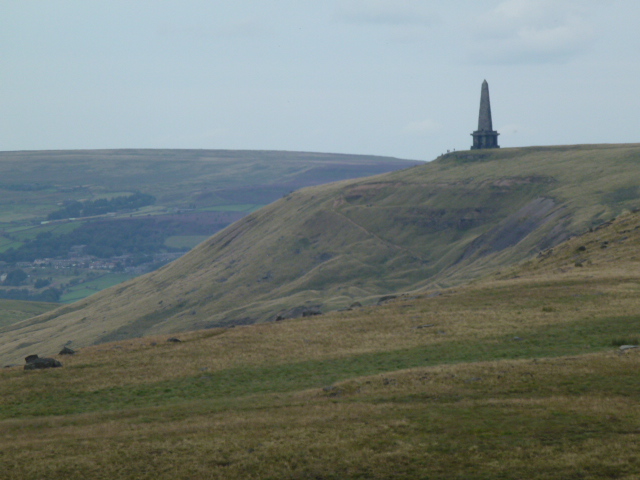
We reached the next Stanza Stone and then it was on to Stoodley Pike. Had a bit of a rest there. Then the last leg back to Hebden and along the canal to the station. I’m quite impressed that I managed it whilst feeling hideous but there wasn’t really a choice.

Into my car and back to Marsden for Cath and B. Then back to my house where I was able to be sick.

Despite my ailments we had a great day, legs were fine. 2 days later I’m still right off coffee and being careful as to what I eat.

Very official looking sign but the only one we saw right at the end of the day
Cath on the way up Pule Hill
First Stanza Stone
First Stanza Stone
Blackstone Edge
Blackstone Edge
Second Stanza Stone
Second Stanza Stone
Water board detritus
Warland reservoir
Warland reservoir

P1040362

The blooming heather
B and Cath
B and Cath
Stoodley Pike, last stretch
Please visit Map and Compass and learn how to interpret a map and use a compass with me and my navigation partner, Cath.

MAPandCOMPASS

Elslack

I have to train for a trip to the Pyrenees in August. So I drove to Thornton-in-Craven to do a circular walk. It took much longer to get there than I had thought it would so I straightaway had to cut back the length. Where I parked up there were some people using a small motorbike on a footpath so I felt a bit fed up and not at all like challenging them. Instead I drove to a car park marked on the map which was just a lay by and did half the planned walk.

I followed the Pennine Way up to Pinhaw beacon, this was a bit disappointing as all there is only a small pile of stones. It’s quite a good high point though and good views all around. Then I strayed off the PW to find Robert Wilson’s grave. He was the beacon keeper and died tragically trying to get food for his fellow beacon keepers in terrible bad weather. I found the grave, another pile of stones. Back to the PW and cut around the hill.

Crossed into a conifer plantation. The first section was very mucky but then it improved and turned into a pleasant stroll through the forest. I did get a bit fed up with being continually nagged by signs telling me to stay on the path. I did stay on it, even to the point where I could see my car was 50m away but to get to it I had to walk round an extra 250m.

It took me just as long to get back, I don’t understand why there is always a traffic jam in Keighley.

From the forest
From the forest
I can't help it with lines of trees on the skyline
I can’t help it with lines of trees on the skyline
The beacon
The beacon
Pinhaw Beacon
Pinhaw Beacon
Please visit Map and Compass and learn how to interpret a map and use a compass with me and my navigation partner, Cath.

MAPandCOMPASS

Through the wind, through the rain, the snow, the wind, the rain: 22nd February 2015

After last week on the west side of Widdop I wanted to head east then up and around White Hill. It started to rain as I left home and as I approached the car park layby, it was a sleety blizzard. Whilst I got my boots on the boot of the car practically filled with sleet.

Fairly quickly I decided just to visit Lower, Middle and Upper Walshaw Dean reservoirs instead of my circular route. It was soon clear that walking into the wind and sleet would be very unpleasant even if I did it at the start of the walk. So I kept the wet stuff to the side and back and went to the end of the 3 reservoirs and then returned the same way. It’s a very clear track. White Hill was a proper whiteout with thick fog as well as snow on it so I think my decision was quite sensible. Walking back was probably as horrid a walk as I’ve ever had with what felt like pins of snow flying into my face. I should have put my contact lenses in although my specs were some protection against pins in the eyes so should have dug out my goggles as well. I was wearing a hat with a big bobble on it, the bobble pushed up against the hood of my anorak which then kept blowing off in the wind.

It was lovely to get back to the car where I had a bite to eat and some delicious if rather expensive Charbonnel and Walker hot chocolate! Then I went and bought a bobbleless hat at Springfield Camping.

Almost solarisation a la Man Ray!

IMG_0029 IMG_0030

Walshaw Dean Upper
Walshaw Dean Upper

IMG_0036

Des res?!
Des res?!
Not a happy bunny
Not a happy bunny

Please visit Map and Compass and learn how to interpret a map and use a compass with me and my navigation partner, Cath.

MAPandCOMPASS

Widdop and Gorple Reservoirs 15th February 2015

This is a walk I’ve done many times and cycled it too. Today I went from Widdop dam and up to the rocks at Shuttleworth Moor and Black Moor overlooking Upper Gorple reservoir. Across to Upper Gorple on a permissive path and then to Lower Gorple reservoir. It was mainly misty with the odd glimpse of sun. I took a path that was new to me to get back across to Widdop. It went through a boggy and gloomy wood where most of the trees had died. The path had been moved which I only realised because I had to check a bearing when I got out of the wood. Then crossed a good chunk of featureless moorland and came out at the top of Cludders Slack. I don’t know what that means but I like it. Some really vast rocks litter the hillsides round here.

Widdop reservoir
Widdop reservoir
Cludders Slack
Cludders Slack
Lower Gorple reservoir
Upper Gorple reservoir
Widdop reservoir
Widdop reservoir
Cludders Slack
Cludders Slack
Widdop reservoir
Widdop reservoir

Please visit Map and Compass and learn how to interpret a map and use a compass with me and my navigation partner, Cath.

MAPandCOMPASS

Wintry walks February 2015

Last weekend Cath and I walked from the Shepherd’s Rest at Lumbutts around the hill and across to Gaddings Dam. We were checking a route for Cath and generally enjoying being out on the snow. At one point we took a right of way on the map that wasn’t visible on the ground and it was nice to see that our bearings worked out and good to keep in practice. Very chilly but lovely in the sun.

P1030311
Intrepid Cath
P1030312
Stoodley Pike from Gaddings
P1030310
Gaddings

P1030313

This weekend I walked from the Hinchliffe Arms in Cragg Vale, going up through the woods behind the pub onto the hill. Very soon I met a group of 4 roe deer who scooted away, I walked carefully and came upon them again but they shot off again. After the wood up onto a very icy track to the road above Withens Clough reservoir. It started off lovely and sunny and was almost warm but then fogged over big time and again very nippy in the wind. Across the top of the dam and then a very neat contour along a drain and up by Tenter Wood where cloth used to be dried on tenter hooks (so my friend Babs assures me). Back down past a couple of houses where they’ve made a feature of the footpath and turned it into a lovely dry gravel path. Some geese skating on an icy pond and then the 4 deer again.

Apart from some not very well behaved dogs, an atmospheric walk in the cold and mist, very Bronte-esque!

Near Tenter wood
Near Tenter wood
Wood behind the Hinchliffe

P1030316

Withens Clough reservoir


Please visit Map and Compass and learn how to interpret a map and use a compass with me and my navigation partner, Cath.

MAPandCOMPASS

css.php