Training for Mont Blanc

St. Sunday Crag 090809
Parked in the hotel car park at Patterdale. £3 for the day.
From Patterdale went through field with cows all lying down. Then up Thornhow End and Harrison Crag, no scrambling. Whilst stopped for short break, 2 women came past with concerns about the bull in the field who had been lively on their way up. I reassured them that all the cows were lying down and that I hadn’t spotted a bull and then forgot about him!
Carried on along the contour on the side of Birks and then up along the ridge to St Sunday Crag. There was one man and two girls on the summit, well we all arrived at the same time and all looked a bit like we wished the others weren’t there. I stuck it out and had my lunch in peace on the top! Whilst there a flare went up from the sheer scree east side of Helvellyn and a helicopter spent a lot of time trying to do something. I found out afterwards that a woman had fallen 3 metres from the top path onto a man on the lower path. She had hurt her leg. She also managed to get herself to hospital after being rescued. Given that the Mountain Rescue is a charity and receives no government funding, it seemed a lot of effort for someone who was walking wounded.
I went across to Gavel Pike as it was about a hundred metres away. It was a lovely spot, quite different, and worth the short hike. Then cut back to the main path and returned the same way.
When I reached the field with the cows, the bull was up and about, he was a very big chap in every way. I just said hello as I had done before and gave them a good wide berth. No problem.

[googlemaps https://maps.google.com/maps?f=q&source=s_q&hl=en&geocode=&q=St+Sunday+Crag,+Patterdale,+Eden+District,+United+Kingdom&aq=0&oq=st.+sunday+c&sll=50.917889,14.056706&sspn=0.008522,0.026157&ie=UTF8&hq=&hnear=St+Sunday+Crag&t=m&ll=54.511914,-2.975922&spn=0.029897,0.051498&z=13&output=embed&w=300&h=300]

High Street 020809
Parked for free on the road at Mardale. It was a bit busy here but then Julia Bradbury had been on the TV going up High Street earlier on in the week. After all, that had made me think of it too.
First turned towards Haweswater to reach the far end of the ridge. Then up along the ridge all the way to the top. The ridge is quite craggy and scrambling is needed. Could be a bit scary to those who don’t like heights. The top is fantastic, really does look like a Roman road, which it is, from I think, Ambleside to Keswick. Lot of effort up there in a toga I can tell you. It was very nippy and I had to put various winter layers on. Bit busy on the top.
Went across to Mardale Ill Bell and then down the Nan Bield Pass. Pleasant route via Small Water.

[googlemaps https://maps.google.com/maps?f=q&source=s_q&hl=en&geocode=&q=High+Street,+Lake+District+National+Park,+Patterdale,+Eden+District,+United+Kingdom&aq=0&oq=high+street+lake+dis&sll=54.410539,-2.850952&sspn=0.125877,0.41851&ie=UTF8&hq=&hnear=High+St&t=m&ll=54.491679,-2.864857&spn=0.029911,0.051498&z=13&iwloc=A&output=embed&w=300&h=300]

Shipman Knotts and Kentmere Pike 260709
Parked for free at Sadgill.
Took the path towards Stile End. Then turned off right to ascend. Quite a lot of scrambling on Wray Crag to get up to Shipman Knotts, by this time in thick mist so have little idea of what it looked like. Continued up following a wall and then fence which I kept in sight. There was one bit when I couldn’t see the handrail but fortunately this part was served by a good path. Got to Kentmere Pike and have no idea whether it has a lovely view or not. Very wet indeed.
I met 2 people on this walk. The cloud lifted a bit on the way down and surprised me with what was there, i.e. lovely views across to Longsleddale but quickly shrouded again.

[googlemaps https://maps.google.com/maps?f=q&source=s_q&hl=en&geocode=&q=kentmere+pike&aq=&sll=54.454223,-3.211602&sspn=0.062871,0.209255&ie=UTF8&hq=&hnear=Stony+Cove+Pike&t=m&ll=54.482007,-2.89876&spn=0.014959,0.025749&z=14&iwloc=A&output=embed&w=300&h=300]

Grey Crag and Tarn Crag 190709
Parked for free on the roadside at Sadgill which is at the end of Longsleddale. Very small road to get to it and Sadgill literally is the end of the road.
Straight up from the road onto the fell, through a lot of very high bracken, up what AW calls an easy gully, ha ha, there is no scrambling but it’s quite wearing. Onto Great Howe and across to Grey Crag. So far so good as good weather but would be hard in mist with no marked paths. From Grey Crag (the E in GrEy very important as there is another fell called GrAy Crag), I could see Harrop Pike was only a couple of hundred metres away so skipped over there, then skipped back and across to Tarn Crag. Then I decided to head back and thought I would go a different route from that planned. Over confidence rushing in here having detoured to Harrop Pike. I tried to get down but it was too steep, didn’t panic, just came back up again and went off an easier way, and followed the fence line across and then back over to just below Great Howe, some very steep bits where I had to hang on to the fence. It was ok and I found a handrail of a wall I recognised and then was back on track. Got back to the car and felt in trouser pocket for the keys, pocket was unzipped and no keys in it. So gave myself several moments of sheer unadulterated panic. Then remembered they were where they always are, on the key ring in the rucksack. Lessons learnt – make plan and stick to it, don’t go off piste unless completely sure of navigation. Be fully prepared and confident in knowledge that I can accurately navigate and not make mistakes.

[googlemaps https://maps.google.com/maps?f=q&source=s_q&hl=en&geocode=&q=Tarn+Crag+(Sleddale),+Longsleddale,+South+Lakeland+District,+United+Kingdom&aq=0&oq=tarn+crag&sll=54.399748,-2.796192&sspn=0.062955,0.209255&ie=UTF8&hq=&hnear=Tarn+Crag+(Sleddale)&t=m&ll=54.463453,-2.790527&spn=0.059864,0.102997&z=12&iwloc=A&output=embed&w=300&h=300]

Red Screes 110709
Parked in Ambleside in the college car park, opposite the main car park. £6 for the day. The route went up the Stock Ghyll waterfall which was nice but quite busy. I didn’t really need to do it to get onto the hill. But once past, a pleasant route up Red Screes. Notable for the big walls. Also no actual scree slope to cross, that’s on the east side, and yes the stone is red.
Quite a long old trudge up to the top but once there, the delight of reaching the trig point and then the reward of the view to Brothers Water. Fantastic and a surprise. Had the summit to myself. Came back down the same way.

[googlemaps https://maps.google.com/maps?f=q&source=s_q&hl=en&geocode=&q=Red+Screes,+Patterdale,+Eden+District,+United+Kingdom&aq=0&oq=red+scree&sll=54.463444,-2.790667&sspn=0.125714,0.41851&ie=UTF8&hq=&hnear=Red+Screes&t=m&ll=54.470586,-2.932577&spn=0.014963,0.025749&z=14&iwloc=A&output=embed&w=300&h=300]

Scafell Pike 010609
Parked in the free village car park at Wasdale Head. Went into tiny little village church, very sweet and cool. Headed on up along the valley. Whilst having a rest got interrupted by a man from Bangor who wanted to chat, at this point I managed to be quite pleasant to him but he was clearly quite needy.
Further on up the road, he had stopped just where I needed to, it being a very hot day and I had to do a reccy. Then 2 more people who wanted to chat to him came along, the man of the couple was a bit weird and asked me what I was laughing at in a very defensive way i.e. hostile. I decided I didn’t need any of it or them and so left them all to it, after all my walk was nothing to do with any of them, and I’m not a social worker.
I went up the corridor, a nice interesting route with a bit of low level scrambling. Stopped again for my lunch and they all went past so I happily ignored them. Carried on, the worst bit was the scree slope to get to the top but that done and then I was there, on top of the highest mountain in England, along with a great many other people. Needless to say, the man from Bangor, who I thought I had lost, appeared with another new friend. He asked me if I’d worked out a route down for US. At this point I said I’d found one for me and that he would have to find his own, I know it was rude but then so was his imposition on me.
Came down the west side which was a nice easy route, I had no idea it was there! I’ve done the big one now and feel no need to repeat it. Bit like Snowdon really, there are lots of nearly as high mountains without crowds or indeed loonies. I will go up Ben Nevis just to be able to say I’ve done the 3 Peaks and I am quite happy that Snowdon was done with the assistance of the train. At least we did walk all the way down it!

[googlemaps https://maps.google.com/maps?f=q&source=s_q&hl=en&geocode=&q=Scafell+Pike,+Wasdale,+Copeland+District,+United+Kingdom&aq=0&oq=scafell+&sll=54.470583,-2.932556&sspn=0.015712,0.052314&ie=UTF8&hq=&hnear=Scafell+Pike&t=m&ll=54.454173,-3.211613&spn=0.029939,0.051498&z=13&iwloc=A&output=embed&w=300&h=300]

Please visit Map and Compass and learn how to interpret a map with me and my navigation partner, Cath.

Koenigstein Monday July 6th 2009

After a surfeit of eggs the day before, I thought it would be kinder to forego them for breakfast – C had a fried one.

We worked out how to ask if we could leave the luggage there to collect later and that achieved and bills settled we went off to do some bits of shopping and sight seeing.
First had to have a coffee, this was at the cafe next to the green seats one of the night before. Whilst there noticed that their fare claimed to be real German and locally sourced so decided to return later for lunch.
Looked in a cheap shop, C attracted by candles. Held back for time being.
Went up to castle and for E2 had a great time looking round. Very nice tickets too with old picture of the castle on. We were the only visitors. C looked through telescope. Wandered round and then went up the tower, 7 flights but the views at the top were worth every step. Could see the Grosser and Kleiner Feldbergs, the Altkoenig and then very oddly, Frankfurt appearing like a futuristic metropolitan blot on the landscape. Looked very out of place somehow.
A short walk through the trees brought us to the open air swimming pool again. Much quieter as all the children were in school and all the adults were making money in Frankfurt. Had a nice swim, not too long as the weather was quite a bit cooler. As soon as we’d got showered and dried under the body driers, great invention, it started raining. Back through the forest to the town and didn’t get wet.
Back to the cafe but went inside as it did quite a big short shower. Chris had pork medallions and I had Wiener style schnitzel. Some beers. All very delicious and properly cooked, yum.
Did a bit of shopping, the cheap shop got raided by Chris who decided to let go at last.
Then back to the hotel to pick up the bags, and back to the train station. Back to Frankfurt main station, posted the postcards. Train to the airport.
All very smooth. Bit more shopping at the airport, bum bag for J. And then a smooth flight home. The plane was jammed full and we couldn’t sit next to each other which was annoying. But many others in same situation so someone had cocked up that lot.
Eventually located the car park and the car at Manchester! Drove back to Fountain Villa, gave C her bag of bits and off she went. A totally lovely holiday, thank you so much.

[googlemaps https://maps.google.com/maps?f=q&source=s_q&hl=en&geocode=&q=K%C3%B6nigstein+Fortress,+K%C3%B6nigstein,+Germany&aq=0&oq=+K%C3%B6nigstein+castle,+Germany&sll=50.206132,8.460503&sspn=0.069217,0.209255&ie=UTF8&hq=K%C3%B6nigstein+Fortress,+K%C3%B6nigstein,+Germany&t=m&ll=50.918538,14.05529&spn=0.008116,0.012875&z=15&iwloc=A&output=embed&w=300&h=300]

Please visit Map and Compass and learn how to interpret a map with me and my navigation partner, Cath.

Koenigstein Sunday July 5th 2009

After not sleeping very well (a lot of traffic noise because of being on the corner for J), we went for breakfast. A nice array, muesli, yoghurt, salamis, hams, cheeses, jams, nice fresh bread, not very nice coffee, possibly with chicory in it. J had a boiled egg.

We asked the lovely breakfast frau, possibly the one on the right in the picture of Cafe H about how to get to the Grosser Feldberg. Actually weirdly none of the people in the pictures on their website or the dog look like anyone that we met.
She gave us the bus number so we went to the train station to get the bus. The bus turned up with a very nice bus driver (Chris’). We climbed up in the bus to the top of the mountain (hill) as it’s only 878 metres where there was the annual town sports rally taking place as well as a biker convention. Despite all this, it was all very calm, there were a couple of cafes and kiosks, so we went to get a coffee.
On the short way, Chris picked up an old geezer who was taking a photo of a car. As well as the challenging language situation he had also had a stroke and so it was amazing that we were able to communicate at all. I kept trying to drag C away from him but this was very difficult so struck was she. Finally got away and into the cafe only to have him come and sit at the next table. At this point we gave in. Anyway his granddaughter lives somewhere in England and is very intelligent. The Americans taught him his English after the war, he was born in 1933. Actually he was quite a nice old man but most of the chat had to be done at high volume so guess we all entertained the cafe customers.
After some small purchases, we set off to walk the so called 7 km back to Koenigstein with the map which took a lot of working out so we just followed the signs and then just the general direction (down).
We had our substantial packed lunch, ate up some of the bits from the previous days extreme hunger rations, ate our new rolls and cheese and ham and tomatoes.
The walk through the forest was lovely, very quiet, a man passed by on a horse, the odd walker. We crossed the big road going up to the top and then came across a cafe/pub so had to investigate. It was next to a campsite and seemed to be part of an old Nature Movement. C had a beer and I had an espresso. Lovely.
At this point I finally managed to work out where we were on the map, better late than never. We walked back into Koenigstein and the Cafe H. Had a nice quiet couple of hours, I had a nap.
Then refreshed, went into town and after some photo opportunities went to what we thought was a real German restaurant that we’d picked out the night before, only to discover it had a Greek theme to the cooking. We sat outside and C had a lamb kebab and I had a lamb steak with cottage cheese in the middle of it. Not a good choice and mainly because I couldn’t remember what Schafkaese was. More beers.
Wandered back, stopping at a bar for a cocktail (C) and a big whisky (me).

[googlemaps https://maps.google.com/maps?f=q&source=s_q&hl=en&geocode=&q=Feldberg,+K%C3%B6nigstein,+Germany&aq=0&oq=feldberg+K%C3%B6nigstein,+Germany&sll=50.194869,8.470974&sspn=0.017308,0.052314&ie=UTF8&hq=&hnear=Feldberg,+K%C3%B6nigstein+im+Taunus,+Germany&t=m&ll=50.224037,8.437157&spn=0.032948,0.051498&z=13&iwloc=A&output=embed&w=300&h=300]

Please visit Map and Compass and learn how to interpret a map with me and my navigation partner, Cath.
Frankfurt and Koenigstein Saturday July 4th 2009


We never did work out what the Women Style was!

Saturday morning woke up having left the curtain open all night, still very hot even though we also left the air con on all night.

Went for sumptuous breakfast, had everything nearly. Muesli, yoghurt, fresh fruit, dried fruit, croissants, bread (bit dry), hams, salamis, cheeses, jams, horseradish (yes), eggs, fried stuff….cakes (resisted).
Took some processed packed things for later hunger attacks. Oh and 2 hot, hot, hot boiled eggs.
Checked out and rode the rails again into Frankfurt. The train made us get off at the airport and whilst we were waiting for the next one, C raced off to get a “bottle of pop”. Expecting her to return with cola etc., she totally surprised me with a bottle of Pikkolo fizzy wine. And very nice it was too. After buggering about at the main station for a little while, decided to go straight to Koenigstein and get into the country air. I think it was this time we stopped for a little coffee and a almond croissant (me) choc (C).
Took the train to Koenigstein, lovely air conned train at last, out into the country. Passed lots of allotment looking gardens. Mostly very flat around the city with various factories including Coca Cola, then more agriculture. Started to rise a bit, went through nice looking well off suburbs and after 40 mins arrived in Koenigstein.
We knew that the Cafe was only 50 metres from the station but we took a slightly longer route to get to it, however avoiding the steps.
Got to the Cafe Haerdtlein, at first the woman didn’t seem to have us down but then she found us. All the bookings I had done were in Chris’ name as she comes first in the alphabet, slightly disconcerting when the ID is the credit card!!
The Cafe H is an eclectic mix of styles, some hideous and some frankly disturbing but quite cheery. Nothing has ever been thrown away.
The room was fine and comfortable although it didn’t ever really get cool.
Chris went off to the supermarket to get some supplies as it shut on Sundays. Stocked up on water.
We were going to try and get some tourist info e.g. a town map but upon asking in the kiosk across the road, a rather nice young man (mine, I think) told us the Tourist Info would be shut and he gave us directions on how to get to the open air pool.
So off we went through the houses and then out onto a country lane, past fields of wheat. Through some trees and there we were. Only E3 to get in, the pool was quite busy as it was a hot Saturday afternoon, lots of families with well behaved children. Worked out all the lockers and systems. Straight in and it was VERY cold water on our HOT bodies. Had lovely swim and dried in the sun. C did some long lengths, the pool seemed immensely long and wide to me. C had a tuna sandwich that looked a bit odd.
After a bit we wended our way along the railway track (single track through the trees) then via the town to the hotel. Stopped at the supermarket to get lunch for next day, ham and cheese.
Another change of clothing and another underwear washing spree and off to get some food, I was kill hungry by this point as had not been fed properly since breakfast, having turned down the weird looking food at the pool.
We saw some nice but rather expensive restaurants along the way, including a dear little Italian one with trees all round it.
Then we found a nice one with green seats and sat outside. C had pasta with salmon and I had mixed roast veg and cous cous which was totally totally delicious. There was also a cocktail (C) and a glass of local cider, very nice.
Then back to sleep, sleep, sleep some more.

[googlemaps https://maps.google.com/maps?f=q&source=s_q&hl=en&geocode=&q=K%C3%B6nigstein,+Germany&aq=2&oq=koenig&sll=50.110891,8.682289&sspn=0.034677,0.104628&ie=UTF8&hq=&hnear=K%C3%B6nigstein+im+Taunus,+Darmstadt,+Hesse,+Germany&t=m&ll=50.178767,8.471918&spn=0.01649,0.025749&z=14&iwloc=A&output=embed&w=300&h=300]

Please visit Map and Compass and learn how to interpret a map with me and my navigation partner, Cath.

Bruce in Frankfurt Friday July 3rd 2009

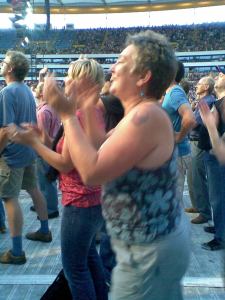
Chris Dancing in the Not Quite Dark Yet
Inflatables
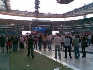
Second position further back but more comfortable
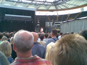
First spot, nearer but hard to see
In the pub before the gig
In the departure lounge
Spooky, another Bruce fan behind me
Broooce!

I’ve already written this right up to Friday afternoon and then it all disappeared but hey at least some of my words of wit will return with luck.

After only 4 hours sleep we had our 1st breakfast of muesli and left nice and early at 6.30 to miss the Manchester rush hour.
Arrived at airport and parked in short stay park next to terminal 1, nice and easy. We both bought CK Summer and a few other bits, no pack a mac for Chris though. Having done the boarding pass thing online, just had time for a 2nd breakfast (bacon sarnie for C, almond pastry for me) and more coffee.
Onto the plane and settled in for 3rd breakfast of cheese sandwich, very nice and a mini Mars bar plus coffee.
Arrived in Frankfurt at 12.10, the luggage arrived just as we did at the terminal, perhaps the long bus ride around the vast number of planes was so that baggage control looked really efficient.
After I’d got on the wrong bus we took the correct shuttle to the NH Hotel in Raunheim. Nice hotel in commercial and residential area. We checked in and went straight for a swim to cool off a bit.
We unpacked a bit, Chris rang Steven Jump about getting into the pit but it meant getting to the stadium at 5.00 so we changed and took what we needed for the evening.
Walked to Raunheim train station where a nice lady sold us her day ticket for half price so we only had to buy one, would have been even nicer if she had given it to us.
Took the fast train to Frankfurt and this would have been nice if it was too. Instead it took twice as long because of track repairs.
Wandered off in direction of the old town passing through the rough town. Chris took a fancy to some dodgy toiletries in a Superdrug type shop. Got more water.
Found the old town which was hosting Iron Man contest, this is swimming and biking. Then so hungry despite the multiple breakfasts stopped at pub and had sausage selection (Chris) and beef and potato dumplings (Jak) plus beer. Terrible smell of drains in this area unfortunately.
No time to go back to the hotel so went straight to the stadium on the train. Already quite good at the trains. Blew up inflatable instruments which caused much comment and amusement for rest of evening. Met the first of Chris’ boyfriends on the train admiring of her horn!. Path from station tree lined which was handy for C’s needs.
Once in, took a while to figure out how to get into the standing area. Got a spot which was quite close, well near the mixing desk but the sound was a bit rubbish and it was hard to see over very tall people. Bruce was very naughty and over 45 minutes late so more beer consumed. J left for a loo break during Outlaw Pete and realised both sound and vision (on screens) much better further back so we moved back and were more comfortable and not so squashed either.
Amazing 28 song set, played some stunners – Something in the Night, Trapped, Point Blank. We waved the guitar and sax and the Frankie sign but he would have struggled to see it without his binos.
20.27

1. Badlands http://twitwoop.com/0n3td40
2. Adam Raised A Cain
3. The Ties The Bind
4. My Lucky Day
5. Outlaw Pete
6. Hungry Heart
http://twitwoop.com/6ek5kw0
7. Working On A Dream
8. Seeds
9. Johnny 99
10. FACTORY
http://twitwoop.com/mb0q430
11. Something In The Night
collecting signs
12. I’m Goin’ Down (request)
13. Ramrod (request)
14. Trapped (request)
15. Because The Night
16. Waitin’ On A Sunny Day
17. The Promised Land
18. POINT BLANK!!
http://twitwoop.com/vd0eel0
19. Kingdom of Days
20. Lonesome Day
21. The Rising
22. Born To Run

23. Hard Times
24. Jungleland
25. American Land
26. Bobby Jean
27. Dancin’ In The Dark
28. Twist & Shout

23.15
On the way out, everyone did the Badlands refrain in the tunnel and beyond. Back to station buying more water and beer on the way, plus a melted cheese bread thing.
But at the station the renowned punctuality suddenly went badly wrong and hundreds of people had to wait forever for the trains to come. Most annoying as just tired, took nearly 2 hours to get back to hotel after gig finished.
Finally got back, showered and slept like logs, so tired forgot to pull the curtain.
One of the best gigs ever.
 

[googlemaps https://maps.google.com/maps?f=q&source=s_q&hl=en&geocode=&q=Frankfurt,+Germany&aq=0&oq=frankfurt&sll=51.219357,4.402771&sspn=0.033868,0.104628&ie=UTF8&hq=&hnear=Frankfurt,+Darmstadt,+Hesse,+Germany&t=m&ll=50.110946,8.682117&spn=0.016513,0.025749&z=14&iwloc=A&output=embed&w=300&h=300]

Please visit Map and Compass and learn how to interpret a map with me and my navigation partner, Cath.
css.php