Thornthwaite Crag and Gray Crag

I set off somewhat later than planned and only arrived at the free (honesty box for donations to the school) car park in Hartsop at 11.45. Only 2 and a quarter hours to get to the centre of the Lakes with no stopping for coffee. The walk along Pasture Beck is a good warm up, and pretty to boot, just contouring along the valley. At the head there is a bit of a climb and then it’s a short section of scree from the shoulder with Stoney Cove Pike. That’s the one that Wainwright refers to as Caudale Moor which is just annoying as the Pike is a perfectly good name and is the summit. This time I headed east up to Thornthwaite Crag which has a great beacon to mark it. This looks a bit like some of the ones I saw over in the Dales. I wondered if it’s connected with the Roman road. I also wondered if you can get a Roman map of the Lake District as they must have made some.
I chatted with some fellas and one of them took my photo on my camera so for once on a solo expedition there is a picture of me but even though I showed him the zoom control and he claimed to be a photographer, his efforts are fairly rubbish.
I could have whizzed up to High Street and back down that way but although I’m fond of it, I opted to bag another Wainwright and come down Gray Crag. This was a long, broad ridge and even though the map had a path that just stopped, I decided to go for it anyway as AW had said it was possible. There were signs that it was a maintained path, just a narrow one and the path did exist for real on the ground.
The weather was good, a bit of sun, a bit of cloud, a bit of wind and a bit of cool on the top.

Looking back towards Hartsop
Beacon on top of Thornthwaite Crag
Bloody useless photographer!
Hayeswater and my boots
Descent to Hartsop
Hayeswater Gill
My horseshoe

[googlemaps https://maps.google.com/maps?f=q&source=s_q&hl=en&geocode=&q=Hartsop,+United+Kingdom&aq=0&oq=hartsop&sll=53.66049,-2.04408&sspn=0.018208,0.060339&t=p&ie=UTF8&hq=&hnear=Hartsop,+Cumbria,+United+Kingdom&ll=54.509772,-2.913351&spn=0.014949,0.025749&z=14&iwloc=A&output=embed&w=300&h=300]

Please visit Map and Compass and learn how to interpret a map with me and my navigation partner, Cath.

Blackstone Edge 17th July

No photos at all because truly horrible weather. After some nagging and a bit of Jak moaning, Babs, Cath, Cath and I all met up at Babs’ house. I passed through driving rain and dense fog on my 20 minute drive which unfortunately was in the area where we were due to walk. The valley was a little better but not much. So we drank Babs’ coffee and tea and then took the quick drive to the start of the walk just below the White House on Blackstone Edge. A lot of pfaffing whilst we togged up, getting quite wet just putting the anti wet gear on. Eventually set off into the horizontal wet. We did a quick change of route to go a bit lower and shorter as it was so vile, we managed to do a few kilometres and then lunched standing up. Cath D had already made her roll disappear but then did the same trick with a Kabanos, or should that be kabanos? Cath B had some ciabatta and an apple. Babs had a fancy combination which I’ve forgotten but about 4 ingredients and Cath D also produced a beef and horseradish roll whilst I had 2 nan breads with beef and cheap, sweet, yellow mustard. I also finished off last night’s apple and raspberry pie and had 2 bits of malt loaf. Then we took the quick route back to Babs’ house. Babs drove me back up to my car and then we all sat around in Babs’ house drinking tea and eating digestive biscuits etc. We listened to Robert playing the piano and generally had a great time talking technology and walking….
Thanks guys!

[googlemaps https://maps.google.com/maps?f=q&source=s_q&hl=en&geocode=&q=Blackstone+Edge+Reservoir,+Littleborough,+United+Kingdom&aq=2&oq=blackstone+edge&sll=53.703049,-2.000476&sspn=0.01819,0.060339&t=p&ie=UTF8&hq=&hnear=Blackstone+Edge+Reservoir&ll=53.660509,-2.044058&spn=0.015258,0.025749&z=14&iwloc=A&output=embed&w=300&h=300]

Please visit Map and Compass and learn how to interpret a map with me and my navigation partner, Cath.

Cragg Vale 9th July 2011

Carol and I went for a very short evening walk before dining at the Hinchliffe which has a new chef and a new, more expensive menu. They had some some desserts which included caramelised fennel and one with black pepper so I just had a bit of ice cream whilst realising that I’m quite conventional. I started thinking I almost prefer their sister outfit Aux Delices in Mytholmroyd, especially as the chef from the now defunct Millbank works there.

We came across this fairly foolish young grouse, who seemed like he’d knocked a bit too much back. Made for some fun photos.

Green lane leading to the Hinchliffe
Dead casual
Less casual just squinting
Mine’s a double
Add caption

[googlemaps https://maps.google.com/maps?f=q&source=s_q&hl=en&geocode=&q=cragg+vale&aq=&sll=54.069208,-1.999407&sspn=0.036062,0.120678&t=p&ie=UTF8&hq=&hnear=Cragg+Vale,+United+Kingdom&ll=53.703058,-2.000456&spn=0.015243,0.025749&z=14&iwloc=A&output=embed&w=300&h=300]

Please visit Map and Compass and learn how to interpret a map with me and my navigation partner, Cath.

Lady Anne’s Way (LAW) Part Two

Barden to Grassington
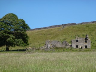
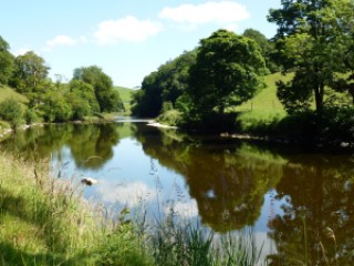
I parked just below Barden Tower for nothing at 10.00. Straight onto the Dales Way and along the bank of the Wharfe to Burnsall. As it was a lovely warm day with a little breeze but not horribly hot, there were lots of people out. Various groups of DoE Award chasers all very loaded up and some Ramblers groups. Every little place where people could get access to the river was occupied.

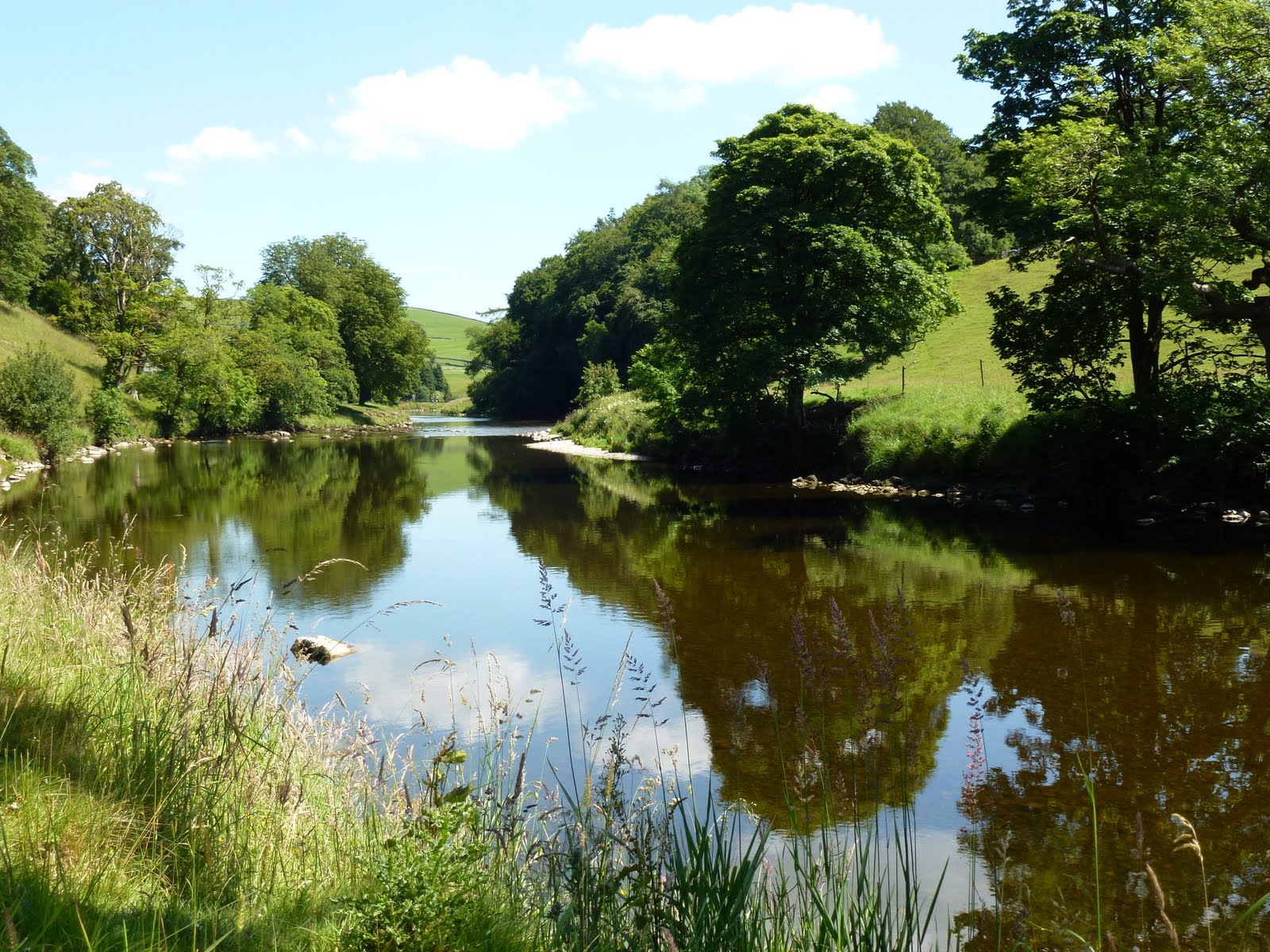
The Wharfe near Barden
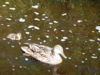
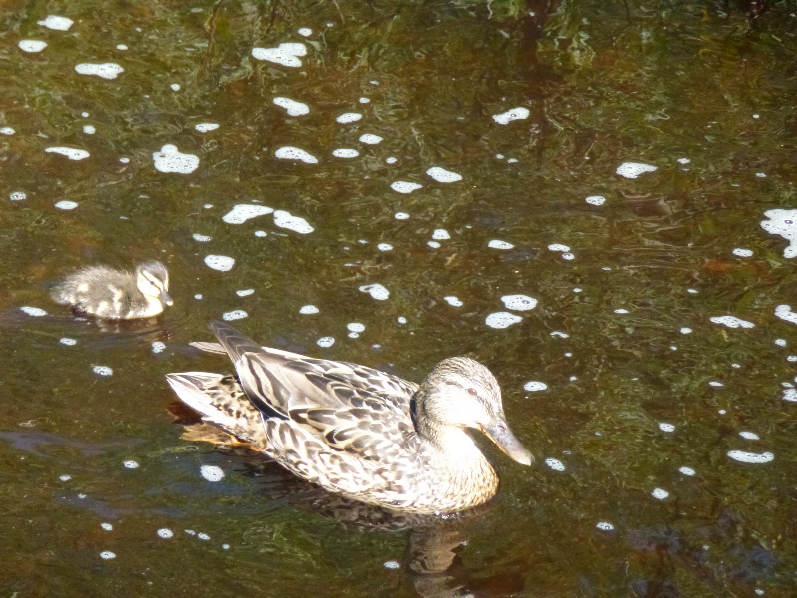
Ducklet

At Burnsall there is a huge car park which when I got to it was fairly quiet, but it was clearly going to get busy, the ice cream van and the burger man all gearing up for mega sales. I left the Dales Way and took the other side of the river, climbing up and leaving most of the people behind, even bringing my legs out for their annual airing. This section was much nicer for that and as always I helped some DoE young people to find out where they were. After a while I reached Hebden, and then it was through that village and out towards Grassington. The route passed through where there had been a not very old hospital but which has been taken down and luxury homes are in its place. This bit was also quite pleasant and quiet and I stopped before dropping into Grassington for my lunch.

Grassy ass was a bit busy and not at all how I remembered it, it must be 20 years since I last went there and it was winter and dark then. I had decided not to wait for the bus as it would be 3 and a half hours of waiting so I headed back going all the way along the river. The section near Grassington was madly busy and didn’t really get quiet, Burnsall was even worse, full of young lads jumping off  a high ledge into the river. I didn’t stick around as didn’t want to have to do first aid on one of them. Children getting sunburnt. Endless dogs shaking the wet off. Occasional smell of cannabis. The car park was now a sort of mini Blackpool with loads of people in the river, barbeques….After Burnsall it quietened down although some people were in inflatable dingies which seemed fairly stupid, considering the number of rocks and the river being low. The last bit back was quite nice as hardly any people.

The Wharfe near Hebden
Hebden Suspension Bridge
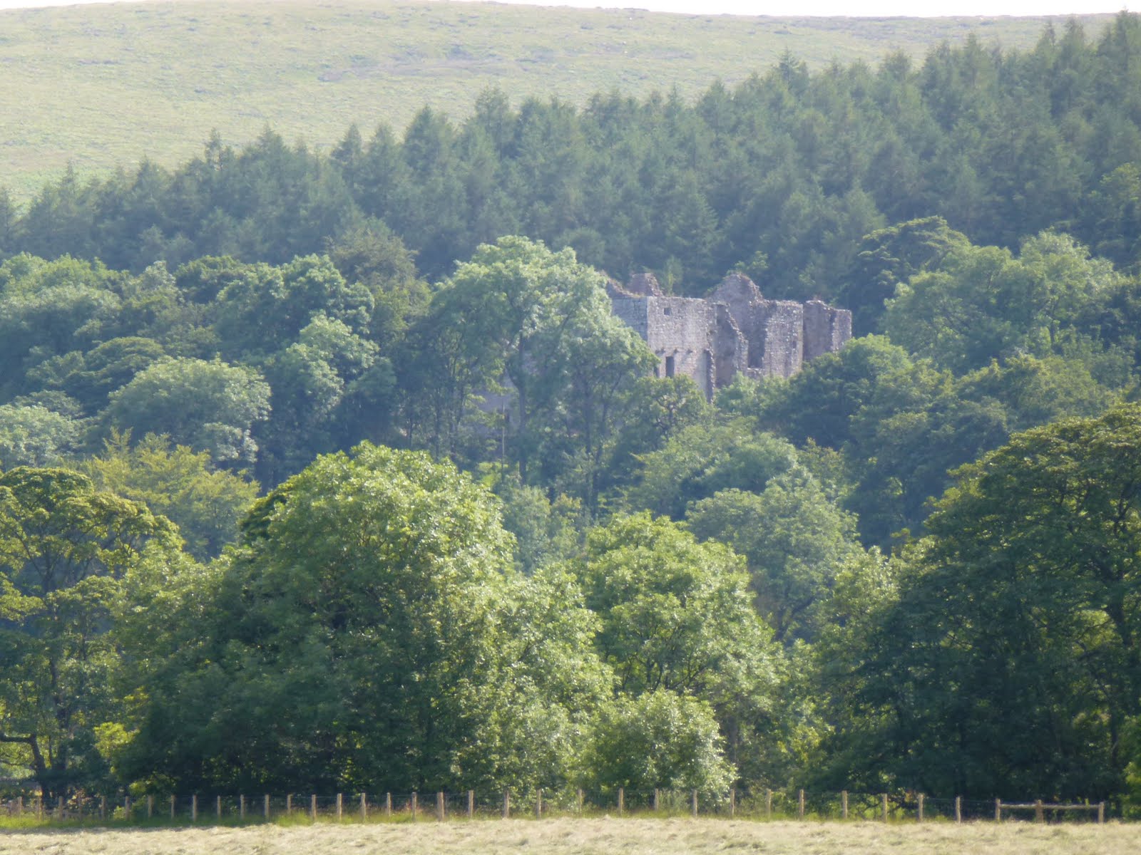
Barden Tower from the river
Are these purple poppies?

At the car, I treated myself to an ice cream.
I just hope there are some really nice bits of Lady Anne’s Way as so far, it’s felt quite hard. Last week was too hot, this week was just too full of people. I think I hate people. Wish it had been a lovely quiet fell in the Lakes. It took me 3.5 hours to get to Grassington and 3 to get back. About 12 or 13 miles.

[googlemaps https://maps.google.com/maps?f=q&source=s_q&hl=en&geocode=&q=grassington&aq=&sll=54.010631,-1.924442&sspn=0.072226,0.241356&t=p&ie=UTF8&hq=&hnear=Grassington,+North+Yorkshire,+United+Kingdom&ll=54.06921,-1.999426&spn=0.01511,0.025749&z=14&iwloc=A&output=embed&w=300&h=300]

Please visit Map and Compass and learn how to interpret a map with me and my navigation partner, Cath.

css.php