MTL Mankinholes to Summit 11 and 12/03/17

I pretty much did this all back to front because didn’t have lots of time.

Sunday 12th March – Foot of Stoodley Pike to Mankinholes

Finished off this section that I’d not done the week before.

Sunday 12th March – Mankinholes to Bottomley

I got up and out early. Gorgeous Spring day, warm and sunny. Parked in Mankinholes. Walked down through the Top Brink pub car park where Carol and I went for our first meal out together in months on Friday (mine was great, hers wasn’t). Then a couple of km along the busy busy single track road to the Shepherds Rest pub and up across the hill contouring round. It’s not a featureless moorland section and most enjoyable for that! Got to Bottomley, turned round and went back the same way.

Saturday 11th March – Bottomley to Summit

I parked at Bottomley by the football pitch and walked the short steep bit to Summit. Good views along the valley. Walked back along the grubby main road.

Every UK pylon is getting a refurb. Some of these are hard to reach.
Towards Walsden.


The Pike

Please visit Map and Compass and learn how to interpret a map and use a compass with me and my navigation partner, Cath.

MAPandCOMPASS

MTL Callis Bridge to Mankinholes 05/03/17

It was so very wet. Carol told me I would feel better if I went out but it didn’t work out that way. It’s not a long stretch at all and I wore all the gear but just got fed up with being out on my own on soggy paths, one bit was like walking down a river.

I did most of the section I’d planned but stopped slightly short of Mankinholes where there’s a bench at the foot of Stoodley Pike.

On the return run, I used the Pennine Way not the Pennine Bridleway and that was better underfoot.

Last time here Chris and I had a picnic, on a bike ride.
Good old Stoodley Pike
This is London Road, it doesn’t go there.
They were listening to a play on the radio!! Yes, really!
Please visit Map and Compass and learn how to interpret a map and use a compass with me and my navigation partner, Cath.

MAPandCOMPASS

MTL Jack Bridge to Callis Bridge 19/02/17

This short stretch packs a punch of height gain, 315m in just over 3km. I walked down to Callis Bridge and back from the New Delight, taking some delight in parking in their car park. It started off dry and then got gradually more drizzly and there was thick fog on the tops on the way home.

Stoodley Pike in the gloom

img_2045 img_2044

Please visit Map and Compass and learn how to interpret a map and use a compass with me and my navigation partner, Cath.

MAPandCOMPASS

MTL Widdop to Jack Bridge 04 and 05/02/17

Widdop to Jack Bridge

A) Sat 4th Feb 2017, Widdop to Gorple

Felt very tired so only walked from Widdop to Gorple reservoir and back round. I didn’t have enough light to go further plus I’d arranged to do the rest with Babs the next day. Chris and I have walked and cycled here many times. Back to weeping all the time.

img_1939
Cludders Stack

img_1937img_1933

img_1931
Gorple reservoir

B) Sun 5th Feb 2017, Gorple to Jack Bridge

We set off from the Pack Horse pub and walked to the New Delight pub and back. The New Delight name always makes me think of the Pure Drop pub in Tess of the D’Urbervilles.

This is a lovely stretch of the walk, we climbed up to 380m which is quite high for this part of the world. Just as we got sight of the New Delight and started thinking about grub, the Mary Towneley Way whisked us away from it and took us a roundabout way to reach it. The pub itself was a bit of a let down and we had to wait ages for a bowl of soup and when it came it was disappointing, plus the staff were borderline rude. So no Delight to be had, won’t be going there again.

We returned via a quicker route. We didn’t get much sun as the day before but at least it didn’t rain on us. 8.4 miles, 13.5km.

img_1941
Gorple reservoir
img_1949
Sadly this isn’t Pisser Rough but I so wish it was. That’s just a few metres up the road.

img_1948img_1944

img_1952

Please visit Map and Compass and learn how to interpret a map and use a compass with me and my navigation partner, Cath.

MAPandCOMPASS

Save

Walk log late 2015 to early 2017

This is just a post to catch up for myself on walks I was unable to record at the time because more pressing things were going on. Keeping up with walking helped me to cope with the stresses of Chris’s illness, and she encouraged me to keep at it. Some of these walks I can barely remember, even with the photos as aide memoire.

2015

4th September

Stoodley Pike circuit.

11th September

Temple Newsam circuit with Carol who was having a 6 week stay in Jimmy’s in Leeds.

18th September

And another one round Temple Newsam. Chris was also having a 6 week stay in Morriston, Swansea during this time and I was driving down there as well as to Leeds and going to work.

1st November

Widdop reccy with Cath.

2016

19th March

Cath and I did a reccy for a walk we led in Barnton. A learning to navigate walk in an industrial landscape which we did in conjunction with Saltscape.

25th March

Walsden circuit including Quaker graveyard at Shoebroad Lane, with Babs.

10th July

Barnton reccy with Cath.

img_1083

30th July

Cath and I did a day showing people how to navigate using a map and compass. The day was organised by Saltscape and we had a good turnout.

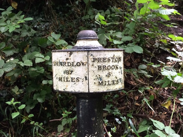
We walked from Barnton along the Weaver in a circuit.

15th August

After work I did a quick walk to reccy this for my Brontes by Dark walk. I was attacked by flying ants, and it turned out so was the rest of the entire population of the UK. 9km

21st August

Babs and I did this as part of my preparation for my Wuthering Heights (Brontes by Dark) night walk. Good day out with my dear friend.

27th and 28th August

Good two days with lovely group of volunteer walkers from Bury. The weather held off and we had a grand time sending people off to their destinations and retrieving them once they’d arrived.

10th September

The Brontes by night with my 3 participants. We had a fun time drinking mead in the so called Wuthering Heights.

11th September

A Heptonstall walk with Babs, lovely weather.

20th September

Social media workshop in Hathersage run by MTA.

25th September

Reccy for an Edale walk which I handed over to a ML I met at the MTA do.

5th November

NNAS (National Navigation Awards Scheme) update training in Brocton. This was a very weird day in between Chris’s death and the funeral. Cath and I had to do the training because it’s a requirement to continue to deliver the scheme. The first person I saw when I walked in was a guy who Chris and I did a winter skills weekend with in the Cairngorms. This was in 2009 and I wasn’t blogging much then. We had a great few days up there.

img_1673

16th December

Blackstone Edge circuit.

img_1853

18th December

Todmorden circuit.

27th December

Withins Clough circuit.

img_1876

28th December

Blackstone Edge, up Roman Road.

31st December

Hollingworth Lake with Babs.

2017

2nd January

Hebden Bridge circuit with Cath and pals.

14th January

Littleborough with Babs, frozen ground. She made me go to the pub!

img_1896

22nd January

Stoodley Pike circuit.

img_1903

Please visit Map and Compass and learn how to interpret a map and use a compass with me and my navigation partner, Cath.

MAPandCOMPASS

css.php