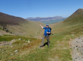
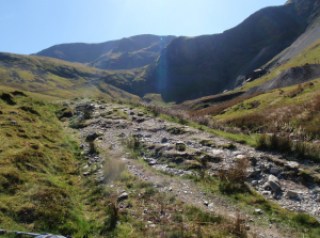
Old Man of Coniston and Dow Crag 12th November

Got up at the crack of dawn and whizzed off to Chris’ house. We set off smartly and stopped at Lancaster services for so C could buy out M&S and get coffee. I’d had a coffee at her house and it was very strong so I held off any more caffeine.
We took the top route to Coniston, via Windermere and Ambleside. The road to the Old Man is very steep but there is plenty of free parking once you get to the vehicle end of the Walna Scar Road.
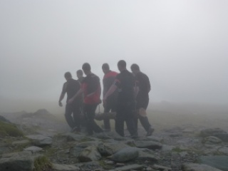
There was a group of young lads carrying a very large log. More later.
It was 11.15 and not raining by the time we set off but the tops were in mist. We went along Walna Scar Road for a short distance. A girl appeared for a chat just as we were about to commence the climb. She seemed quite nice but clearly was going to be going much faster than us so we emphasised this as I don’t think either Chris or I wanted her to tag along.
A slow, steady climb past some old quarries, but the spoil heap higher than us so we couldn’t see inside it. Then we were in the cloud and stayed in it with some brief bursts of light and even some sun at times until we reached the top. The path we were on took us directly to the Old Man but on the map we should have reached a path across and then turned left so this was a path on the ground and not on the map.
It was still very misty on top of the Old Man so we sat to eat our lunches. Chris on falafel and hummous wrap and me on hummous and tomato pittas. We’d been very warm climbing up but now it was cold in the wind and we were glad of our layers and hats and gloves.
The boys with log appeared out of the mist. They all had Eddie Stobart shirts on and were doing “team building”. I am now considering instituting log bearing up steep hills for my team at work! We thought they were probably being rehabilitated. Then some mountain bikes came past and then another team of log bearers, so after a very quiet walk up only seeing 3 people, it was suddenly very busy.
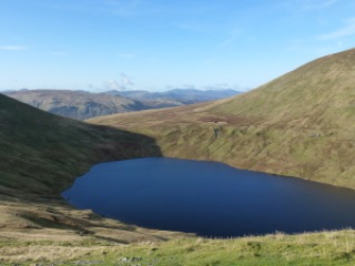
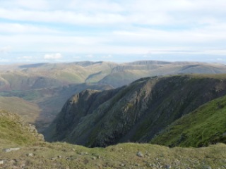
I took a bearing and we headed off for Goat’s Hause. This is the col between the Old Man and Dow Crag. Just when we needed it the clouds parted and we got a view down to the col. Then up a bit more ascent with good views to Goat’s Tarn and onto Dow Crag, this has great gullies which were all in mist. On the ridge and along to Buck Pike and Brown Pike. It stayed misty but we had occasional openings to see a wider vista.
Down from Brown Pike and onto the Walna Scar Road where we turned left and headed back down and along and back to the car at 4.15 where we finished off our supplies and then drove home, stopping again at M&S for various future meal supplies.

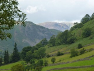
Starting to rise
Log men
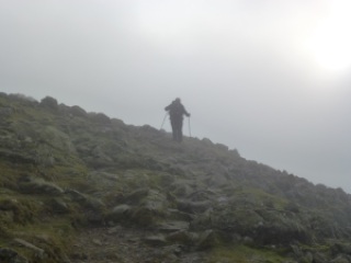
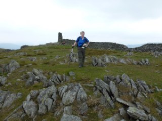
Chris at the top of the Old Man
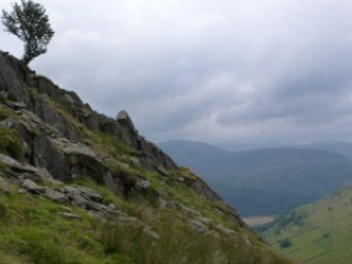
Across to Goat’s Hause
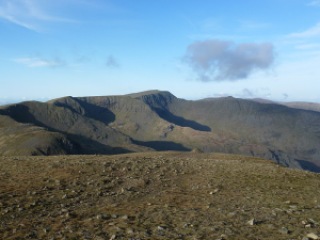
Looking back to ridge between Old Man and Brim Fell
Very steep gully on Dow Crag
Chris disappearing into mist
Bridge on Walna Scar Road
Across towards west
To the west
Jak

[googlemaps https://maps.google.com/maps?f=q&source=s_q&hl=en&geocode=&q=The+Old+Man+of+Coniston,+Coniston,+South+Lakeland+District,+United+Kingdom&aq=0&oq=old+man+con&sll=54.509782,-2.91331&sspn=0.017839,0.060339&t=p&ie=UTF8&hq=&hnear=Old+Man&ll=54.370659,-3.12149&spn=0.03,0.051498&z=13&iwloc=A&output=embed&w=300&h=300]

Please visit Map and Compass and learn how to interpret a map with me and my navigation partner, Cath.

Fairfield, Great Rigg and Heron Pike 5th November 2011

I got to Grasmere at about 10.30 which was ok as I’d stopped at Lancaster services to buy some lunch and a coffee. I had an Americano. Back on the coffee. This is worse than giving up fags! The loos in Grasmere car park smell of old wee so not recommended. I drove through Grasmere as I’d always bypassed it before. I noted a Cotswold Rock Bottom shop for future reference. It’s clearly dining out on Wm. and Dorothy, more later on them.
I parked up on the verge of the A road along with everyone else. Across the road and up a track past some nice houses and then straight up through a bog. Great start to the walk. The path goes along Tongue Gill and winds up quite gently passing waterfalls. I saw no one all the way up to the top of Grisedale Hause. There’s a big flat plateau which may be the Fair Field. I ate my packet of crisps looking at Grisedale Tarn (nowhere near either Grizedale or Grisedale Pike!).

There was a man swimming across the tarn, must have been very chilly indeed. Also a helicopter rescue of someone on Striding Edge (again). Then the steep ascent to Fairfield which I found hard as have now had 6 weeks of the gym being shut so not had any exercise since we were in Scotland. The gym is being cleaned out from top to bottom because they found a tiny amount of legionella. I chatted to the manager the other day and as well as the refunds we may be getting a spin room set up to encourage us back in. I will go back as the best thing will be that the showers will have to be hotter because of this. Plus the convenience factor. It will be good to get up early because I’m doing something for myself and not just because I want an easy parking spot.
There was a large party of elderly women coming down from Fairfield but they all forgot the code to give way to those ascending which mildly irritated me as there were loads of them.
The top of Fairfield is another flat plateau and looks over to Seat Sandal which I summited in thick mist some time ago, you can also see a really long way around all the Lakes and nearby to St. Sunday Crag, Helvellyn and Great Rigg. I ate my lunch (1.5 bean and cheese wraps) and kept some back as had no energy bars or flapjack for an emergency. I pondered about Wm. and Dorothy Wordsworth as I recently read a Guardian freebie which was a sample of his pomes and her diary. I didn’t read the pomes but the diary was very like the Wordsmiths of Gorsemere which
was on Radio 4 Extra recently. When Wm. and D weren’t being ill with headach etc. they were charging about the hills a lot. But no Goretex, fleece, or Vibram soles. Did they take a packed lunch, did they just take a cup, what sort? And fill it from a stream? D picked a lot of plants from the fells and put them in her garden. They also came across a lot of beggars and had an active social life, sometimes out very late indeed,and it would have been very dark then. And of course the trials of having drug addled S T Choleric to stay!
A quick lunch and then what Wainwright describes as the easiest mile in Lakeland to Great Rigg and then on to Heron Pike so 3 Wainwrights all in one day. Here I took a right of way that had no path on the ground to get back to Grasmere. I’m glad I did this as I had to really navigate properly to do this safely. I went through a rocky outcrop (Butter Crag) and did a short scramble and then met up with a path back. This was good as I feel my nav skills have improved greatly and it’s good to put it into practice. 3 more elderly people were going up at 3.30 which seemed late to start going up hills.
I got back to the car just after 4 and it was dark by 5.
A good day with great weather and I have decided to do my exercises when I get in from work until the gym reopens.

Here is the only quote I can find of The Wordsmiths of Gorsemere by Sue Limb:
Dorothy – “Oh William! Look! DAFFODILS! Fluttering, and, as it were, dancing in the BREEZE!”
Wm. – “Not now, Dorothy, I am contemplating my Withered Turnip”.

Tongue Gill
Nearly at Grisedale Hause
Grisedale Tarn
Across to Striding Edge
From Fairfield
Butter Crag
Nearly back

[googlemaps https://maps.google.com/maps?f=q&source=s_q&hl=en&geocode=&q=Fairfield,+Patterdale,+Eden+District,+United+Kingdom&aq=1&oq=fairfield&sll=54.362676,-2.917245&sspn=0.560899,1.377411&t=p&ie=UTF8&hq=Fairfield,&hnear=Patterdale,+Cumbria,+United+Kingdom&ll=54.362958,-2.91687&spn=0.240044,0.411987&z=10&iwloc=A&output=embed&w=300&h=300]

Please visit Map and Compass and learn how to interpret a map with me and my navigation partner, Cath.

Hartsop Dodd

A leisurely start to the day including coffee at Lancaster services where I also bought a sandwich and a packet of crisps in M&S. I’d spotted Hartsop Dodd a couple of weeks ago and it took my fancy. I knew it would be steep straight away and it was a stiff climb. I took a breather after about a 100m of climbing for a call of nature whereupon I piddled all over my camera case. Considering it was holding my new camera, you will be glad to know that the case is waterproof! I’ve now washed it and will be giving it a squirt of Nikwax!
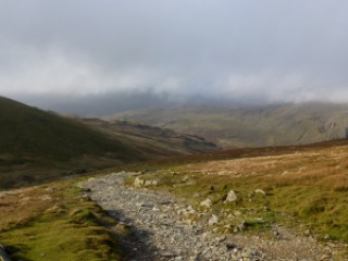
It took about an hour to get to the top of the Dodd so I stopped and had half my lunch. I wanted a longer walk so decided to carry on up to Stony Cove Pike (also known as Caudale Moor). I could see over to Thornthwaite Crag beacon which soon became obscured by mist. Although the mist loomed all day, I managed to miss it all which was great as I didn’t have to keep changing clothes. However one of my objectives was to have to navigate in mist but hey ho you can’t win ’em all!
The drop from Stony Cove down to Threshthwaite col is very steep indeed and basically 100m of scrambling which was great fun. I stopped at the bottom of the scramble and had the rest of my lunch.
Then it was down via Pasture Beck all the way back to the car. The path was much wetter than a fortnight back, more like a stream most of the way.
Good weather, good climb, good scramble descent, lovely.

Hartsop Dodd
Looking back
On top of the Dodd
Herdwick sheep
Lowering clouds
Nearly back
Not sure what these are for

[googlemaps https://maps.google.com/maps?f=q&source=s_q&hl=en&geocode=&q=Hartsop,+United+Kingdom&aq=0&oq=hartsop&sll=53.793463,-2.063957&sspn=0.018151,0.060339&t=p&ie=UTF8&hq=&hnear=Hartsop,+Cumbria,+United+Kingdom&ll=54.509772,-2.913351&spn=0.014949,0.025749&z=14&iwloc=A&output=embed&w=300&h=300]

Please visit Map and Compass and learn how to interpret a map with me and my navigation partner, Cath.

Thornthwaite Crag and Gray Crag

I set off somewhat later than planned and only arrived at the free (honesty box for donations to the school) car park in Hartsop at 11.45. Only 2 and a quarter hours to get to the centre of the Lakes with no stopping for coffee. The walk along Pasture Beck is a good warm up, and pretty to boot, just contouring along the valley. At the head there is a bit of a climb and then it’s a short section of scree from the shoulder with Stoney Cove Pike. That’s the one that Wainwright refers to as Caudale Moor which is just annoying as the Pike is a perfectly good name and is the summit. This time I headed east up to Thornthwaite Crag which has a great beacon to mark it. This looks a bit like some of the ones I saw over in the Dales. I wondered if it’s connected with the Roman road. I also wondered if you can get a Roman map of the Lake District as they must have made some.
I chatted with some fellas and one of them took my photo on my camera so for once on a solo expedition there is a picture of me but even though I showed him the zoom control and he claimed to be a photographer, his efforts are fairly rubbish.
I could have whizzed up to High Street and back down that way but although I’m fond of it, I opted to bag another Wainwright and come down Gray Crag. This was a long, broad ridge and even though the map had a path that just stopped, I decided to go for it anyway as AW had said it was possible. There were signs that it was a maintained path, just a narrow one and the path did exist for real on the ground.
The weather was good, a bit of sun, a bit of cloud, a bit of wind and a bit of cool on the top.

Looking back towards Hartsop
Beacon on top of Thornthwaite Crag
Bloody useless photographer!
Hayeswater and my boots
Descent to Hartsop
Hayeswater Gill
My horseshoe

[googlemaps https://maps.google.com/maps?f=q&source=s_q&hl=en&geocode=&q=Hartsop,+United+Kingdom&aq=0&oq=hartsop&sll=53.66049,-2.04408&sspn=0.018208,0.060339&t=p&ie=UTF8&hq=&hnear=Hartsop,+Cumbria,+United+Kingdom&ll=54.509772,-2.913351&spn=0.014949,0.025749&z=14&iwloc=A&output=embed&w=300&h=300]

Please visit Map and Compass and learn how to interpret a map with me and my navigation partner, Cath.
Grisedale Pike 010511

Woke up nice and early and got the coffee on. We piddled about a bit and had our yoghurt and compote and muesli breakfast, followed by more coffee. Before long we were on the way to Braithwaite via the Whinlatter Pass. We parked up off the road as by this time the car parks were quite busy. A short hop up to the start of the walk at the first car park. Up steps for a steep section and then a fairly leisurely meander along until Sleet How. There were a few other parties on the fell, including a group carrying up a rather large baby.
At the steep section near the top it had become increasingly windy and gusty. A woman coming down seemed a bit antsy and then a young couple coming down said it was even worse at the top. We were at this point nearly at the top. As we got up both Chris and I had to get down on all fours to get our centres of gravity as low to the ground as possible. I used my pole to get more anchorage too. We made it up and then took respite against the wall of rock on the summit. The summit is very pointy and fortunately we weren’t sharing it with anyone. However thanks to bending so low, my map, which had been secured by only my rucksack belt, had taken off in the wind, never to be seen again. I was sorry about this, as the map case had been a present from Carol but also because I didn’t like not having the map.
After we had got our breath and wits back, we made our way down to the shelter for lunch, samosa for me, gala pie for Chris and shared some salad. I had brought Mr Wainwright up on this walk, despite his weight and this helped us with mapping.
We decided not to carry on to Hopegill Head as it was too windy. So instead wound our way down the top of the valley and back past old mine workings to Braithwaite along a long miners’ track.
We came out at the other side of the car park from which we’d started, back to the car and then drove it up to the now nearly empty car park and brewed up a cup of tea and finished off our cake!
Returned home stopping at Tebay for more supplies.

I have assured Carol that we did make a sensible decision despite appearances and that our route was well designed as we had no further wind problems because of direction of travel. I can’t say the same for the party that subjected a baby to such conditions, nor for those who were descending via that route. At least the wind was pretty much pushing us against the mountain and the unpleasantness was for a very short amount of time.
700m ascent
Quite a lot of along too but can’t measure it right this minute as have no map!
Please visit Map and Compass and learn how to interpret a map with me and my navigation partner, Cath.
At the Bradleys’ camp site
Grisedale Pike that way
From the summit, holding on tight to camera
Safe in the shelter
Wind woman, in more ways than one!
Swirly path down
Chris descending
We were just there
Wake me up when we get down
I know you are laughing even though my eyes are shut!
We were up there too
Nice cup of tea, Gromit
Wow, another big achievement!

Please visit Map and Compass and learn how to interpret a map with me and my navigation partner, Cath.

css.php